Author:
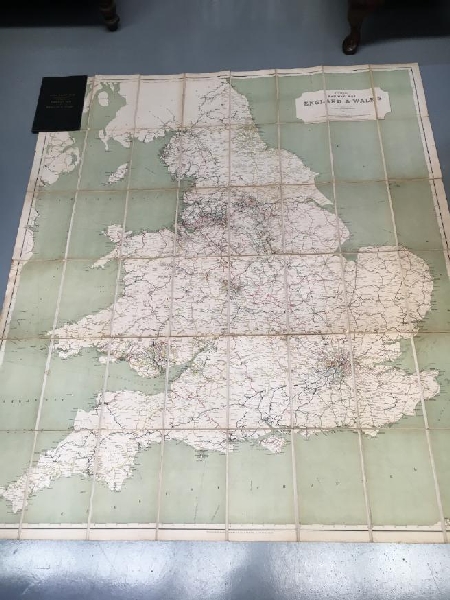
Title: Official Railway Map of England & Wales.
Description: First Edition; Large (120 x 144 cm) engraved coloured folding map, 48 sections laid down on linen, folding into the original black cloth folder with title lettered in gilt on spine and front of folder, scale 1 inch to 7 1/2 miles, fine copy. London; Railway Clearing House; 1918. Printed by McCorquodale & Co. Limited, London. Drawn and Engraved by J & W Emslie, London.
Keywords: england history railway cartography
Price: AUD 575.00 = appr. US$ 397.83 Seller: Time Booksellers
- Book number: 116897
- Book number: 116897