Author: Blaeu-- Joan
Title: Scandinavia - Blaeu, 1643-1650
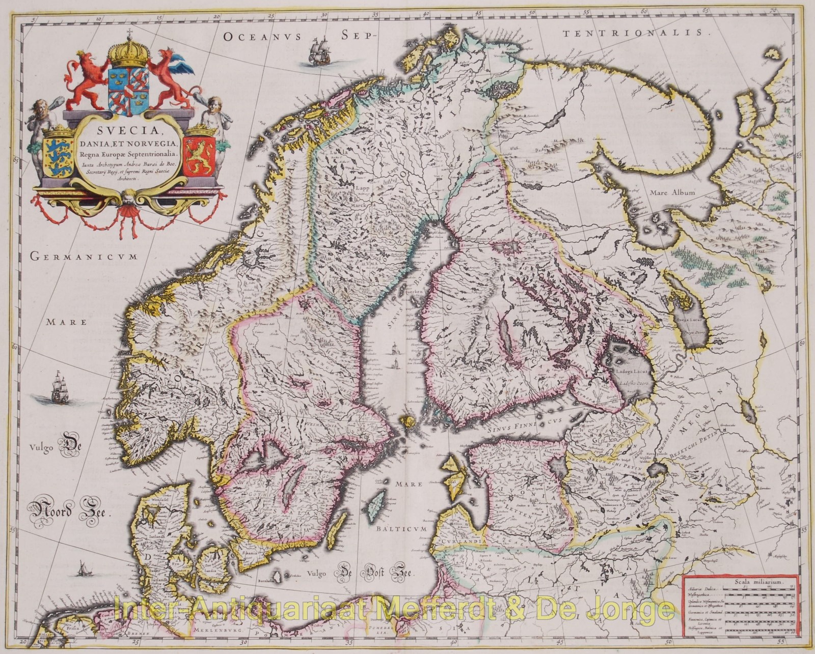
Description: Suecia, Dania, et Norvegia, Regna Europae Septentrionalia Copper engraving published by the house of Blaeu, between 1643-50. Verso: French text. With original hand colouring. Size: 42,7 x 53,1 cm. This fine map depicts the kingdoms of Sweden, Denmark and Norway, whose coats of arms are featured within the title cartouche. The map is attributed to Anders Bure (1571-1646), a Swedish cartographer and mathematician. Bure, also known as Andreas Bureus, compiled a map of the northern part of Sweden and the first separately printed map of the country. Bure was an important figure in the history of Swedish cartography and set up a land surveying office which continued for over 200 years. The Kingdom of Sweden is shown at its largest extent. The map extends to present day Finland and the Baltic states, and is filled with details of towns, political boundaries, rivers, and topography. Price: Euro850,-
Keywords: Blaeu-- Joan
Title: Scandinavia - Blaeu, 1643-1650
Description: Suecia, Dania, et Norvegia, Regna Europae Septentrionalia Copper engraving published by the house of Blaeu, between 1643-50. Verso: French text. With original hand colouring. Size: 42,7 x 53,1 cm. This fine map depicts the kingdoms of Sweden, Denmark and Norway, whose coats of arms are featured within the title cartouche. The map is attributed to Anders Bure (1571-1646), a Swedish cartographer and mathematician. Bure, also known as Andreas Bureus, compiled a map of the northern part of Sweden and the first separately printed map of the country. Bure was an important figure in the history of Swedish cartography and set up a land surveying office which continued for over 200 years. The Kingdom of Sweden is shown at its largest extent. The map extends to present day Finland and the Baltic states, and is filled with details of towns, political boundaries, rivers, and topography. Price: Euro850,-
Keywords: Blaeu-- Joan
Price: EUR 850.00 = appr. US$ 923.82 Seller: Inter-Antiquariaat Mefferdt & De Jonge
- Book number: 1656
- Book number: 1656