Author: Admiralty
Title: Nautical Chart No. 3250 New Guinea - North Coast, Tanjong Narwaku (Cape D'Urville) to Wuvulu Island
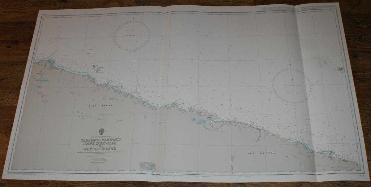
Description: Admiralty, 1997. Revised Edition, Softcover. Very Good Condition/No Dust Jacket. Crisp and clean colour chart with two vertical folds. Nautical Chart No. 3250 New Guinea - North Coast, Tanjong Narwaku (Cape D'Urville) to Wuvulu Island. Copyright 1972 with small corrections to 1997. Scale 1:500,000. Area Covered: Papua (part), Papua New Guinea (part), Teba, Liki, Armo, Oenake Range, Serra Hills, Torricelli Range, Wuvulu Island. North Pacific Ocean (part), Denau Rombebai, Si Mamberamo, Denau Sentani, Neumayer River Size: 71x126cm. Single sheet map/chart which is suitable for framing and will be shipped rolled and in a cardboard tube. Quantity Available: 1. Shipped Weight: under 1 kg. Pictures of this item not already displayed here available upon request. Inventory No: 45517114056. ISBN: 0195123824
Keywords: BZDB4 Maps; Indian sub-continent & South East Asia; naval, naval history, maritime, ships, boats. Admiralty Nautical Chart No. 3250 New Guinea - North Coast, Tanjong Narwaku (Cape D'Urville) to Wuvulu Island Indian sub-continent & South East Asia naval,
See more books from our catalog: Maps
Title: Nautical Chart No. 3250 New Guinea - North Coast, Tanjong Narwaku (Cape D'Urville) to Wuvulu Island
Description: Admiralty, 1997. Revised Edition, Softcover. Very Good Condition/No Dust Jacket. Crisp and clean colour chart with two vertical folds. Nautical Chart No. 3250 New Guinea - North Coast, Tanjong Narwaku (Cape D'Urville) to Wuvulu Island. Copyright 1972 with small corrections to 1997. Scale 1:500,000. Area Covered: Papua (part), Papua New Guinea (part), Teba, Liki, Armo, Oenake Range, Serra Hills, Torricelli Range, Wuvulu Island. North Pacific Ocean (part), Denau Rombebai, Si Mamberamo, Denau Sentani, Neumayer River Size: 71x126cm. Single sheet map/chart which is suitable for framing and will be shipped rolled and in a cardboard tube. Quantity Available: 1. Shipped Weight: under 1 kg. Pictures of this item not already displayed here available upon request. Inventory No: 45517114056. ISBN: 0195123824
Keywords: BZDB4 Maps; Indian sub-continent & South East Asia; naval, naval history, maritime, ships, boats. Admiralty Nautical Chart No. 3250 New Guinea - North Coast, Tanjong Narwaku (Cape D'Urville) to Wuvulu Island Indian sub-continent & South East Asia naval,
Price: GBP 28.00 = appr. US$ 39.98 Seller: Bailgate Books Ltd
- Book number: 45517114056
- Book number: 45517114056
See more books from our catalog: Maps