Author: Admiralty
Title: Nautical Chart No. 292 North Sea Offshore Charts - Sheet 3 with Oil & Gas Fields
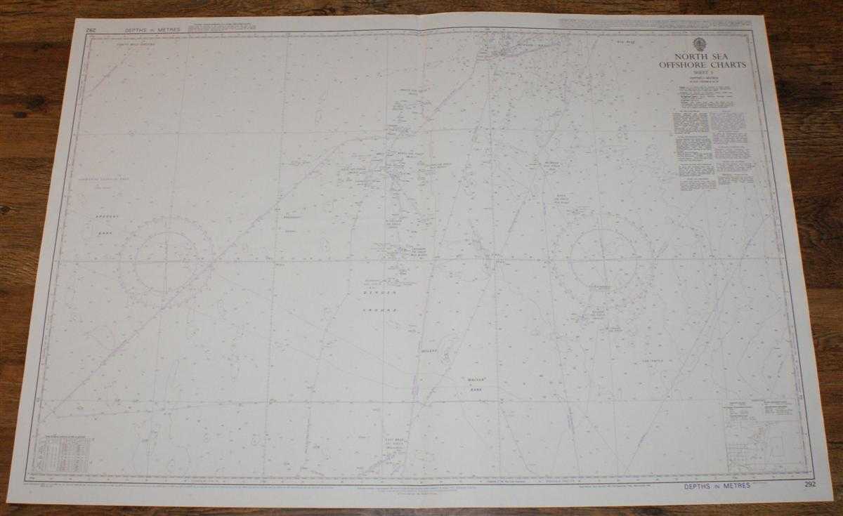
Description: Admiralty, 2005. Revised Edition, Softcover. Very Good Condition/No Dust Jacket. Crisp and clean black, white and purple chart with formal vertical centre fold. Nautical Chart No. 292 North Sea Offshore Charts - Sheet 3. Copyright 1995 with notices to 2005. Scale 1:200,000. Area Covered: North Sea (part), Bressay Bank, Bergen Ground, Walker Bank, Bergen Bank, The Patch, Holene, Alle Bank. Beryl Oil Field, Ness Oil Field, Frigg Gas Field, Heimdal Gas Field, Gryphon Oil Field, East Brae Gas Field, Balder Oil Field, etc. Size: 72x104cm. Single sheet map/chart which is suitable for framing and will be shipped rolled and in a cardboard tube. Quantity Available: 1. Shipped Weight: under 1 kg. Pictures of this item not already displayed here available upon request. Inventory No: 45517114047. ISBN: 0195123824
Keywords: BZDB4 Maps; Scandinavia; Scotland; naval, naval history, maritime, ships, boats. Admiralty Nautical Chart No. 292 North Sea Offshore Charts - Sheet 3 with Oil & Gas Fields Scandinavia Scotland naval, naval history, maritime, ships, boats
See more books from our catalog: Maps
Title: Nautical Chart No. 292 North Sea Offshore Charts - Sheet 3 with Oil & Gas Fields
Description: Admiralty, 2005. Revised Edition, Softcover. Very Good Condition/No Dust Jacket. Crisp and clean black, white and purple chart with formal vertical centre fold. Nautical Chart No. 292 North Sea Offshore Charts - Sheet 3. Copyright 1995 with notices to 2005. Scale 1:200,000. Area Covered: North Sea (part), Bressay Bank, Bergen Ground, Walker Bank, Bergen Bank, The Patch, Holene, Alle Bank. Beryl Oil Field, Ness Oil Field, Frigg Gas Field, Heimdal Gas Field, Gryphon Oil Field, East Brae Gas Field, Balder Oil Field, etc. Size: 72x104cm. Single sheet map/chart which is suitable for framing and will be shipped rolled and in a cardboard tube. Quantity Available: 1. Shipped Weight: under 1 kg. Pictures of this item not already displayed here available upon request. Inventory No: 45517114047. ISBN: 0195123824
Keywords: BZDB4 Maps; Scandinavia; Scotland; naval, naval history, maritime, ships, boats. Admiralty Nautical Chart No. 292 North Sea Offshore Charts - Sheet 3 with Oil & Gas Fields Scandinavia Scotland naval, naval history, maritime, ships, boats
Price: GBP 24.00 = appr. US$ 34.27 Seller: Bailgate Books Ltd
- Book number: 45517114047
- Book number: 45517114047
See more books from our catalog: Maps