Author: Admiralty
Title: Nautical Chart No. 4923 Canada - British Columbia, Queen Charlotte Sound
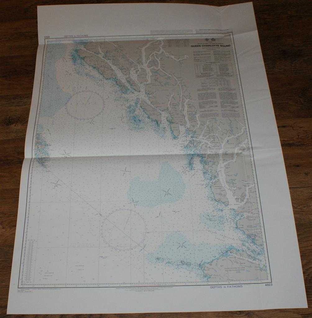
Description: Map Admiralty, 2005. Revised Edition, Softcover. Very Good Condition/No Dust Jacket. Crisp and clean colour chart with single vertical and two horizontal folds. Nautical Chart No. 4923 Canada - British Columbia, Queen Charlotte Sound. 2003 edition with notices to 2005. Scale 1:365,100. Area Covered: Canada (part), Vancouver Island (part), Calvert Island, King Island, Hunter Island, Swindle Island, Roderick Island, Aristazabal Island, Princess Royal Island, Banks Island, Pitt Island, McCauley Island, etc. Queen Charlotte Sound, Hecate Strait, Caamano Sound, Squally Channel, Douglas Channel, Millbanke Sound, Fitz Hugh Sound, etc. Size: 119x84cm. Item Type: Map. Single sheet map/chart which is suitable for framing and will be shipped rolled and in a cardboard tube. Quantity Available: 1. Shipped Weight: under 1 kg. Pictures of this item not already displayed here available upon request. Inventory No: 45517104082. ISBN: 1870141156
Keywords: BZDB4 Maps; USA & Canada; naval, naval history, maritime, ships, boats. Admiralty Nautical Chart No. 4923 Canada - British Columbia, Queen Charlotte Sound USA & Canada naval, naval history, maritime, ships, boats
See more books from our catalog: Maps
Title: Nautical Chart No. 4923 Canada - British Columbia, Queen Charlotte Sound
Description: Map Admiralty, 2005. Revised Edition, Softcover. Very Good Condition/No Dust Jacket. Crisp and clean colour chart with single vertical and two horizontal folds. Nautical Chart No. 4923 Canada - British Columbia, Queen Charlotte Sound. 2003 edition with notices to 2005. Scale 1:365,100. Area Covered: Canada (part), Vancouver Island (part), Calvert Island, King Island, Hunter Island, Swindle Island, Roderick Island, Aristazabal Island, Princess Royal Island, Banks Island, Pitt Island, McCauley Island, etc. Queen Charlotte Sound, Hecate Strait, Caamano Sound, Squally Channel, Douglas Channel, Millbanke Sound, Fitz Hugh Sound, etc. Size: 119x84cm. Item Type: Map. Single sheet map/chart which is suitable for framing and will be shipped rolled and in a cardboard tube. Quantity Available: 1. Shipped Weight: under 1 kg. Pictures of this item not already displayed here available upon request. Inventory No: 45517104082. ISBN: 1870141156
Keywords: BZDB4 Maps; USA & Canada; naval, naval history, maritime, ships, boats. Admiralty Nautical Chart No. 4923 Canada - British Columbia, Queen Charlotte Sound USA & Canada naval, naval history, maritime, ships, boats
Price: GBP 26.00 = appr. US$ 37.13 Seller: Bailgate Books Ltd
- Book number: 45517104082
- Book number: 45517104082
See more books from our catalog: Maps