Author: Admiralty
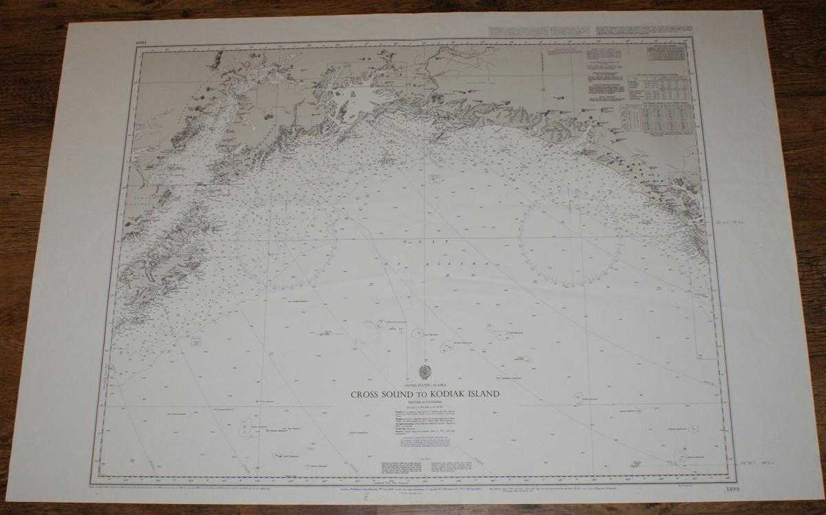
Title: Nautical Chart No. 1499 United States - Alaska, Cross Sound to Kodiak Island
Description: Map Admiralty, 2003. Revised Edition, Softcover. Good Condition/No Dust Jacket. Black and white chart with single vertical fold. Sheet is a little marked and creased. Two pencil bearings marked in the right hand margin. Nautical Chart No. 1499 United States - Alaska, Cross Sound to Kodiak Island. Copyright 1993 with small corrections to 2003. Scale 1:1,393,000. Area Covered: North America (part), Alaska (part), Kodiaki, Alaska Peninsula, Kenai Peninsula, Montague Island, Bering Glacier, Malaspina Glacier. Gulf of Alaska, Cook Inlet, Shelikof Strait, Prince William Sound, Copper River. Size: 72x104. Item Type: Map. Single sheet map/chart which is suitable for framing and will be shipped rolled and in a cardboard tube. Quantity Available: 1. Shipped Weight: under 1 kg. Pictures of this item not already displayed here available upon request. Inventory No: 45517104072. ISBN: 1870141156
Keywords: BZDB4 Maps; USA & Canada; Arctic & Antarctic; naval, naval history, maritime, ships, boats. Admiralty Nautical Chart No. 1499 United States - Alaska, Cross Sound to Kodiak Island USA & Canada Arctic & Antarctic naval, naval history, maritime, ships, boat
See more books from our catalog: Maps
Title: Nautical Chart No. 1499 United States - Alaska, Cross Sound to Kodiak Island
Description: Map Admiralty, 2003. Revised Edition, Softcover. Good Condition/No Dust Jacket. Black and white chart with single vertical fold. Sheet is a little marked and creased. Two pencil bearings marked in the right hand margin. Nautical Chart No. 1499 United States - Alaska, Cross Sound to Kodiak Island. Copyright 1993 with small corrections to 2003. Scale 1:1,393,000. Area Covered: North America (part), Alaska (part), Kodiaki, Alaska Peninsula, Kenai Peninsula, Montague Island, Bering Glacier, Malaspina Glacier. Gulf of Alaska, Cook Inlet, Shelikof Strait, Prince William Sound, Copper River. Size: 72x104. Item Type: Map. Single sheet map/chart which is suitable for framing and will be shipped rolled and in a cardboard tube. Quantity Available: 1. Shipped Weight: under 1 kg. Pictures of this item not already displayed here available upon request. Inventory No: 45517104072. ISBN: 1870141156
Keywords: BZDB4 Maps; USA & Canada; Arctic & Antarctic; naval, naval history, maritime, ships, boats. Admiralty Nautical Chart No. 1499 United States - Alaska, Cross Sound to Kodiak Island USA & Canada Arctic & Antarctic naval, naval history, maritime, ships, boat
Price: GBP 22.00 = appr. US$ 31.42 Seller: Bailgate Books Ltd
- Book number: 45517104072
- Book number: 45517104072
See more books from our catalog: Maps