Author: Admiralty
Title: Nautical Chart No. 4928 Canada - British Columbia, Hecate Strait
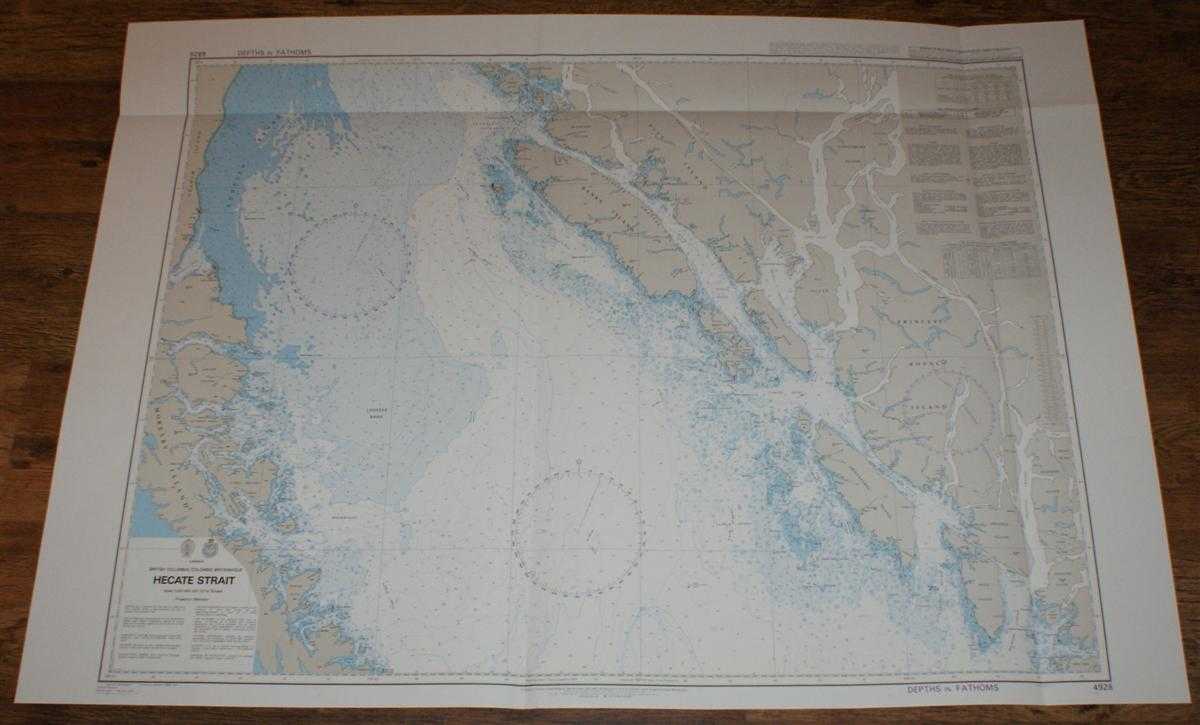
Description: Map Admiralty, 2005. Revised Edition, Softcover. Very Good Condition/No Dust Jacket. Crisp and clean colour chart with single horizontal and two vertical folds. Nautical Chart No. 4928 Canada - British Columbia, Hecate Strait. Published 2004 with notices to 2005. Scale 1:250,000. Area Covered: North America (part), Canada (part), Moresby Island, Graham Island, Louise Island, Lyell Island, Banks Island, Pitt Island, Aristazabal Island, Estevan Group, Campania Island, Gil Island, Princess Royal Island, Hawkesbury Island, etc. Hecate Strait, Juan Perez Sound, Caamano Sound, Grenville Channel, Laredo Channel, Douglas Channel, etc. Size: 84x119cm. Item Type: Map. Single sheet map/chart which is suitable for framing and will be shipped rolled and in a cardboard tube. Quantity Available: 1. Shipped Weight: under 1 kg. Pictures of this item not already displayed here available upon request. Inventory No: 45517104068. ISBN: 1870141156
Keywords: BZDB4 Maps; USA & Canada; naval, naval history, maritime, ships, boats. Admiralty Nautical Chart No. 4928 Canada - British Columbia, Hecate Strait USA & Canada naval, naval history, maritime, ships, boats
See more books from our catalog: Maps
Title: Nautical Chart No. 4928 Canada - British Columbia, Hecate Strait
Description: Map Admiralty, 2005. Revised Edition, Softcover. Very Good Condition/No Dust Jacket. Crisp and clean colour chart with single horizontal and two vertical folds. Nautical Chart No. 4928 Canada - British Columbia, Hecate Strait. Published 2004 with notices to 2005. Scale 1:250,000. Area Covered: North America (part), Canada (part), Moresby Island, Graham Island, Louise Island, Lyell Island, Banks Island, Pitt Island, Aristazabal Island, Estevan Group, Campania Island, Gil Island, Princess Royal Island, Hawkesbury Island, etc. Hecate Strait, Juan Perez Sound, Caamano Sound, Grenville Channel, Laredo Channel, Douglas Channel, etc. Size: 84x119cm. Item Type: Map. Single sheet map/chart which is suitable for framing and will be shipped rolled and in a cardboard tube. Quantity Available: 1. Shipped Weight: under 1 kg. Pictures of this item not already displayed here available upon request. Inventory No: 45517104068. ISBN: 1870141156
Keywords: BZDB4 Maps; USA & Canada; naval, naval history, maritime, ships, boats. Admiralty Nautical Chart No. 4928 Canada - British Columbia, Hecate Strait USA & Canada naval, naval history, maritime, ships, boats
Price: GBP 26.00 = appr. US$ 37.13 Seller: Bailgate Books Ltd
- Book number: 45517104068
- Book number: 45517104068
See more books from our catalog: Maps