Author: Admiralty
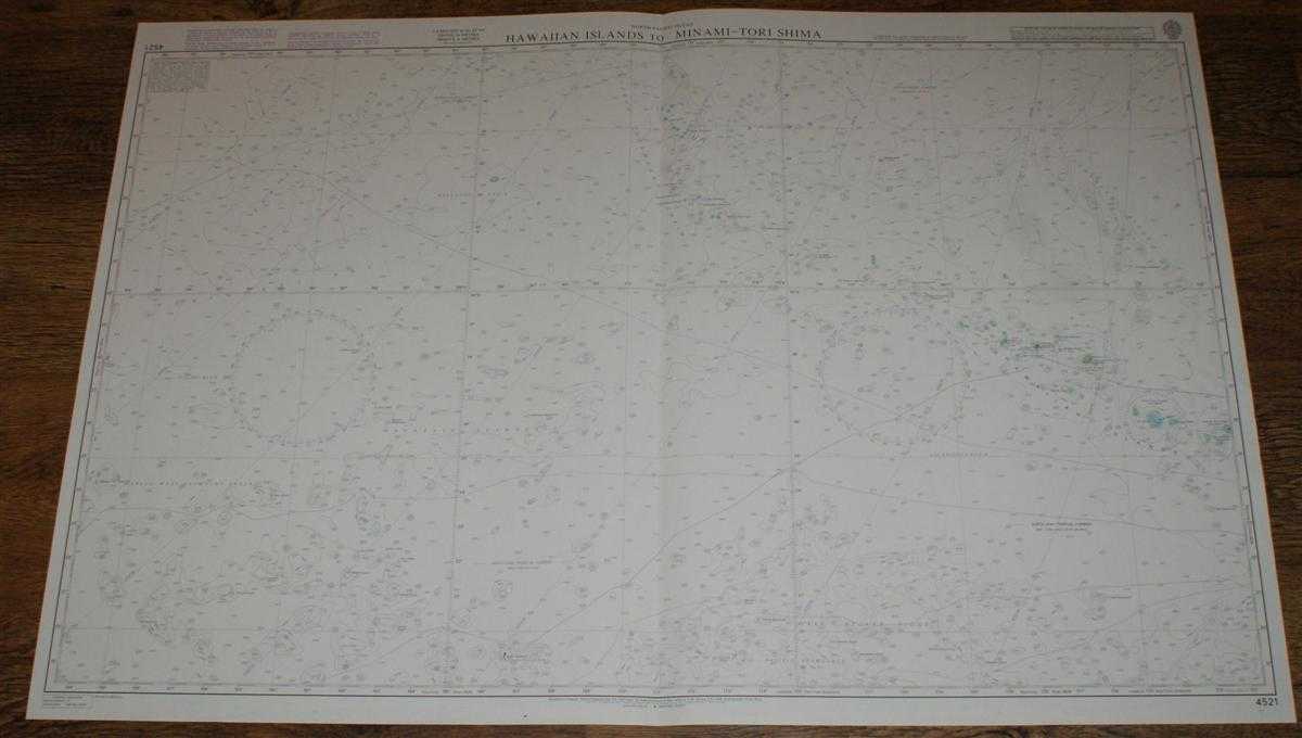
Title: Nautical Chart No. 4521 North Pacific Ocean, Hawaiian Islands to Minami-Tori Shima
Description: Map Admiralty, 2003. Revised Edition, Softcover. Very Good Condition/No Dust Jacket. Crisp and clean colour chart with single vertical fold. Nautical Chart No. 4521 North Pacific Ocean, Hawaiian Islands to Minami-Tori Shima. 2003 edition of 1983 publication. Scale 1:3,500,000. Area Covered: North Pacific (part), Hawaiian Islands (part), Emperor Seamount Chain, Marcus-Wake Seamount Group, Schatskiy Rise, Wake Necker Ridge, Liliuokalani Ridge. Size: 72x104. Item Type: Map. Single sheet map/chart which is suitable for framing and will be shipped rolled and in a cardboard tube. Quantity Available: 1. Shipped Weight: under 1 kg. Pictures of this item not already displayed here available upon request. Inventory No: 45517104053. ISBN: 1870141156
Keywords: BZDB4 Maps; USA & Canada; Australasia and the Pacific; naval, naval history, maritime, ships, boats. Admiralty Nautical Chart No. 4521 North Pacific Ocean, Hawaiian Islands to Minami-Tori Shima USA & Canada Australasia and the Pacific naval, naval histor
See more books from our catalog: Maps
Title: Nautical Chart No. 4521 North Pacific Ocean, Hawaiian Islands to Minami-Tori Shima
Description: Map Admiralty, 2003. Revised Edition, Softcover. Very Good Condition/No Dust Jacket. Crisp and clean colour chart with single vertical fold. Nautical Chart No. 4521 North Pacific Ocean, Hawaiian Islands to Minami-Tori Shima. 2003 edition of 1983 publication. Scale 1:3,500,000. Area Covered: North Pacific (part), Hawaiian Islands (part), Emperor Seamount Chain, Marcus-Wake Seamount Group, Schatskiy Rise, Wake Necker Ridge, Liliuokalani Ridge. Size: 72x104. Item Type: Map. Single sheet map/chart which is suitable for framing and will be shipped rolled and in a cardboard tube. Quantity Available: 1. Shipped Weight: under 1 kg. Pictures of this item not already displayed here available upon request. Inventory No: 45517104053. ISBN: 1870141156
Keywords: BZDB4 Maps; USA & Canada; Australasia and the Pacific; naval, naval history, maritime, ships, boats. Admiralty Nautical Chart No. 4521 North Pacific Ocean, Hawaiian Islands to Minami-Tori Shima USA & Canada Australasia and the Pacific naval, naval histor
Price: GBP 22.00 = appr. US$ 31.42 Seller: Bailgate Books Ltd
- Book number: 45517104053
- Book number: 45517104053
See more books from our catalog: Maps