Author: Admiralty
Title: Nautical Chart No. 4972 United States, Alaska - Southeast Coast, Etolin Island to Midway Islands including Sumner Strait
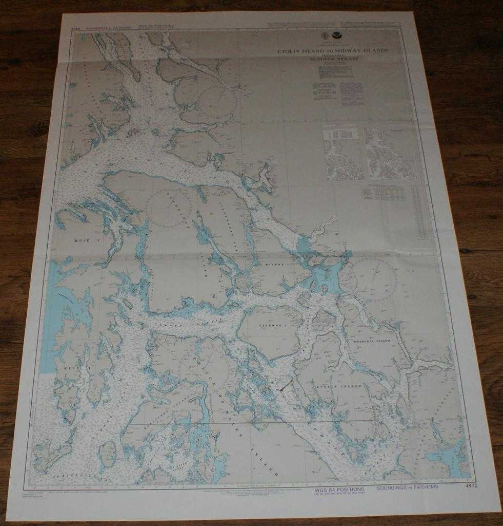
Description: Map Admiralty, 2005. Revised Edition, Softcover. Good Condition/No Dust Jacket. Crisp colour chart with two vertical and two horizontal folds. Sheet has small elongated tear/hole in the area of Clarence Strait. Some pencil bearings. Nautical Chart No. 4972 United States, Alaska - Southeast Coast, Etolin Island to Midway Islands including Sumner Strait. 2002 edition with notices to 2005. Scale 1:217,828. Area Covered: North America (part), Alaska (part), Kuiu Island, Prince of Wales Island, Kupreanof Island, Zarembo Island, Etolin Island, Wrangell Island, Mitkof Island, Lindenberg Peninsula, Admiralty Island. Frederick Sound, Stephens Passage, Tebenkof Bay, Sumner Strait, Clarence Strait, Iphigenia Bay, Ernest Sound. Size: 119x84cm. Item Type: Map. Single sheet map/chart which is suitable for framing and will be shipped rolled and in a cardboard tube. Quantity Available: 1. Shipped Weight: under 1 kg. Pictures of this item not already displayed here available upon request. Inventory No: 45517104049. ISBN: 1870141156
Keywords: BZDB4 Maps; USA & Canada; Arctic & Antarctic; naval, naval history, maritime, ships, boats. Admiralty Nautical Chart No. 4972 United States, Alaska - Southeast Coast, Etolin Island to Midway Islands including Sumner Strait USA & Canada Arctic & Antarctic
See more books from our catalog: Maps
Title: Nautical Chart No. 4972 United States, Alaska - Southeast Coast, Etolin Island to Midway Islands including Sumner Strait
Description: Map Admiralty, 2005. Revised Edition, Softcover. Good Condition/No Dust Jacket. Crisp colour chart with two vertical and two horizontal folds. Sheet has small elongated tear/hole in the area of Clarence Strait. Some pencil bearings. Nautical Chart No. 4972 United States, Alaska - Southeast Coast, Etolin Island to Midway Islands including Sumner Strait. 2002 edition with notices to 2005. Scale 1:217,828. Area Covered: North America (part), Alaska (part), Kuiu Island, Prince of Wales Island, Kupreanof Island, Zarembo Island, Etolin Island, Wrangell Island, Mitkof Island, Lindenberg Peninsula, Admiralty Island. Frederick Sound, Stephens Passage, Tebenkof Bay, Sumner Strait, Clarence Strait, Iphigenia Bay, Ernest Sound. Size: 119x84cm. Item Type: Map. Single sheet map/chart which is suitable for framing and will be shipped rolled and in a cardboard tube. Quantity Available: 1. Shipped Weight: under 1 kg. Pictures of this item not already displayed here available upon request. Inventory No: 45517104049. ISBN: 1870141156
Keywords: BZDB4 Maps; USA & Canada; Arctic & Antarctic; naval, naval history, maritime, ships, boats. Admiralty Nautical Chart No. 4972 United States, Alaska - Southeast Coast, Etolin Island to Midway Islands including Sumner Strait USA & Canada Arctic & Antarctic
Price: GBP 22.00 = appr. US$ 31.42 Seller: Bailgate Books Ltd
- Book number: 45517104049
- Book number: 45517104049
See more books from our catalog: Maps