Author: Admiralty
Title: Nautical Chart No.425 West Indies - Ports and Anchorages on the North Coast of Cuba
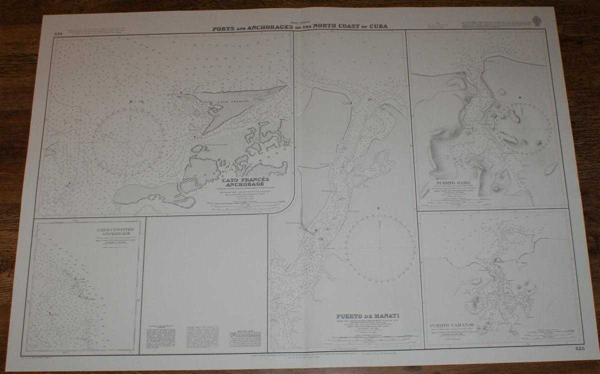
Description: Map Admiralty, 2000. Revised Edition, Softcover. Very Good Condition/No Dust Jacket. Crisp and clean black and white chart with single vertical fold. Nautical Chart No. 425 West Indies - Ports and Anchorages on the North Coast of Cuba. Copyright 1998. Sheet contains five separate charts: Cayo Frances Anchorage at scale 1:30,000 Cayo Confites Anchorage at scale 1:75,000 Puerto de Manati at scale 1:14,600 Puerto Sama at scale 1:10,000 Puerto Naranjo at scale 1:25,000 Size: 72x104cm. Item Type: Map. Quantity Available: 1. Shipped Weight: under 1 kg. Pictures of this item not already displayed here available upon request. Inventory No: 45517094068. ISBN: 1859831060
Keywords: BZDB4 Maps; naval, naval history, maritime, ships, boats; South & Central America & the West Indies. Admiralty Nautical Chart No.425 West Indies - Ports and Anchorages on the North Coast of Cuba naval, naval history, maritime, ships, boats South & Centr
See more books from our catalog: Maps
Title: Nautical Chart No.425 West Indies - Ports and Anchorages on the North Coast of Cuba
Description: Map Admiralty, 2000. Revised Edition, Softcover. Very Good Condition/No Dust Jacket. Crisp and clean black and white chart with single vertical fold. Nautical Chart No. 425 West Indies - Ports and Anchorages on the North Coast of Cuba. Copyright 1998. Sheet contains five separate charts: Cayo Frances Anchorage at scale 1:30,000 Cayo Confites Anchorage at scale 1:75,000 Puerto de Manati at scale 1:14,600 Puerto Sama at scale 1:10,000 Puerto Naranjo at scale 1:25,000 Size: 72x104cm. Item Type: Map. Quantity Available: 1. Shipped Weight: under 1 kg. Pictures of this item not already displayed here available upon request. Inventory No: 45517094068. ISBN: 1859831060
Keywords: BZDB4 Maps; naval, naval history, maritime, ships, boats; South & Central America & the West Indies. Admiralty Nautical Chart No.425 West Indies - Ports and Anchorages on the North Coast of Cuba naval, naval history, maritime, ships, boats South & Centr
Price: GBP 26.00 = appr. US$ 37.13 Seller: Bailgate Books Ltd
- Book number: 45517094068
- Book number: 45517094068
See more books from our catalog: Maps