Author: Admiralty
Title: Nautical Chart No. 390 Bahamas - Grand Bahama Island, Approaches to Freeport
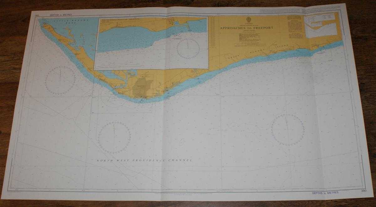
Description: Map Admiralty, 2001. Revised Edition, Softcover. Very Good Condition/No Dust Jacket. Crisp and clean colour chart with two vertical folds. Nautical Chart No. 390 Bahamas - Grand Bahama Island, Approaches to Freeport. Copyright 1998 with small corrections to 2001. Scale 1:75,000. Sheet contains inset chart of South Riding Point Oil Terminal at scale 1:25,000. Area Covered: Grand Bahama Island (part), Freeport, West End International Airport, Freeport Harbour, John Jack Point, Grand Lucayan Waterway, North West Providence Channel, Little Bahama Bank. Size: 72x118cm. Item Type: Map. Quantity Available: 1. Shipped Weight: under 1 kg. Pictures of this item not already displayed here available upon request. Inventory No: 45517094066. ISBN: 1859831060
Keywords: BZDB4 Maps; naval, naval history, maritime, ships, boats; South & Central America & the West Indies. Admiralty Nautical Chart No. 390 Bahamas - Grand Bahama Island, Approaches to Freeport naval, naval history, maritime, ships, boats South & Central Amer
See more books from our catalog: Maps
Title: Nautical Chart No. 390 Bahamas - Grand Bahama Island, Approaches to Freeport
Description: Map Admiralty, 2001. Revised Edition, Softcover. Very Good Condition/No Dust Jacket. Crisp and clean colour chart with two vertical folds. Nautical Chart No. 390 Bahamas - Grand Bahama Island, Approaches to Freeport. Copyright 1998 with small corrections to 2001. Scale 1:75,000. Sheet contains inset chart of South Riding Point Oil Terminal at scale 1:25,000. Area Covered: Grand Bahama Island (part), Freeport, West End International Airport, Freeport Harbour, John Jack Point, Grand Lucayan Waterway, North West Providence Channel, Little Bahama Bank. Size: 72x118cm. Item Type: Map. Quantity Available: 1. Shipped Weight: under 1 kg. Pictures of this item not already displayed here available upon request. Inventory No: 45517094066. ISBN: 1859831060
Keywords: BZDB4 Maps; naval, naval history, maritime, ships, boats; South & Central America & the West Indies. Admiralty Nautical Chart No. 390 Bahamas - Grand Bahama Island, Approaches to Freeport naval, naval history, maritime, ships, boats South & Central Amer
Price: GBP 26.00 = appr. US$ 37.13 Seller: Bailgate Books Ltd
- Book number: 45517094066
- Book number: 45517094066
See more books from our catalog: Maps