Author: Admiralty
Title: Nautical Chart No. 3450 West Indies, Cuba - South Coast, Ensenada de Mora
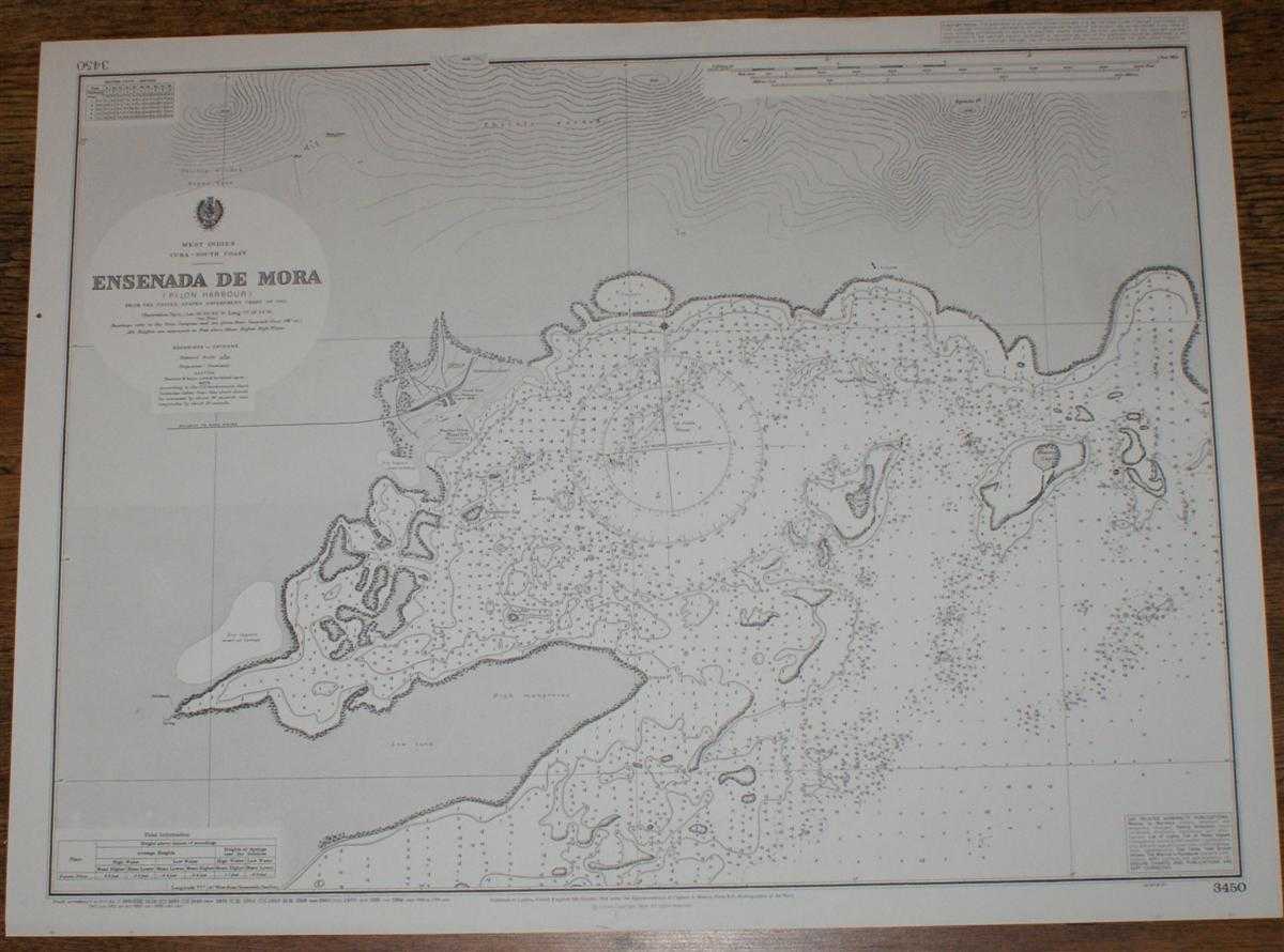
Description: Map Admiralty, 1998. Revised Edition, Softcover. Very Good Condition/No Dust Jacket. Crisp and clean black and white chart with no formal fold. Nautical Chart No. 3450 West Indies, Cuba - South Coast, Ensenada de Mora. Copyright 1904 with small corrections to 1998. Scale 1:14,530. Area Covered: Cuba (part), Puerto Pilan, Sugar Mill, Purgatorio Cay, Pajaro Cay, Blanco Cay, Redondo Cay. Size: 52x71cm. Item Type: Map. Quantity Available: 1. Shipped Weight: under 1 kg. Pictures of this item not already displayed here available upon request. Inventory No: 45517094045. ISBN: 1859831060
Keywords: BZDB4 Maps; naval, naval history, maritime, ships, boats; South & Central America & the West Indies. Admiralty Nautical Chart No. 3450 West Indies, Cuba - South Coast, Ensenada de Mora naval, naval history, maritime, ships, boats South & Central America
See more books from our catalog: Maps
Title: Nautical Chart No. 3450 West Indies, Cuba - South Coast, Ensenada de Mora
Description: Map Admiralty, 1998. Revised Edition, Softcover. Very Good Condition/No Dust Jacket. Crisp and clean black and white chart with no formal fold. Nautical Chart No. 3450 West Indies, Cuba - South Coast, Ensenada de Mora. Copyright 1904 with small corrections to 1998. Scale 1:14,530. Area Covered: Cuba (part), Puerto Pilan, Sugar Mill, Purgatorio Cay, Pajaro Cay, Blanco Cay, Redondo Cay. Size: 52x71cm. Item Type: Map. Quantity Available: 1. Shipped Weight: under 1 kg. Pictures of this item not already displayed here available upon request. Inventory No: 45517094045. ISBN: 1859831060
Keywords: BZDB4 Maps; naval, naval history, maritime, ships, boats; South & Central America & the West Indies. Admiralty Nautical Chart No. 3450 West Indies, Cuba - South Coast, Ensenada de Mora naval, naval history, maritime, ships, boats South & Central America
Price: GBP 20.00 = appr. US$ 28.56 Seller: Bailgate Books Ltd
- Book number: 45517094045
- Book number: 45517094045
See more books from our catalog: Maps