Author: Admiralty
Title: Nautical Chart No. 465 West Indies - Haiti, Fort Liberte to Ile de la Tortue
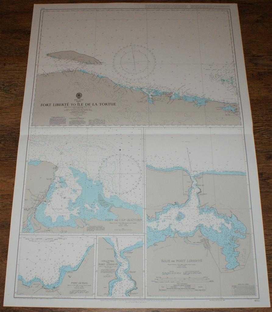
Description: Map Admiralty, 1999. Revised Edition, Softcover. Very Good Condition/No Dust Jacket. Crisp and clean colour chart with single horizontal fold. Nautical Chart No. 465 West Indies - Haiti, Fort Liberte to Ile de la Tortue. Copyright 1988 with small corrections to 1999. Sheet contains five separate charts: Fort Liberte to Ile de la Tortue at scale 1:200,000 Port de Cap-Haitien at scale 1:25,000 Port de Paix at scale 1:12,000 Channel to Port Liberte at scale 1:12,000 Baie de Fort Liberte at scale 1:25,000 Size: 104x72cm. Item Type: Map. Quantity Available: 1. Shipped Weight: under 1 kg. Pictures of this item not already displayed here available upon request. Inventory No: 45517094043. ISBN: 1859831060
Keywords: BZDB4 Maps; naval, naval history, maritime, ships, boats; South & Central America & the West Indies. Admiralty Nautical Chart No. 465 West Indies - Haiti, Fort Liberte to Ile de la Tortue naval, naval history, maritime, ships, boats South & Central Amer
See more books from our catalog: Maps
Title: Nautical Chart No. 465 West Indies - Haiti, Fort Liberte to Ile de la Tortue
Description: Map Admiralty, 1999. Revised Edition, Softcover. Very Good Condition/No Dust Jacket. Crisp and clean colour chart with single horizontal fold. Nautical Chart No. 465 West Indies - Haiti, Fort Liberte to Ile de la Tortue. Copyright 1988 with small corrections to 1999. Sheet contains five separate charts: Fort Liberte to Ile de la Tortue at scale 1:200,000 Port de Cap-Haitien at scale 1:25,000 Port de Paix at scale 1:12,000 Channel to Port Liberte at scale 1:12,000 Baie de Fort Liberte at scale 1:25,000 Size: 104x72cm. Item Type: Map. Quantity Available: 1. Shipped Weight: under 1 kg. Pictures of this item not already displayed here available upon request. Inventory No: 45517094043. ISBN: 1859831060
Keywords: BZDB4 Maps; naval, naval history, maritime, ships, boats; South & Central America & the West Indies. Admiralty Nautical Chart No. 465 West Indies - Haiti, Fort Liberte to Ile de la Tortue naval, naval history, maritime, ships, boats South & Central Amer
Price: GBP 26.00 = appr. US$ 37.13 Seller: Bailgate Books Ltd
- Book number: 45517094043
- Book number: 45517094043
See more books from our catalog: Maps