Author: Admiralty
Title: Nautical Chart No. 435 Ports and Anchorages in the Eastern Part of Cuba
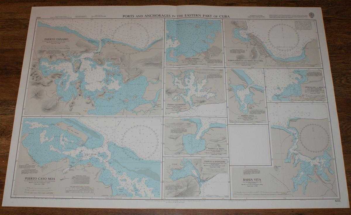
Description: Map Admiralty, 2001. Revised Edition, Softcover. Very Good Condition/No Dust Jacket. Crisp and clean colour chart with single vertical fold. Nautical Chart No. 435 Ports and Anchorages in the Eastern Part of Cuba. Copyright 1991 with small corrections to 2001. Sheet contains ten separate charts at varying scales: Puerto Tanamo, Puerto Cayo Moa, Bahia Niquero, Puerto Escondido, Puerto de Mata, Puerto de Baitiquiri, Puerto Baracoa and Bahia de la Miel, Puerto Taco, Approaches to Belic and Rio Limones, Bahia Vita. Size: 72x104cm. Item Type: Map. Quantity Available: 1. Shipped Weight: under 1 kg. Pictures of this item not already displayed here available upon request. Inventory No: 45517094038. ISBN: 1859831060
Keywords: BZDB4 Maps; naval, naval history, maritime, ships, boats; South & Central America & the West Indies. Admiralty Nautical Chart No. 435 Ports and Anchorages in the Eastern Part of Cuba naval, naval history, maritime, ships, boats South & Central America &
See more books from our catalog: Maps
Title: Nautical Chart No. 435 Ports and Anchorages in the Eastern Part of Cuba
Description: Map Admiralty, 2001. Revised Edition, Softcover. Very Good Condition/No Dust Jacket. Crisp and clean colour chart with single vertical fold. Nautical Chart No. 435 Ports and Anchorages in the Eastern Part of Cuba. Copyright 1991 with small corrections to 2001. Sheet contains ten separate charts at varying scales: Puerto Tanamo, Puerto Cayo Moa, Bahia Niquero, Puerto Escondido, Puerto de Mata, Puerto de Baitiquiri, Puerto Baracoa and Bahia de la Miel, Puerto Taco, Approaches to Belic and Rio Limones, Bahia Vita. Size: 72x104cm. Item Type: Map. Quantity Available: 1. Shipped Weight: under 1 kg. Pictures of this item not already displayed here available upon request. Inventory No: 45517094038. ISBN: 1859831060
Keywords: BZDB4 Maps; naval, naval history, maritime, ships, boats; South & Central America & the West Indies. Admiralty Nautical Chart No. 435 Ports and Anchorages in the Eastern Part of Cuba naval, naval history, maritime, ships, boats South & Central America &
Price: GBP 26.00 = appr. US$ 37.13 Seller: Bailgate Books Ltd
- Book number: 45517094038
- Book number: 45517094038
See more books from our catalog: Maps