Author: Admiralty
Title: Nautical Chart No. 260 West Indies - Pedro Bank to the South Coast of Jamaica
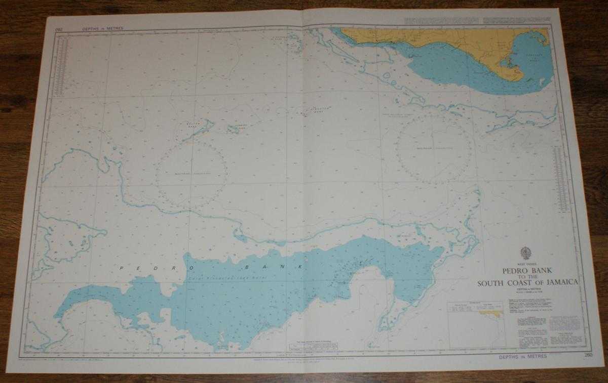
Description: Map Admiralty, 1999. Revised Edition, Softcover. Very Good Condition/No Dust Jacket. Crisp and clean colour chart with single vertical fold. Nautical Chart No. 260 West Indies - Pedro Bank to the South Coast of Jamaica. Copyright 1976 with small corrections to 1999. Scale 1:200,000. Area Covered: Jamaica (part), Portland Bight, Salt River, Brazilletto Mountains, Port Kaiser, Pedro Plains, Santa Cruz Mountains, Pedro Cays, Pedro Bank, Blossom Bank, Kingston Bank, Sunbury Bank, Walton Bank. Size: 72x104cm. Item Type: Map. Quantity Available: 1. Shipped Weight: under 1 kg. Pictures of this item not already displayed here available upon request. Inventory No: 45517094033. ISBN: 1859831060
Keywords: BZDB4 Maps; naval, naval history, maritime, ships, boats; South & Central America & the West Indies. Admiralty Nautical Chart No. 260 West Indies - Pedro Bank to the South Coast of Jamaica naval, naval history, maritime, ships, boats South & Central Ame
See more books from our catalog: Maps
Title: Nautical Chart No. 260 West Indies - Pedro Bank to the South Coast of Jamaica
Description: Map Admiralty, 1999. Revised Edition, Softcover. Very Good Condition/No Dust Jacket. Crisp and clean colour chart with single vertical fold. Nautical Chart No. 260 West Indies - Pedro Bank to the South Coast of Jamaica. Copyright 1976 with small corrections to 1999. Scale 1:200,000. Area Covered: Jamaica (part), Portland Bight, Salt River, Brazilletto Mountains, Port Kaiser, Pedro Plains, Santa Cruz Mountains, Pedro Cays, Pedro Bank, Blossom Bank, Kingston Bank, Sunbury Bank, Walton Bank. Size: 72x104cm. Item Type: Map. Quantity Available: 1. Shipped Weight: under 1 kg. Pictures of this item not already displayed here available upon request. Inventory No: 45517094033. ISBN: 1859831060
Keywords: BZDB4 Maps; naval, naval history, maritime, ships, boats; South & Central America & the West Indies. Admiralty Nautical Chart No. 260 West Indies - Pedro Bank to the South Coast of Jamaica naval, naval history, maritime, ships, boats South & Central Ame
Price: GBP 26.00 = appr. US$ 37.13 Seller: Bailgate Books Ltd
- Book number: 45517094033
- Book number: 45517094033
See more books from our catalog: Maps