Author: Admiralty
Title: Nautical Chart No. 476 West Indies, Haiti - South Coast, Baie D'Aquin to Baie Aux Cayes including Ile Vache
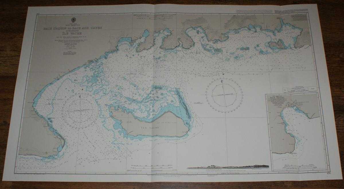
Description: Map Admiralty, 1999. Revised Edition, Softcover. Very Good Condition/No Dust Jacket. Crisp and clean colour chart with two vertical folds. Nautical Chart No. 476 West Indies, Haiti - South Coast, Baie D'Aquin to Baie Aux Cayes including Ile Vache. Copyright 1954 with small corrections to 1999. Scale 1:50,000. Sheet contains an engraved long-section coastal view and an inset chart of Baie Jacmel at scale 1:37,500. Area Covered: Haiti (part), Ile Vache, Abacou, Port Nanette, Aux Cayes, La Grosse Caye, Baie aux Cayes, Passe du Sud, Passe de L'Est, Baie des Flamands, Grande Baie Mesle, Baie St. Louis, Baie des Anglais. Size: 72x118cm. Item Type: Map. Quantity Available: 1. Shipped Weight: under 1 kg. Pictures of this item not already displayed here available upon request. Inventory No: 45517094023. ISBN: 1859831060
Keywords: BZDB4 Maps; naval, naval history, maritime, ships, boats; South & Central America & the West Indies. Admiralty Nautical Chart No. 476 West Indies, Haiti - South Coast, Baie D'Aquin to Baie Aux Cayes including Ile Vache naval, naval history, maritime, ship
See more books from our catalog: Maps
Title: Nautical Chart No. 476 West Indies, Haiti - South Coast, Baie D'Aquin to Baie Aux Cayes including Ile Vache
Description: Map Admiralty, 1999. Revised Edition, Softcover. Very Good Condition/No Dust Jacket. Crisp and clean colour chart with two vertical folds. Nautical Chart No. 476 West Indies, Haiti - South Coast, Baie D'Aquin to Baie Aux Cayes including Ile Vache. Copyright 1954 with small corrections to 1999. Scale 1:50,000. Sheet contains an engraved long-section coastal view and an inset chart of Baie Jacmel at scale 1:37,500. Area Covered: Haiti (part), Ile Vache, Abacou, Port Nanette, Aux Cayes, La Grosse Caye, Baie aux Cayes, Passe du Sud, Passe de L'Est, Baie des Flamands, Grande Baie Mesle, Baie St. Louis, Baie des Anglais. Size: 72x118cm. Item Type: Map. Quantity Available: 1. Shipped Weight: under 1 kg. Pictures of this item not already displayed here available upon request. Inventory No: 45517094023. ISBN: 1859831060
Keywords: BZDB4 Maps; naval, naval history, maritime, ships, boats; South & Central America & the West Indies. Admiralty Nautical Chart No. 476 West Indies, Haiti - South Coast, Baie D'Aquin to Baie Aux Cayes including Ile Vache naval, naval history, maritime, ship
Price: GBP 26.00 = appr. US$ 37.13 Seller: Bailgate Books Ltd
- Book number: 45517094023
- Book number: 45517094023
See more books from our catalog: Maps