Author: Admiralty
Title: Nautical Chart No. 558 South America - East Coast, Isla Leones to Estrecho de Magallanes including the Falkland Islands
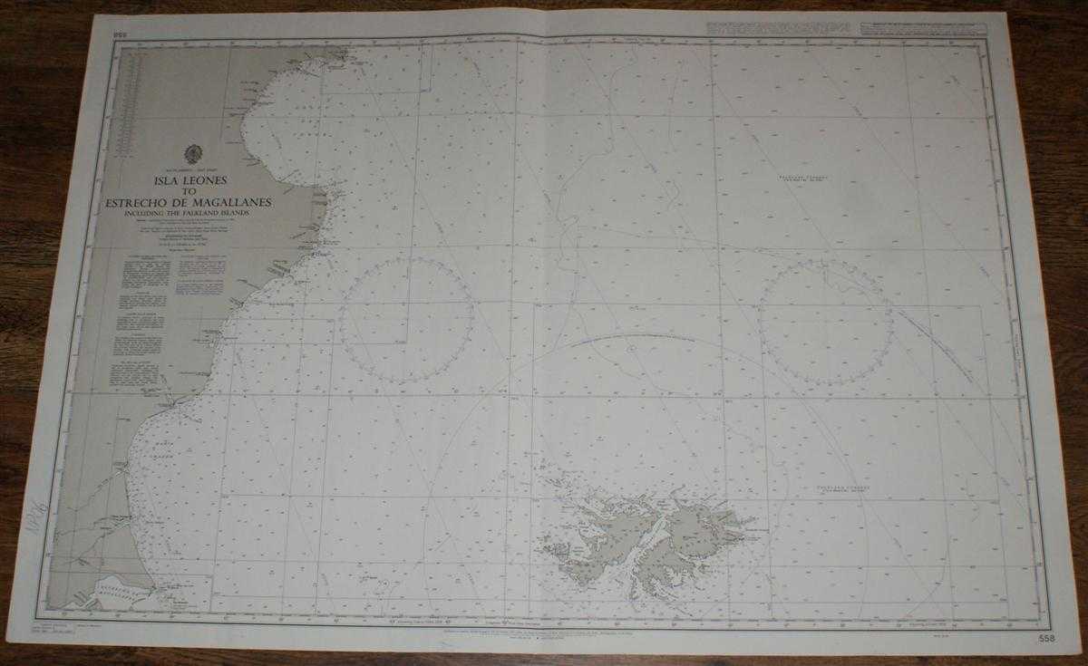
Description: Map Admiralty, 2003. Revised Edition, Softcover. Very Good Condition/No Dust Jacket. Black and white chart with single vertical fold. Pencil annotation in bottom left margin and single staple in top right margin. Sheet is slightly worn. Nautical Chart No. 558 South America - East Coast, Isla Leones to Estrecho de Magallanes including the Falkland Islands. 2003 edition of 1967 publication. Scale 1:1,750,000. Area Covered: South America (part), Chile (part), Argentina (part), Santa Cruz, Gallegos, Cabo Dos Bahias, Comodoro Rivadavia, Golfo San Jorge, Bahia Grande, Estrecho de Magallanes. West Falkland, East Falkland, Weddell Island, King George Bay, Queen Charlotte Bay, Falkland Sound, Jason Islands, Pebble Island, Bay of Harbours, Sea Lion Island, Berkeley Sound, Port Salvador. Size: 72x104cm. Item Type: Map. Quantity Available: 1. Shipped Weight: under 1 kg. Pictures of this item not already displayed here available upon request. Inventory No: 45517094014. ISBN: 1859831060
Keywords: BZDB4 Maps; naval, naval history, maritime, ships, boats; South & Central America & the West Indies. Admiralty Nautical Chart No. 558 South America - East Coast, Isla Leones to Estrecho de Magallanes including the Falkland Islands naval, naval history, ma
See more books from our catalog: Maps
Title: Nautical Chart No. 558 South America - East Coast, Isla Leones to Estrecho de Magallanes including the Falkland Islands
Description: Map Admiralty, 2003. Revised Edition, Softcover. Very Good Condition/No Dust Jacket. Black and white chart with single vertical fold. Pencil annotation in bottom left margin and single staple in top right margin. Sheet is slightly worn. Nautical Chart No. 558 South America - East Coast, Isla Leones to Estrecho de Magallanes including the Falkland Islands. 2003 edition of 1967 publication. Scale 1:1,750,000. Area Covered: South America (part), Chile (part), Argentina (part), Santa Cruz, Gallegos, Cabo Dos Bahias, Comodoro Rivadavia, Golfo San Jorge, Bahia Grande, Estrecho de Magallanes. West Falkland, East Falkland, Weddell Island, King George Bay, Queen Charlotte Bay, Falkland Sound, Jason Islands, Pebble Island, Bay of Harbours, Sea Lion Island, Berkeley Sound, Port Salvador. Size: 72x104cm. Item Type: Map. Quantity Available: 1. Shipped Weight: under 1 kg. Pictures of this item not already displayed here available upon request. Inventory No: 45517094014. ISBN: 1859831060
Keywords: BZDB4 Maps; naval, naval history, maritime, ships, boats; South & Central America & the West Indies. Admiralty Nautical Chart No. 558 South America - East Coast, Isla Leones to Estrecho de Magallanes including the Falkland Islands naval, naval history, ma
Price: GBP 26.00 = appr. US$ 37.13 Seller: Bailgate Books Ltd
- Book number: 45517094014
- Book number: 45517094014
See more books from our catalog: Maps