Author: Admiralty
Title: Nautical Chart No. 456 West Indies, Jamaica - South Coast, Approaches to Kingston Harbour
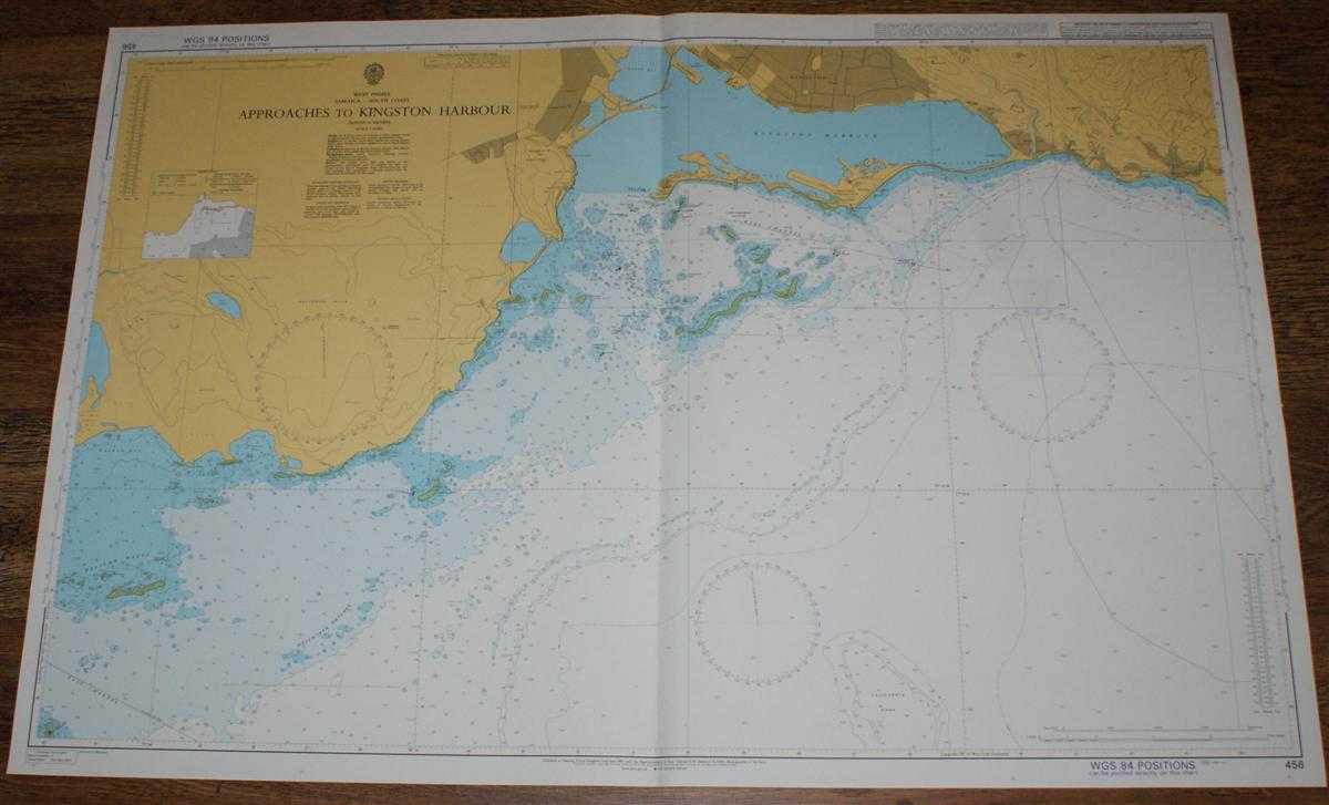
Description: Map Admiralty, 2001. Revised Edition, Softcover. Very Good Condition/No Dust Jacket. Crisp and clean colour chart with single vertical fold. Several small pencil ticks. Nautical Chart No. 456 West Indies, Jamaica - South Coast, Approaches to Kingston Harbour. 2001 edition of 1984 publication. Scale 1:40,000. Area Covered: Jamaica (part), Kingston (part), The Palisadoes, Port Royal, Hangar, Bull Bay, Seven Mile, White Houses, Braeton, Hellshire Hills, Pelican Reefs, Hotch Kyn Patches, Wreck Reef, South Channel, East Channel, Lim Cay, Hunts Bay, Manatee Bay, Walker Bay, Kingston Harbour, Calafornia Bank. Size: 72x104cm. Item Type: Map. Quantity Available: 1. Shipped Weight: under 1 kg. Pictures of this item not already displayed here available upon request. Inventory No: 45517094008. ISBN: 1859831060
Keywords: BZDB4 Maps; naval, naval history, maritime, ships, boats; South & Central America & the West Indies. Admiralty Nautical Chart No. 456 West Indies, Jamaica - South Coast, Approaches to Kingston Harbour naval, naval history, maritime, ships, boats South &
See more books from our catalog: Maps
Title: Nautical Chart No. 456 West Indies, Jamaica - South Coast, Approaches to Kingston Harbour
Description: Map Admiralty, 2001. Revised Edition, Softcover. Very Good Condition/No Dust Jacket. Crisp and clean colour chart with single vertical fold. Several small pencil ticks. Nautical Chart No. 456 West Indies, Jamaica - South Coast, Approaches to Kingston Harbour. 2001 edition of 1984 publication. Scale 1:40,000. Area Covered: Jamaica (part), Kingston (part), The Palisadoes, Port Royal, Hangar, Bull Bay, Seven Mile, White Houses, Braeton, Hellshire Hills, Pelican Reefs, Hotch Kyn Patches, Wreck Reef, South Channel, East Channel, Lim Cay, Hunts Bay, Manatee Bay, Walker Bay, Kingston Harbour, Calafornia Bank. Size: 72x104cm. Item Type: Map. Quantity Available: 1. Shipped Weight: under 1 kg. Pictures of this item not already displayed here available upon request. Inventory No: 45517094008. ISBN: 1859831060
Keywords: BZDB4 Maps; naval, naval history, maritime, ships, boats; South & Central America & the West Indies. Admiralty Nautical Chart No. 456 West Indies, Jamaica - South Coast, Approaches to Kingston Harbour naval, naval history, maritime, ships, boats South &
Price: GBP 26.00 = appr. US$ 37.13 Seller: Bailgate Books Ltd
- Book number: 45517094008
- Book number: 45517094008
See more books from our catalog: Maps