Author: Admiralty
Title: Nautical Chart No. 457 West Indies, Jamaica - South Coast, Portland Bight
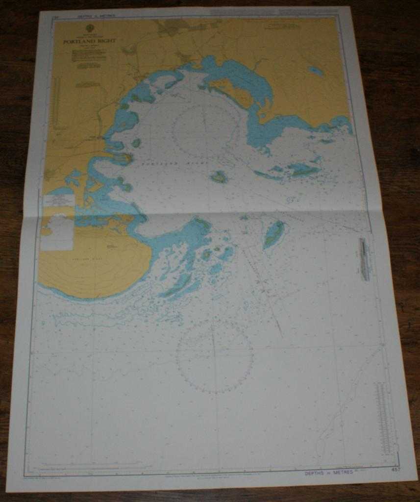
Description: Map Admiralty, 2001. Revised Edition, Softcover. Very Good Condition/No Dust Jacket. Crisp and clean colour chart with single horizontal fold. Nautical Chart No. 457 West Indies, Jamaica - South Coast, Portland Bight. Copyright 1988 with small corrections to 2001. Scale 1:40,000. Area Covered: Jamaica (part), Portland Bight, Port Esquivel, Old Harbour Bay, Salt River, Old Harbour, Mitchell Town, Portland Ridge, Brazilletto Mountains, Freetown, Great Goat Island, Little Goat Island, Pelican Reefs, Peake Bay, Galleon Harbour, Pigeon Island, Bare Bush Cay, Portland Reefs, Bower's River. Size: 104x72cm. Item Type: Map. Quantity Available: 1. Shipped Weight: under 1 kg. Pictures of this item not already displayed here available upon request. Inventory No: 45517094005. ISBN: 1859831060
Keywords: BZDB4 Maps; naval, naval history, maritime, ships, boats; South & Central America & the West Indies. Admiralty Nautical Chart No. 457 West Indies, Jamaica - South Coast, Portland Bight naval, naval history, maritime, ships, boats South & Central America
See more books from our catalog: Maps
Title: Nautical Chart No. 457 West Indies, Jamaica - South Coast, Portland Bight
Description: Map Admiralty, 2001. Revised Edition, Softcover. Very Good Condition/No Dust Jacket. Crisp and clean colour chart with single horizontal fold. Nautical Chart No. 457 West Indies, Jamaica - South Coast, Portland Bight. Copyright 1988 with small corrections to 2001. Scale 1:40,000. Area Covered: Jamaica (part), Portland Bight, Port Esquivel, Old Harbour Bay, Salt River, Old Harbour, Mitchell Town, Portland Ridge, Brazilletto Mountains, Freetown, Great Goat Island, Little Goat Island, Pelican Reefs, Peake Bay, Galleon Harbour, Pigeon Island, Bare Bush Cay, Portland Reefs, Bower's River. Size: 104x72cm. Item Type: Map. Quantity Available: 1. Shipped Weight: under 1 kg. Pictures of this item not already displayed here available upon request. Inventory No: 45517094005. ISBN: 1859831060
Keywords: BZDB4 Maps; naval, naval history, maritime, ships, boats; South & Central America & the West Indies. Admiralty Nautical Chart No. 457 West Indies, Jamaica - South Coast, Portland Bight naval, naval history, maritime, ships, boats South & Central America
Price: GBP 26.00 = appr. US$ 37.13 Seller: Bailgate Books Ltd
- Book number: 45517094005
- Book number: 45517094005
See more books from our catalog: Maps