Author: Admiralty
Title: Nautical Chart No. 2993 Central Pacific Ocean - Plans in Christmas Island
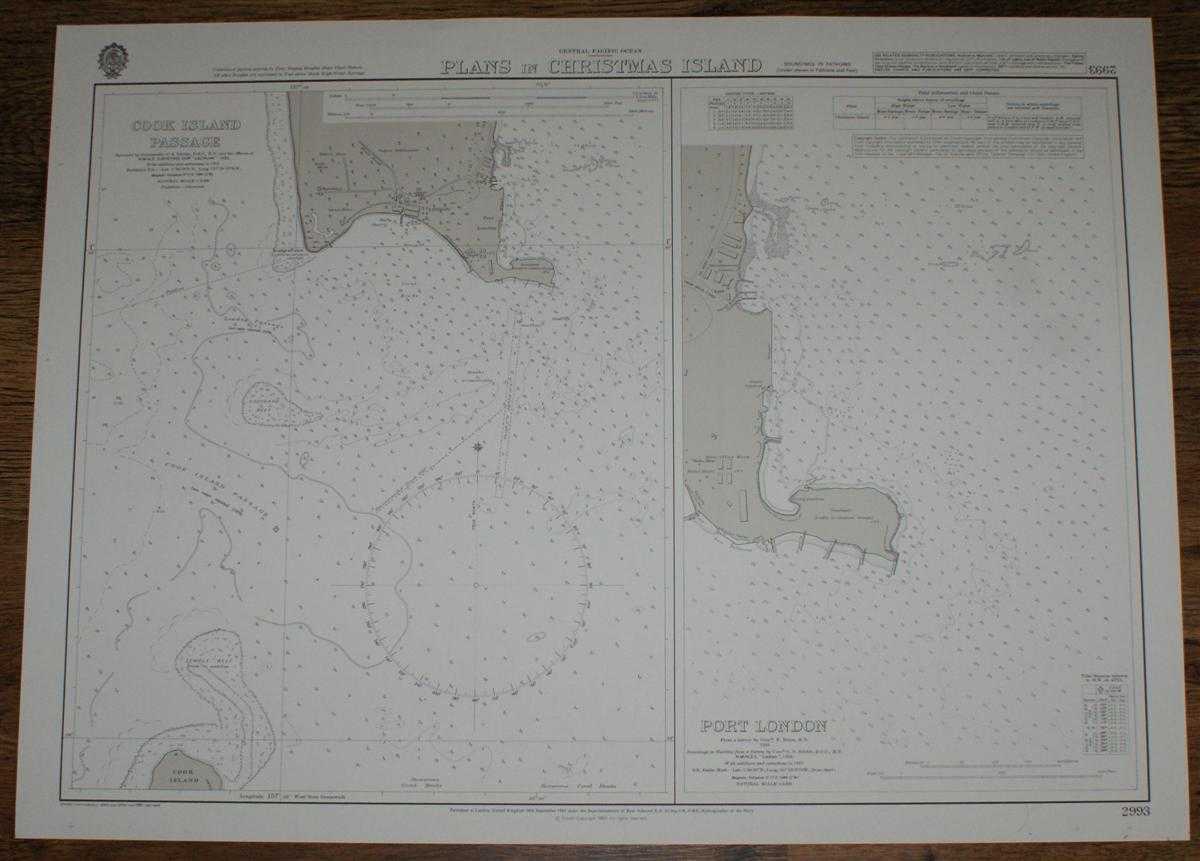
Description: Map Admiralty, 1983. Revised Edition, Softcover. Very Good Condition/No Dust Jacket. Crisp and clean black and white chart with no folds. Nautical Chart No. 2993 Central Pacific Ocean - Plans in Christmas Island. Copyright 1963 with small corrections to 1983. Sheet contains two separate charts: Cook Island Passage at scale 1:6,000 with London, Port London, Cook Island (part) and Bridges Point. Port London at scale 1:2,500. Item Type: Map. Quantity Available: 1. Shipped Weight: under 1 kg. Pictures of this item not already displayed here available upon request. Inventory No: 45517084051. ISBN: 1859831060
Keywords: BZDB4 Maps; naval, naval history, maritime, ships, boats; Australasia and the Pacific. Admiralty Nautical Chart No. 2993 Central Pacific Ocean - Plans in Christmas Island naval, naval history, maritime, ships, boats Australasia and the Pacific
See more books from our catalog: Maps
Title: Nautical Chart No. 2993 Central Pacific Ocean - Plans in Christmas Island
Description: Map Admiralty, 1983. Revised Edition, Softcover. Very Good Condition/No Dust Jacket. Crisp and clean black and white chart with no folds. Nautical Chart No. 2993 Central Pacific Ocean - Plans in Christmas Island. Copyright 1963 with small corrections to 1983. Sheet contains two separate charts: Cook Island Passage at scale 1:6,000 with London, Port London, Cook Island (part) and Bridges Point. Port London at scale 1:2,500. Item Type: Map. Quantity Available: 1. Shipped Weight: under 1 kg. Pictures of this item not already displayed here available upon request. Inventory No: 45517084051. ISBN: 1859831060
Keywords: BZDB4 Maps; naval, naval history, maritime, ships, boats; Australasia and the Pacific. Admiralty Nautical Chart No. 2993 Central Pacific Ocean - Plans in Christmas Island naval, naval history, maritime, ships, boats Australasia and the Pacific
Price: GBP 26.00 = appr. US$ 37.13 Seller: Bailgate Books Ltd
- Book number: 45517084051
- Book number: 45517084051
See more books from our catalog: Maps