Author: Admiralty
Title: Nautical Chart No. AUS 462 Pacific Ocean - Bismarck Archipelago, North Cape, New Ireland to Wuvulu Island
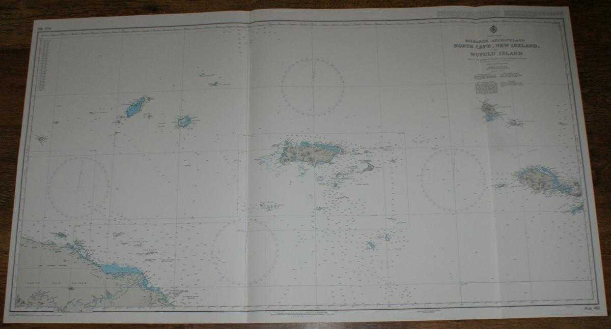
Description: Map Admiralty, 2005. Revised Edition, Softcover. Very Good Condition/No Dust Jacket. Crisp and clean colour chart with two vertical folds. Nautical Chart No. AUS 462 Pacific Ocean - Bismarck Archipelago, North Cape, New Ireland to Wuvulu Island. Copyright 1993 with small corrections to 2005. Scale 1:750,000. Area Covered: Papua New Guinea (part), Manam Island, Schouten Islands, Purdy Islands, Admiralty Islands, Manus Island, Hermit Islands, Ninigo Islands, New Hanover, Mussau, Island New Ireland (part). South Pacific Ocean, Ysabel Channel, Stephan Strait, Sepik Rivers, Hansemann Coast. Item Type: Map. Quantity Available: 1. Shipped Weight: under 1 kg. Pictures of this item not already displayed here available upon request. Inventory No: 45517084048. ISBN: 1859831060
Keywords: BZDB4 Maps; naval, naval history, maritime, ships, boats; Australasia and the Pacific. Admiralty Nautical Chart No. AUS 462 Pacific Ocean - Bismarck Archipelago, North Cape, New Ireland to Wuvulu Island naval, naval history, maritime, ships, boats Austr
See more books from our catalog: Maps
Title: Nautical Chart No. AUS 462 Pacific Ocean - Bismarck Archipelago, North Cape, New Ireland to Wuvulu Island
Description: Map Admiralty, 2005. Revised Edition, Softcover. Very Good Condition/No Dust Jacket. Crisp and clean colour chart with two vertical folds. Nautical Chart No. AUS 462 Pacific Ocean - Bismarck Archipelago, North Cape, New Ireland to Wuvulu Island. Copyright 1993 with small corrections to 2005. Scale 1:750,000. Area Covered: Papua New Guinea (part), Manam Island, Schouten Islands, Purdy Islands, Admiralty Islands, Manus Island, Hermit Islands, Ninigo Islands, New Hanover, Mussau, Island New Ireland (part). South Pacific Ocean, Ysabel Channel, Stephan Strait, Sepik Rivers, Hansemann Coast. Item Type: Map. Quantity Available: 1. Shipped Weight: under 1 kg. Pictures of this item not already displayed here available upon request. Inventory No: 45517084048. ISBN: 1859831060
Keywords: BZDB4 Maps; naval, naval history, maritime, ships, boats; Australasia and the Pacific. Admiralty Nautical Chart No. AUS 462 Pacific Ocean - Bismarck Archipelago, North Cape, New Ireland to Wuvulu Island naval, naval history, maritime, ships, boats Austr
Price: GBP 26.00 = appr. US$ 37.13 Seller: Bailgate Books Ltd
- Book number: 45517084048
- Book number: 45517084048
See more books from our catalog: Maps