Author: Admiralty
Title: Nautical Chart No. AUS 389 Papua New Guinea - North Coast, Kairiru Island to Vanimo Harbour
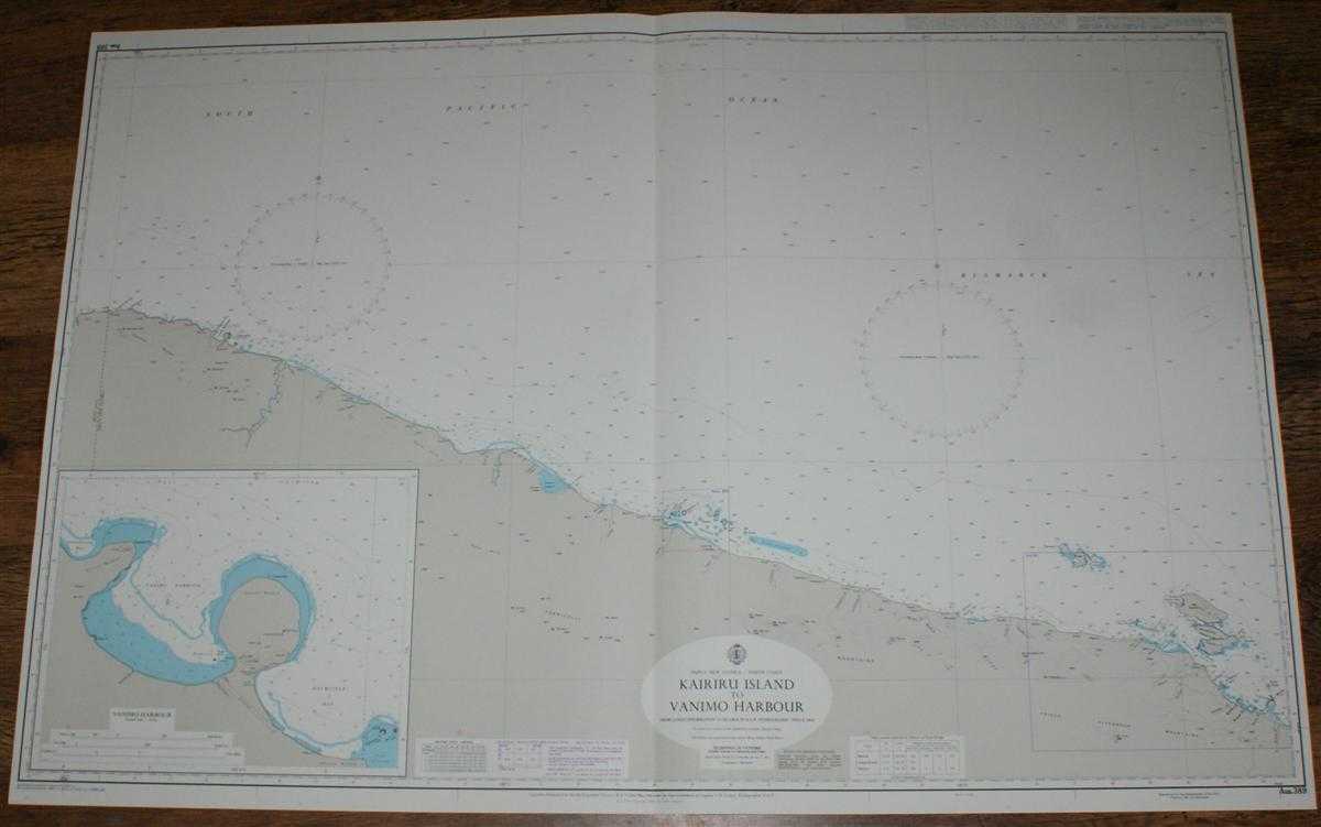
Description: Map Admiralty, 2005. Revised Edition, Softcover. Very Good Condition/No Dust Jacket. Crisp and clean colour chart with single vertical fold. Nautical Chart No. 389 Papua New Guinea - North Coast, Kairiru Island to Vanimo Harbour. Copyright 1969 with small corrections to 2005. Scale 1:300,000. Sheet contains inset of Vanimo Harbour at scale 1:25,000 Area Covered: Papua New Guinea (part), Irian Java Boarder, Oenake Range, Cape Concordia, Vanimo, Torricelli Mountains, Prince Alexander Mountains, Walis Islands, Kairiru Islands, Muschu Island, Wewak. South Pacific Ocean, Bismarck Sea, Neumayer River, Arnold River, Sissano Lagoon, Muschu Strait, Vanimo Harbour, Daumlinge Bay. Item Type: Map. Quantity Available: 1. Shipped Weight: under 1 kg. Pictures of this item not already displayed here available upon request. Inventory No: 45517084044. ISBN: 1859831060
Keywords: BZDB4 Maps; naval, naval history, maritime, ships, boats; Australasia and the Pacific. Admiralty Nautical Chart No. AUS 389 Papua New Guinea - North Coast, Kairiru Island to Vanimo Harbour naval, naval history, maritime, ships, boats Australasia and the
See more books from our catalog: Maps
Title: Nautical Chart No. AUS 389 Papua New Guinea - North Coast, Kairiru Island to Vanimo Harbour
Description: Map Admiralty, 2005. Revised Edition, Softcover. Very Good Condition/No Dust Jacket. Crisp and clean colour chart with single vertical fold. Nautical Chart No. 389 Papua New Guinea - North Coast, Kairiru Island to Vanimo Harbour. Copyright 1969 with small corrections to 2005. Scale 1:300,000. Sheet contains inset of Vanimo Harbour at scale 1:25,000 Area Covered: Papua New Guinea (part), Irian Java Boarder, Oenake Range, Cape Concordia, Vanimo, Torricelli Mountains, Prince Alexander Mountains, Walis Islands, Kairiru Islands, Muschu Island, Wewak. South Pacific Ocean, Bismarck Sea, Neumayer River, Arnold River, Sissano Lagoon, Muschu Strait, Vanimo Harbour, Daumlinge Bay. Item Type: Map. Quantity Available: 1. Shipped Weight: under 1 kg. Pictures of this item not already displayed here available upon request. Inventory No: 45517084044. ISBN: 1859831060
Keywords: BZDB4 Maps; naval, naval history, maritime, ships, boats; Australasia and the Pacific. Admiralty Nautical Chart No. AUS 389 Papua New Guinea - North Coast, Kairiru Island to Vanimo Harbour naval, naval history, maritime, ships, boats Australasia and the
Price: GBP 26.00 = appr. US$ 37.13 Seller: Bailgate Books Ltd
- Book number: 45517084044
- Book number: 45517084044
See more books from our catalog: Maps