Author: Admiralty
Title: Nautical Chart No. AUS 388 Papua New Guinea - North Coast, Karkar Island to Kairiru Island
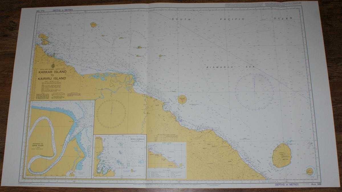
Description: Map Admiralty, 2005. Revised Edition, Softcover. Very Good Condition/No Dust Jacket. Crisp and clean colour chart with two vertical folds. Nautical Chart No. 388 Papua New Guinea - North Coast, Karkar Island to Kairiru Island. Copyright 1991 with small corrections to 2005. Scale 1:300,000. Sheet contains two inset charts: Entrance to Sepik River at scale 1:50,000 Bogia Harbour at scale 1:37,500 Area Covered: Papua New Guinea (part), Schouten Islands, Kairiru Island, Muschu Island, Wewak, Manam Island, Adelbert Range, Karkar Island, Bagabag Island. South Pacific Ocean, Bismarck Sea, Sepik River, Ramu River, Hansemann Coast, Stephan Strait, Isumrud Strait. Item Type: Map. Quantity Available: 1. Shipped Weight: under 1 kg. Pictures of this item not already displayed here available upon request. Inventory No: 45517084043. ISBN: 1859831060
Keywords: BZDB4 Maps; naval, naval history, maritime, ships, boats; Australasia and the Pacific. Admiralty Nautical Chart No. AUS 388 Papua New Guinea - North Coast, Karkar Island to Kairiru Island naval, naval history, maritime, ships, boats Australasia and the
See more books from our catalog: Maps
Title: Nautical Chart No. AUS 388 Papua New Guinea - North Coast, Karkar Island to Kairiru Island
Description: Map Admiralty, 2005. Revised Edition, Softcover. Very Good Condition/No Dust Jacket. Crisp and clean colour chart with two vertical folds. Nautical Chart No. 388 Papua New Guinea - North Coast, Karkar Island to Kairiru Island. Copyright 1991 with small corrections to 2005. Scale 1:300,000. Sheet contains two inset charts: Entrance to Sepik River at scale 1:50,000 Bogia Harbour at scale 1:37,500 Area Covered: Papua New Guinea (part), Schouten Islands, Kairiru Island, Muschu Island, Wewak, Manam Island, Adelbert Range, Karkar Island, Bagabag Island. South Pacific Ocean, Bismarck Sea, Sepik River, Ramu River, Hansemann Coast, Stephan Strait, Isumrud Strait. Item Type: Map. Quantity Available: 1. Shipped Weight: under 1 kg. Pictures of this item not already displayed here available upon request. Inventory No: 45517084043. ISBN: 1859831060
Keywords: BZDB4 Maps; naval, naval history, maritime, ships, boats; Australasia and the Pacific. Admiralty Nautical Chart No. AUS 388 Papua New Guinea - North Coast, Karkar Island to Kairiru Island naval, naval history, maritime, ships, boats Australasia and the
Price: GBP 26.00 = appr. US$ 37.13 Seller: Bailgate Books Ltd
- Book number: 45517084043
- Book number: 45517084043
See more books from our catalog: Maps