Author: Admiralty
Title: Nautical Chart No. AUS 397 Papua New Guinea - Gazelle Peninsula and St. Georges Channel
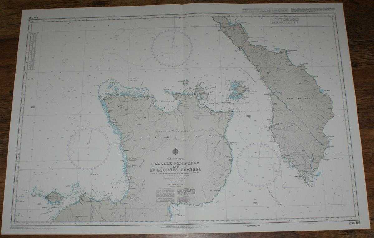
Description: Map Admiralty, 2005. Revised Edition, Softcover. Very Good Condition/No Dust Jacket. Crisp and clean colour chart with single vertical fold. Nautical Chart No. AUS 397 Papua New Guinea - Gazelle Peninsula and St. Georges Channel. Copyright 1993 with small corrections to 2005. Scale 1:263,000. Area Covered: Papua New Guinea (part), New Britain, New Ireland, Lolobau, Gazelle Peninsula, Crater Peninsula, Duke of York Group, Lambom Island, Verron Range. Expectation Strait, Open Bay, Ataliklikun Bay, Wide Bay, St. Georges Channel, Blanche Bay, Dolomakas Bay. Item Type: Map. Quantity Available: 1. Shipped Weight: under 1 kg. Pictures of this item not already displayed here available upon request. Inventory No: 45517084042. ISBN: 1859831060
Keywords: BZDB4 Maps; naval, naval history, maritime, ships, boats; Australasia and the Pacific. Admiralty Nautical Chart No. AUS 397 Papua New Guinea - Gazelle Peninsula and St. Georges Channel naval, naval history, maritime, ships, boats Australasia and the Pac
See more books from our catalog: Maps
Title: Nautical Chart No. AUS 397 Papua New Guinea - Gazelle Peninsula and St. Georges Channel
Description: Map Admiralty, 2005. Revised Edition, Softcover. Very Good Condition/No Dust Jacket. Crisp and clean colour chart with single vertical fold. Nautical Chart No. AUS 397 Papua New Guinea - Gazelle Peninsula and St. Georges Channel. Copyright 1993 with small corrections to 2005. Scale 1:263,000. Area Covered: Papua New Guinea (part), New Britain, New Ireland, Lolobau, Gazelle Peninsula, Crater Peninsula, Duke of York Group, Lambom Island, Verron Range. Expectation Strait, Open Bay, Ataliklikun Bay, Wide Bay, St. Georges Channel, Blanche Bay, Dolomakas Bay. Item Type: Map. Quantity Available: 1. Shipped Weight: under 1 kg. Pictures of this item not already displayed here available upon request. Inventory No: 45517084042. ISBN: 1859831060
Keywords: BZDB4 Maps; naval, naval history, maritime, ships, boats; Australasia and the Pacific. Admiralty Nautical Chart No. AUS 397 Papua New Guinea - Gazelle Peninsula and St. Georges Channel naval, naval history, maritime, ships, boats Australasia and the Pac
Price: GBP 26.00 = appr. US$ 37.13 Seller: Bailgate Books Ltd
- Book number: 45517084042
- Book number: 45517084042
See more books from our catalog: Maps