Author: Admiralty
Title: Nautical Chart No. AUS 383 Papua New Guinea - North East Coast, Bonvouloir Islands to Woodlark Islands
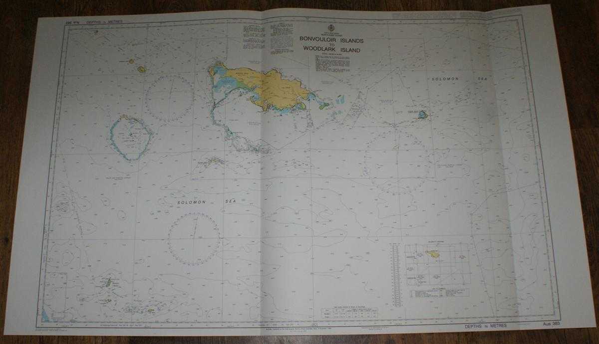
Description: Admiralty, 2005. Revised Edition, Softcover. Very Good Condition/No Dust Jacket. Crisp and clean colour chart with two vertical folds. Nautical Chart No. AUS 383 Papua New Guinea - North East Coast, Bonvouloir Islands to Woodlark Islands. Copyright 1996 and with small corrections to 2005. Scale 1:300,000. Area Covered: Solomon Sea, Woodlark Island, Madau Island, Bonvouloir Islands, Strathord Islands, Egum Atoll, Alcester or Virosi Island, Laughlan or Budibudi Islands, Marshall Bennett Islands, Gawa Island. Size: 72x119cm. Single sheet map/chart which is suitable for framing and will be shipped rolled and in a cardboard tube. Quantity Available: 1. Shipped Weight: under 1 kg. Pictures of this item not already displayed here available upon request. Inventory No: 45517084039. ISBN: 1844940721
Keywords: BZDB4 Maps; Australasia and the Pacific; naval, naval history, maritime, ships, boats. Admiralty Nautical Chart No. AUS 383 Papua New Guinea - North East Coast, Bonvouloir Islands to Woodlark Islands Australasia and the Pacific naval, naval history, mar
See more books from our catalog: Maps
Title: Nautical Chart No. AUS 383 Papua New Guinea - North East Coast, Bonvouloir Islands to Woodlark Islands
Description: Admiralty, 2005. Revised Edition, Softcover. Very Good Condition/No Dust Jacket. Crisp and clean colour chart with two vertical folds. Nautical Chart No. AUS 383 Papua New Guinea - North East Coast, Bonvouloir Islands to Woodlark Islands. Copyright 1996 and with small corrections to 2005. Scale 1:300,000. Area Covered: Solomon Sea, Woodlark Island, Madau Island, Bonvouloir Islands, Strathord Islands, Egum Atoll, Alcester or Virosi Island, Laughlan or Budibudi Islands, Marshall Bennett Islands, Gawa Island. Size: 72x119cm. Single sheet map/chart which is suitable for framing and will be shipped rolled and in a cardboard tube. Quantity Available: 1. Shipped Weight: under 1 kg. Pictures of this item not already displayed here available upon request. Inventory No: 45517084039. ISBN: 1844940721
Keywords: BZDB4 Maps; Australasia and the Pacific; naval, naval history, maritime, ships, boats. Admiralty Nautical Chart No. AUS 383 Papua New Guinea - North East Coast, Bonvouloir Islands to Woodlark Islands Australasia and the Pacific naval, naval history, mar
Price: GBP 26.00 = appr. US$ 37.13 Seller: Bailgate Books Ltd
- Book number: 45517084039
- Book number: 45517084039
See more books from our catalog: Maps