Author: Admiralty
Title: Nautical Chart No. AUS 395 Papua New Guinea - New Britain, Vitu Islands to Watom Island
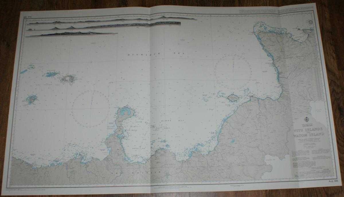
Description: Admiralty, 2005. Revised Edition, Softcover. Very Good Condition/No Dust Jacket. Crisp and clean colour chart with two vertical folds. Nautical Chart No. AUS 395 Papua New Guinea - New Britain, Vitu Islands to Watom Island. Copyright 1992 with small corrections to 2005. Scale 1:300,000. Sheet includes three engraved long-section coastal views. Area Covered: Papua New Guinea (part), New Britain, Willaumez Peninsula, Vitu Islands, Garove Island, Unea Island, Hoskins Peninsula, Lolobau, Gazelle Peninsula, Watom Island. Bismarck Sea, Riebeck Bay, Stettin Bay, Kimbe Bay, Expectation Strait, Open Bay, Ataliklikun Bay, Banban Reefs, Jacquinot Bay, Wide Bay. Size: 72x119cm. Single sheet map/chart which is suitable for framing and will be shipped rolled and in a cardboard tube. Quantity Available: 1. Shipped Weight: under 1 kg. Pictures of this item not already displayed here available upon request. Inventory No: 45517084033. ISBN: 1844940721
Keywords: BZDB4 Maps; Australasia and the Pacific; naval, naval history, maritime, ships, boats. Admiralty Nautical Chart No. AUS 395 Papua New Guinea - New Britain, Vitu Islands to Watom Island Australasia and the Pacific naval, naval history, maritime, ships, b
See more books from our catalog: Maps
Title: Nautical Chart No. AUS 395 Papua New Guinea - New Britain, Vitu Islands to Watom Island
Description: Admiralty, 2005. Revised Edition, Softcover. Very Good Condition/No Dust Jacket. Crisp and clean colour chart with two vertical folds. Nautical Chart No. AUS 395 Papua New Guinea - New Britain, Vitu Islands to Watom Island. Copyright 1992 with small corrections to 2005. Scale 1:300,000. Sheet includes three engraved long-section coastal views. Area Covered: Papua New Guinea (part), New Britain, Willaumez Peninsula, Vitu Islands, Garove Island, Unea Island, Hoskins Peninsula, Lolobau, Gazelle Peninsula, Watom Island. Bismarck Sea, Riebeck Bay, Stettin Bay, Kimbe Bay, Expectation Strait, Open Bay, Ataliklikun Bay, Banban Reefs, Jacquinot Bay, Wide Bay. Size: 72x119cm. Single sheet map/chart which is suitable for framing and will be shipped rolled and in a cardboard tube. Quantity Available: 1. Shipped Weight: under 1 kg. Pictures of this item not already displayed here available upon request. Inventory No: 45517084033. ISBN: 1844940721
Keywords: BZDB4 Maps; Australasia and the Pacific; naval, naval history, maritime, ships, boats. Admiralty Nautical Chart No. AUS 395 Papua New Guinea - New Britain, Vitu Islands to Watom Island Australasia and the Pacific naval, naval history, maritime, ships, b
Price: GBP 26.00 = appr. US$ 37.13 Seller: Bailgate Books Ltd
- Book number: 45517084033
- Book number: 45517084033
See more books from our catalog: Maps