Author: Admiralty
Title: Nautical Chart No. 4633 Pacific Ocean - Soloman Islands to Fiji including Vanuatu
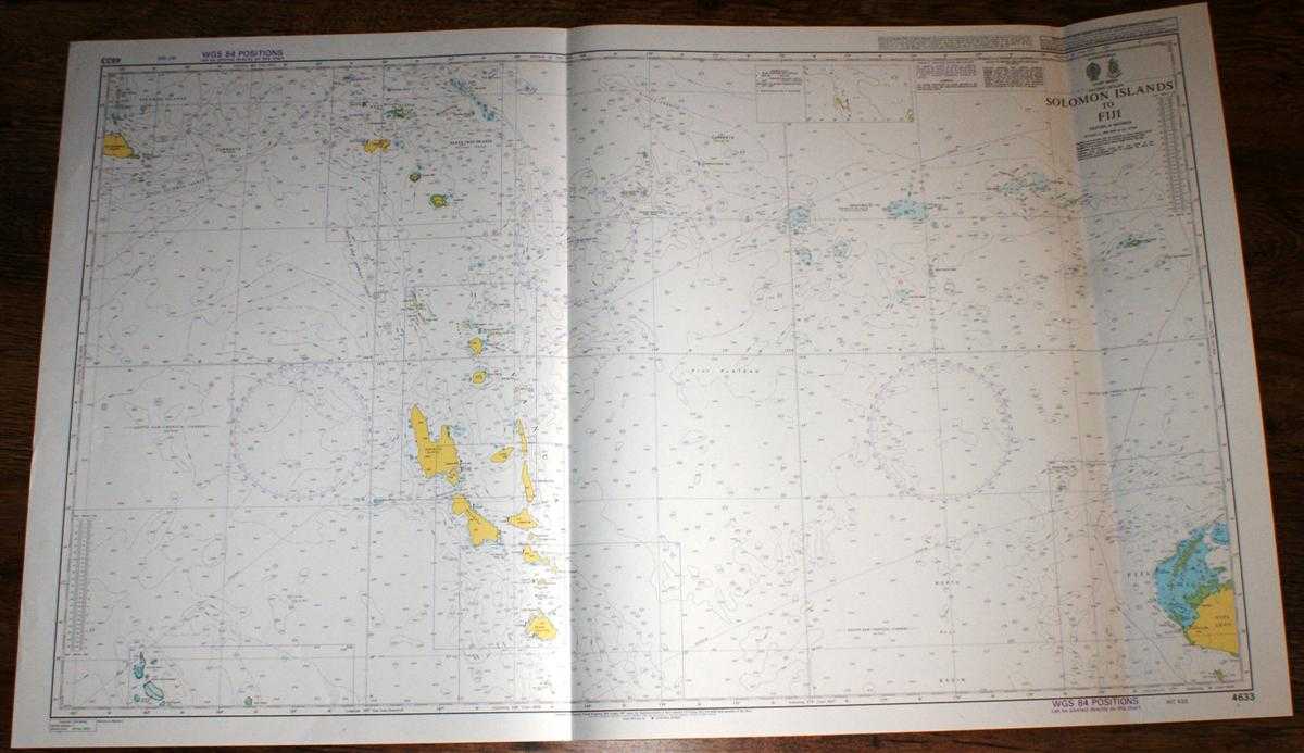
Description: Admiralty, 2003. Revised Edition, Softcover. Very Good Condition/No Dust Jacket. Crisp and clean colour chart with two vertical folds. Nautical Chart No. 4633 Pacific Ocean - Soloman Islands to Fiji. 2003 edition of 1997 publication. Scale 1:1,500,000. Area Covered: Solomon Islands (part), San Cristobal Island, Santa Cruz Islands, Ndendo, Duff Islands, Torres Islands, Banks Islands, Vanuatu, Espiritu Santo, Malakula, Aoba, Ambrym, Epi, Efate, Fiji (part), Viti Levu, Yasawa Group, Lautoka, Rotuma Island. South Solomon Trench, Vitiaz Trench, Fiji Plateau, North Fiji Basin. Size: 72x119cm. Single sheet map/chart which is suitable for framing and will be shipped rolled and in a cardboard tube. Quantity Available: 1. Shipped Weight: under 1 kg. Pictures of this item not already displayed here available upon request. Inventory No: 45517084020. ISBN: 1844940721
Keywords: BZDB4 Maps; Australasia and the Pacific; naval, naval history, maritime, ships, boats. Admiralty Nautical Chart No. 4633 Pacific Ocean - Soloman Islands to Fiji including Vanuatu Australasia and the Pacific naval, naval history, maritime, ships, boats
See more books from our catalog: Maps
Title: Nautical Chart No. 4633 Pacific Ocean - Soloman Islands to Fiji including Vanuatu
Description: Admiralty, 2003. Revised Edition, Softcover. Very Good Condition/No Dust Jacket. Crisp and clean colour chart with two vertical folds. Nautical Chart No. 4633 Pacific Ocean - Soloman Islands to Fiji. 2003 edition of 1997 publication. Scale 1:1,500,000. Area Covered: Solomon Islands (part), San Cristobal Island, Santa Cruz Islands, Ndendo, Duff Islands, Torres Islands, Banks Islands, Vanuatu, Espiritu Santo, Malakula, Aoba, Ambrym, Epi, Efate, Fiji (part), Viti Levu, Yasawa Group, Lautoka, Rotuma Island. South Solomon Trench, Vitiaz Trench, Fiji Plateau, North Fiji Basin. Size: 72x119cm. Single sheet map/chart which is suitable for framing and will be shipped rolled and in a cardboard tube. Quantity Available: 1. Shipped Weight: under 1 kg. Pictures of this item not already displayed here available upon request. Inventory No: 45517084020. ISBN: 1844940721
Keywords: BZDB4 Maps; Australasia and the Pacific; naval, naval history, maritime, ships, boats. Admiralty Nautical Chart No. 4633 Pacific Ocean - Soloman Islands to Fiji including Vanuatu Australasia and the Pacific naval, naval history, maritime, ships, boats
Price: GBP 26.00 = appr. US$ 37.13 Seller: Bailgate Books Ltd
- Book number: 45517084020
- Book number: 45517084020
See more books from our catalog: Maps