Author: Admiralty
Title: Nautical Chart No. AUS 683 South Pacific Ocean, Plans on the East Coast Bougainville Island
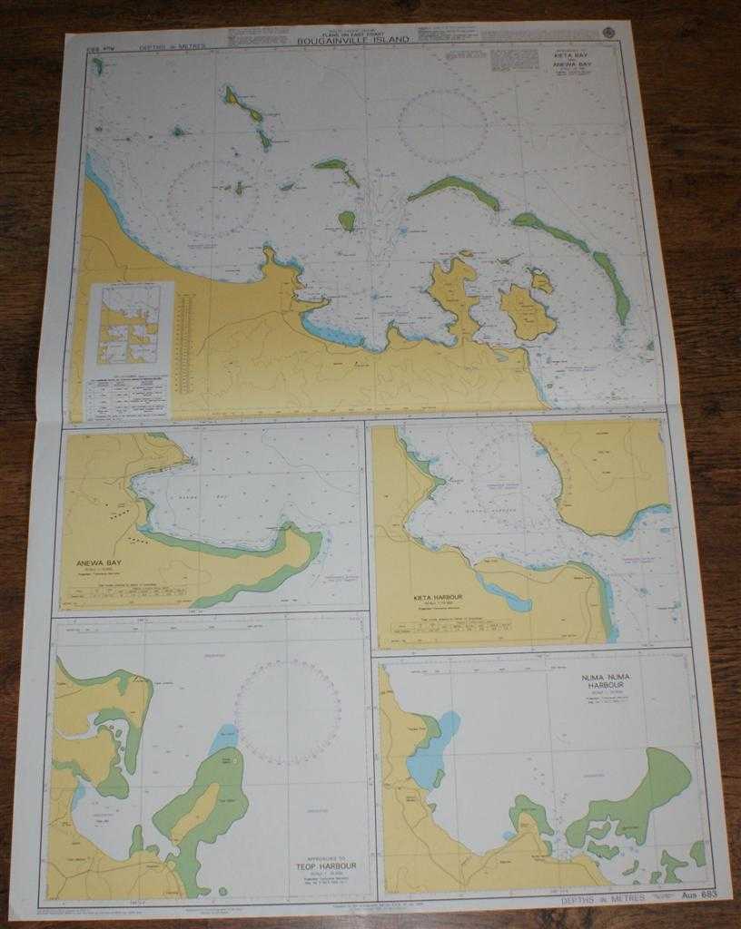
Description: Admiralty, 2005. Revised Edition, Softcover. Very Good Condition/No Dust Jacket. Crisp and clean colour chart with single horizontal fold. Nautical Chart No. AUS 683 South Pacific Ocean, Plans on the East Coast Bougainville Island. Copyright 1999 with small corrections to 2005. Sheet contains five separate charts: Kieta Bay and Anewa Bay at scale 1:50,000 Anewa Bay at scale 1:10,000 Kieta Harbour at scale 1:15,000 Approaches to Teop Harbour at scale 1:25,000 Numa Numa Harbour at scale 1:37,500 Size: 107x72cm. Single sheet map/chart which is suitable for framing and will be shipped rolled and in a cardboard tube. Quantity Available: 1. Shipped Weight: under 1 kg. Pictures of this item not already displayed here available upon request. Inventory No: 45517084019. ISBN: 1844940721
Keywords: BZDB4 Maps; Australasia and the Pacific; naval, naval history, maritime, ships, boats. Admiralty Nautical Chart No. AUS 683 South Pacific Ocean, Plans on the East Coast Bougainville Island Australasia and the Pacific naval, naval history, maritime, ship
See more books from our catalog: Maps
Title: Nautical Chart No. AUS 683 South Pacific Ocean, Plans on the East Coast Bougainville Island
Description: Admiralty, 2005. Revised Edition, Softcover. Very Good Condition/No Dust Jacket. Crisp and clean colour chart with single horizontal fold. Nautical Chart No. AUS 683 South Pacific Ocean, Plans on the East Coast Bougainville Island. Copyright 1999 with small corrections to 2005. Sheet contains five separate charts: Kieta Bay and Anewa Bay at scale 1:50,000 Anewa Bay at scale 1:10,000 Kieta Harbour at scale 1:15,000 Approaches to Teop Harbour at scale 1:25,000 Numa Numa Harbour at scale 1:37,500 Size: 107x72cm. Single sheet map/chart which is suitable for framing and will be shipped rolled and in a cardboard tube. Quantity Available: 1. Shipped Weight: under 1 kg. Pictures of this item not already displayed here available upon request. Inventory No: 45517084019. ISBN: 1844940721
Keywords: BZDB4 Maps; Australasia and the Pacific; naval, naval history, maritime, ships, boats. Admiralty Nautical Chart No. AUS 683 South Pacific Ocean, Plans on the East Coast Bougainville Island Australasia and the Pacific naval, naval history, maritime, ship
Price: GBP 26.00 = appr. US$ 37.13 Seller: Bailgate Books Ltd
- Book number: 45517084019
- Book number: 45517084019
See more books from our catalog: Maps