Author: Admiralty
Title: Nautical Chart No. 3552 North Pacific Ocean - Mariana Islands (Northern Part)
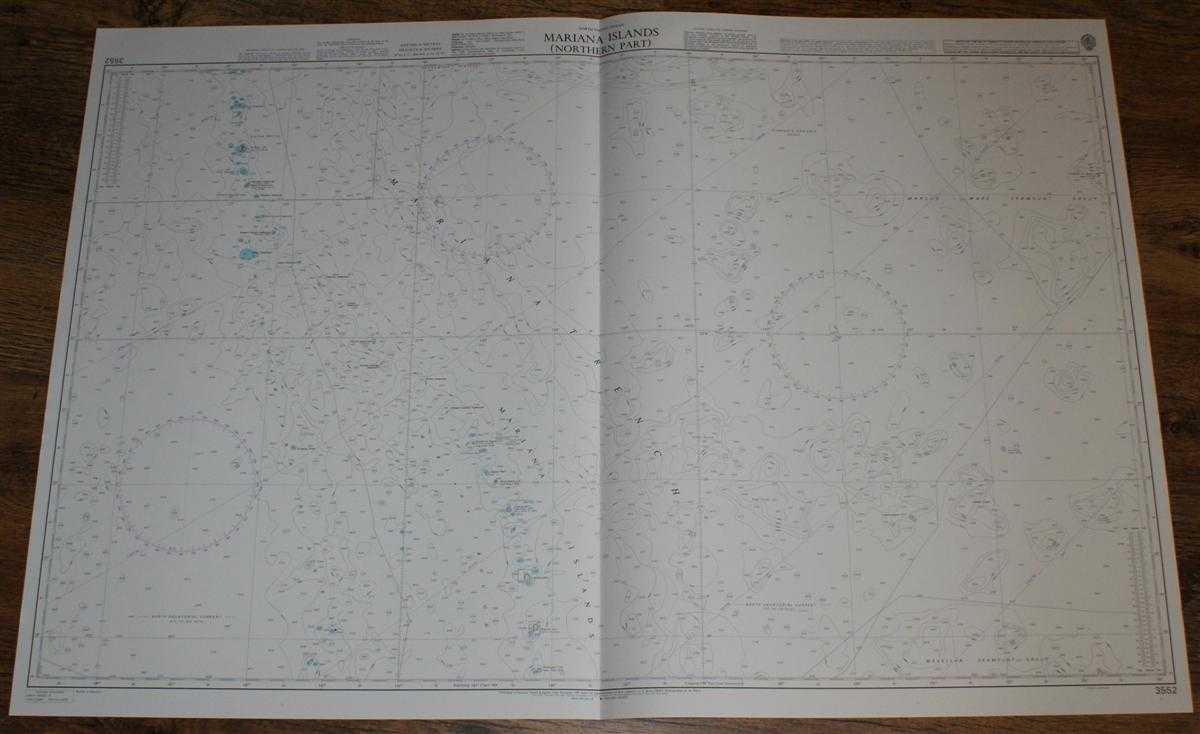
Description: Admiralty, 2003. Revised Edition, Softcover. Very Good Condition/No Dust Jacket. Crisp and clean colour chart with single vertical fold. Nautical Chart No. 3552 North Pacific Ocean - Mariana Islands (Northern Part). 2003 edition of 1991 publication. Scale 1:1,500,000. Area Covered: Mariana Trench, Mariana Trough, West Mariana Ridge, Magellan Seamount Group, Marcus Wake Seamount Group, Mariana Islands, Pagan (active volcano), Alamagan, Agrihan, Asuncion, Maug Islands, Farallon de Pajaros (active volcano), Kazan Retto, Io Shima, Kita-io Shima. Size: 72x107cm. Single sheet map/chart which is suitable for framing and will be shipped rolled and in a cardboard tube. Quantity Available: 1. Shipped Weight: under 1 kg. Pictures of this item not already displayed here available upon request. Inventory No: 45517084012. ISBN: 1844940721
Keywords: BZDB4 Maps; Australasia and the Pacific; naval, naval history, maritime, ships, boats. Admiralty Nautical Chart No. 3552 North Pacific Ocean - Mariana Islands (Northern Part) Australasia and the Pacific naval, naval history, maritime, ships, boats
See more books from our catalog: Maps
Title: Nautical Chart No. 3552 North Pacific Ocean - Mariana Islands (Northern Part)
Description: Admiralty, 2003. Revised Edition, Softcover. Very Good Condition/No Dust Jacket. Crisp and clean colour chart with single vertical fold. Nautical Chart No. 3552 North Pacific Ocean - Mariana Islands (Northern Part). 2003 edition of 1991 publication. Scale 1:1,500,000. Area Covered: Mariana Trench, Mariana Trough, West Mariana Ridge, Magellan Seamount Group, Marcus Wake Seamount Group, Mariana Islands, Pagan (active volcano), Alamagan, Agrihan, Asuncion, Maug Islands, Farallon de Pajaros (active volcano), Kazan Retto, Io Shima, Kita-io Shima. Size: 72x107cm. Single sheet map/chart which is suitable for framing and will be shipped rolled and in a cardboard tube. Quantity Available: 1. Shipped Weight: under 1 kg. Pictures of this item not already displayed here available upon request. Inventory No: 45517084012. ISBN: 1844940721
Keywords: BZDB4 Maps; Australasia and the Pacific; naval, naval history, maritime, ships, boats. Admiralty Nautical Chart No. 3552 North Pacific Ocean - Mariana Islands (Northern Part) Australasia and the Pacific naval, naval history, maritime, ships, boats
Price: GBP 26.00 = appr. US$ 37.13 Seller: Bailgate Books Ltd
- Book number: 45517084012
- Book number: 45517084012
See more books from our catalog: Maps