Author: Admiralty
Title: Nautical Chart No. 1708 South Pacific Ocean - Solomon Islands, Bougainville Strait
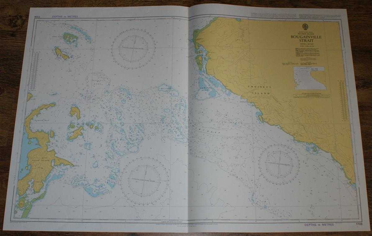
Description: Admiralty, 2004. Revised Edition, Softcover. Very Good Condition/No Dust Jacket. Crisp and clean colour chart with single vertical fold. Nautical Chart No. 1708 South Pacific Ocean - Solomon Islands, Bougainville Strait. Copyright 1977 with small corrections to 2004. Scale 1:75,000. Area Covered: Oema Island, Fauro Island, Piru Island, Masamasa Island, Rohae Island, Choiseul Island (part), Kondakanimboko Point, Sakatokana Ridge. Bougainville Strait, North Bay, Hydra Reefs, Guppy Deep, Haslam Reefs, Oldham Deep, Taylor Reefs, Heming Bank, Russell Bank, Oema Reef, Stork Reefs. Size: 72x107cm. Single sheet map/chart which is suitable for framing and will be shipped rolled and in a cardboard tube. Quantity Available: 1. Shipped Weight: under 1 kg. Pictures of this item not already displayed here available upon request. Inventory No: 45517084008. ISBN: 1844940721
Keywords: BZDB4 Maps; Australasia and the Pacific; naval, naval history, maritime, ships, boats. Admiralty Nautical Chart No. 1708 South Pacific Ocean - Solomon Islands, Bougainville Strait Australasia and the Pacific naval, naval history, maritime, ships, boats
See more books from our catalog: Maps
Title: Nautical Chart No. 1708 South Pacific Ocean - Solomon Islands, Bougainville Strait
Description: Admiralty, 2004. Revised Edition, Softcover. Very Good Condition/No Dust Jacket. Crisp and clean colour chart with single vertical fold. Nautical Chart No. 1708 South Pacific Ocean - Solomon Islands, Bougainville Strait. Copyright 1977 with small corrections to 2004. Scale 1:75,000. Area Covered: Oema Island, Fauro Island, Piru Island, Masamasa Island, Rohae Island, Choiseul Island (part), Kondakanimboko Point, Sakatokana Ridge. Bougainville Strait, North Bay, Hydra Reefs, Guppy Deep, Haslam Reefs, Oldham Deep, Taylor Reefs, Heming Bank, Russell Bank, Oema Reef, Stork Reefs. Size: 72x107cm. Single sheet map/chart which is suitable for framing and will be shipped rolled and in a cardboard tube. Quantity Available: 1. Shipped Weight: under 1 kg. Pictures of this item not already displayed here available upon request. Inventory No: 45517084008. ISBN: 1844940721
Keywords: BZDB4 Maps; Australasia and the Pacific; naval, naval history, maritime, ships, boats. Admiralty Nautical Chart No. 1708 South Pacific Ocean - Solomon Islands, Bougainville Strait Australasia and the Pacific naval, naval history, maritime, ships, boats
Price: GBP 26.00 = appr. US$ 37.13 Seller: Bailgate Books Ltd
- Book number: 45517084008
- Book number: 45517084008
See more books from our catalog: Maps