Author: Admiralty
Title: Nautical Chart No. 4506 North Pacific Ocean, Mariana Islands to the Gilbert Group
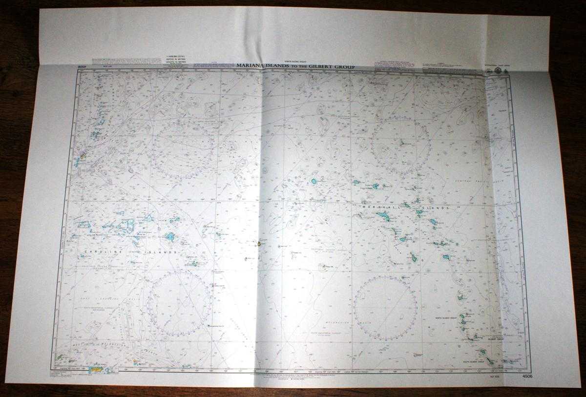
Description: Admiralty, 2005. Revised Edition, Softcover. Very Good Condition/No Dust Jacket. Crisp and clean colour chart with one horizontal and two vertical folds. Slight crinkling to top edge. Nautical Chart No. Nautical Chart No. 4506 North Pacific Ocean, Mariana Islands to the Gilbert Group. 2003 edition of 1983 publication with notices to 2005. Scale 1:3,500,000. Area Covered: North Pacific Ocean (part), Marshall Islands, Ratak Chain, Ralik Chain, North Gilbert Group, South Gilbert Group, Caroline Islands, West Melanesian Trench, Ontong-Java Rise, Admiralty Islands, Ninigo Islands, Mariana Islands. Size: 84x119cm. Single sheet map/chart which is suitable for framing and will be shipped rolled and in a cardboard tube. Quantity Available: 1. Shipped Weight: under 1 kg. Pictures of this item not already displayed here available upon request. Inventory No: 45517084001. ISBN: 1844940721
Keywords: BZDB4 Maps; Australasia and the Pacific; naval, naval history, maritime, ships, boats. Admiralty Nautical Chart No. 4506 North Pacific Ocean, Mariana Islands to the Gilbert Group Australasia and the Pacific naval, naval history, maritime, ships, boats
See more books from our catalog: Maps
Title: Nautical Chart No. 4506 North Pacific Ocean, Mariana Islands to the Gilbert Group
Description: Admiralty, 2005. Revised Edition, Softcover. Very Good Condition/No Dust Jacket. Crisp and clean colour chart with one horizontal and two vertical folds. Slight crinkling to top edge. Nautical Chart No. Nautical Chart No. 4506 North Pacific Ocean, Mariana Islands to the Gilbert Group. 2003 edition of 1983 publication with notices to 2005. Scale 1:3,500,000. Area Covered: North Pacific Ocean (part), Marshall Islands, Ratak Chain, Ralik Chain, North Gilbert Group, South Gilbert Group, Caroline Islands, West Melanesian Trench, Ontong-Java Rise, Admiralty Islands, Ninigo Islands, Mariana Islands. Size: 84x119cm. Single sheet map/chart which is suitable for framing and will be shipped rolled and in a cardboard tube. Quantity Available: 1. Shipped Weight: under 1 kg. Pictures of this item not already displayed here available upon request. Inventory No: 45517084001. ISBN: 1844940721
Keywords: BZDB4 Maps; Australasia and the Pacific; naval, naval history, maritime, ships, boats. Admiralty Nautical Chart No. 4506 North Pacific Ocean, Mariana Islands to the Gilbert Group Australasia and the Pacific naval, naval history, maritime, ships, boats
Price: GBP 26.00 = appr. US$ 37.13 Seller: Bailgate Books Ltd
- Book number: 45517084001
- Book number: 45517084001
See more books from our catalog: Maps