Author: Admiralty
Title: Nautical Chart No. 2967 Russia - Arctic Ocean, Approaches to Proliv Karskiye Vorota and Proliv Yugorskiy Shar
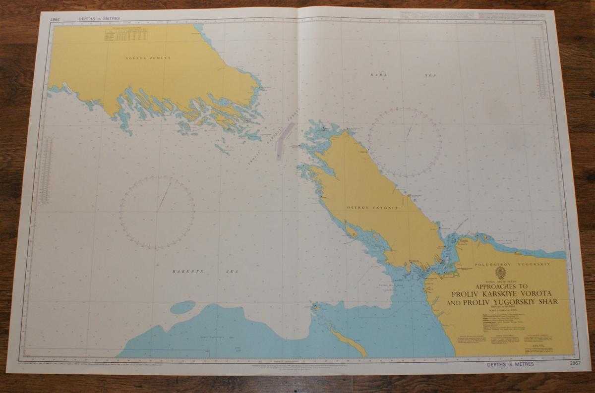
Description: Admiralty, 2003. Revised Edition, Softcover. Very Good Condition/No Dust Jacket. Crisp and clean colour chart with single vertical fold. Very minor creasing to margin at centre of bottom edge. Nautical Chart No. 2967 Russia - Arctic Ocean, Approaches to Proliv Karskiye Vorota and Proliv Yugorskiy Shar. Copyright 1986 with small corrections to 2003. Scale 1:325,000. Area Covered: Russia (part), Novaya Zemlya, Ostrov Vaygach, Poloustrov Yugorskiy, O. Matveyev, O. Dolgiy. Arctic Ocean (part), Barents Sea (part), Kara Sea (part), Proliv Karskiye Vorota, Proliv Yugorskiy Shar Size: 72x104cm. Single sheet map/chart which is suitable for framing and will be shipped rolled and in a cardboard tube.. Quantity Available: 1. Shipped Weight: under 1 kg. Pictures of this item not already displayed here available upon request. Inventory No: 45517074049. ISBN: 0304355410
Keywords: BZDB4 Russia & Eastern Europe; Arctic & Antarctic. Admiralty Nautical Chart No. 2967 Russia - Arctic Ocean, Approaches to Proliv Karskiye Vorota and Proliv Yugorskiy Shar Arctic & Antarctic
See more books from our catalog: Russia & Eastern Europe
Title: Nautical Chart No. 2967 Russia - Arctic Ocean, Approaches to Proliv Karskiye Vorota and Proliv Yugorskiy Shar
Description: Admiralty, 2003. Revised Edition, Softcover. Very Good Condition/No Dust Jacket. Crisp and clean colour chart with single vertical fold. Very minor creasing to margin at centre of bottom edge. Nautical Chart No. 2967 Russia - Arctic Ocean, Approaches to Proliv Karskiye Vorota and Proliv Yugorskiy Shar. Copyright 1986 with small corrections to 2003. Scale 1:325,000. Area Covered: Russia (part), Novaya Zemlya, Ostrov Vaygach, Poloustrov Yugorskiy, O. Matveyev, O. Dolgiy. Arctic Ocean (part), Barents Sea (part), Kara Sea (part), Proliv Karskiye Vorota, Proliv Yugorskiy Shar Size: 72x104cm. Single sheet map/chart which is suitable for framing and will be shipped rolled and in a cardboard tube.. Quantity Available: 1. Shipped Weight: under 1 kg. Pictures of this item not already displayed here available upon request. Inventory No: 45517074049. ISBN: 0304355410
Keywords: BZDB4 Russia & Eastern Europe; Arctic & Antarctic. Admiralty Nautical Chart No. 2967 Russia - Arctic Ocean, Approaches to Proliv Karskiye Vorota and Proliv Yugorskiy Shar Arctic & Antarctic
Price: GBP 26.00 = appr. US$ 37.13 Seller: Bailgate Books Ltd
- Book number: 45517074049
- Book number: 45517074049
See more books from our catalog: Russia & Eastern Europe