Author: Admiralty
Title: Nautical Chart No. 2270 White Sea, Lumbovskiy Zaliv to Mys Konushin
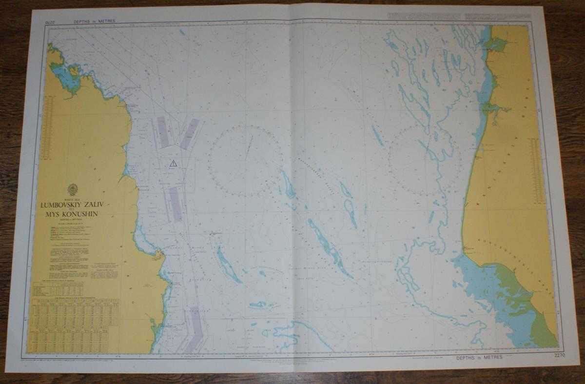
Description: Admiralty, 2003. Revised Edition, Softcover. Very Good Condition/No Dust Jacket. Crisp and clean colour chart with single vertical fold. Very faint diagonal crease across bottom left corner. Nautical Chart No. 2270 White Sea, Lumbovskiy Zaliv to Mys Konushin. Copyright 1988 with small corrections to 2003. Scale 1:200,000. Area Covered: Russia (part), Terskiy Bereg, Kaninskiy Bereg, Konushinskiy Bereg, O. Lumbovskiy. White Sea (part), Proliv Orlovskaya Salma, Reka Ponoy, Reka Shoyna, Reka Mal Kiya, Reka Bol Kiya, Konushinskaya Koshka, Bol'shaya Srednyaya Koshka. Size: 72x104. Single sheet map/chart which is suitable for framing and will be shipped rolled and in a cardboard tube.. Quantity Available: 1. Shipped Weight: under 1 kg. Pictures of this item not already displayed here available upon request. Inventory No: 45517074044. ISBN: 0304355410
Keywords: BZDB4 Russia & Eastern Europe; Arctic & Antarctic. Admiralty Nautical Chart No. 2270 White Sea, Lumbovskiy Zaliv to Mys Konushin Arctic & Antarctic
See more books from our catalog: Russia & Eastern Europe
Title: Nautical Chart No. 2270 White Sea, Lumbovskiy Zaliv to Mys Konushin
Description: Admiralty, 2003. Revised Edition, Softcover. Very Good Condition/No Dust Jacket. Crisp and clean colour chart with single vertical fold. Very faint diagonal crease across bottom left corner. Nautical Chart No. 2270 White Sea, Lumbovskiy Zaliv to Mys Konushin. Copyright 1988 with small corrections to 2003. Scale 1:200,000. Area Covered: Russia (part), Terskiy Bereg, Kaninskiy Bereg, Konushinskiy Bereg, O. Lumbovskiy. White Sea (part), Proliv Orlovskaya Salma, Reka Ponoy, Reka Shoyna, Reka Mal Kiya, Reka Bol Kiya, Konushinskaya Koshka, Bol'shaya Srednyaya Koshka. Size: 72x104. Single sheet map/chart which is suitable for framing and will be shipped rolled and in a cardboard tube.. Quantity Available: 1. Shipped Weight: under 1 kg. Pictures of this item not already displayed here available upon request. Inventory No: 45517074044. ISBN: 0304355410
Keywords: BZDB4 Russia & Eastern Europe; Arctic & Antarctic. Admiralty Nautical Chart No. 2270 White Sea, Lumbovskiy Zaliv to Mys Konushin Arctic & Antarctic
Price: GBP 26.00 = appr. US$ 37.13 Seller: Bailgate Books Ltd
- Book number: 45517074044
- Book number: 45517074044
See more books from our catalog: Russia & Eastern Europe