Author: Admiralty
Title: Nautical Chart No. 3002 Norway - West Coast, Stavanger
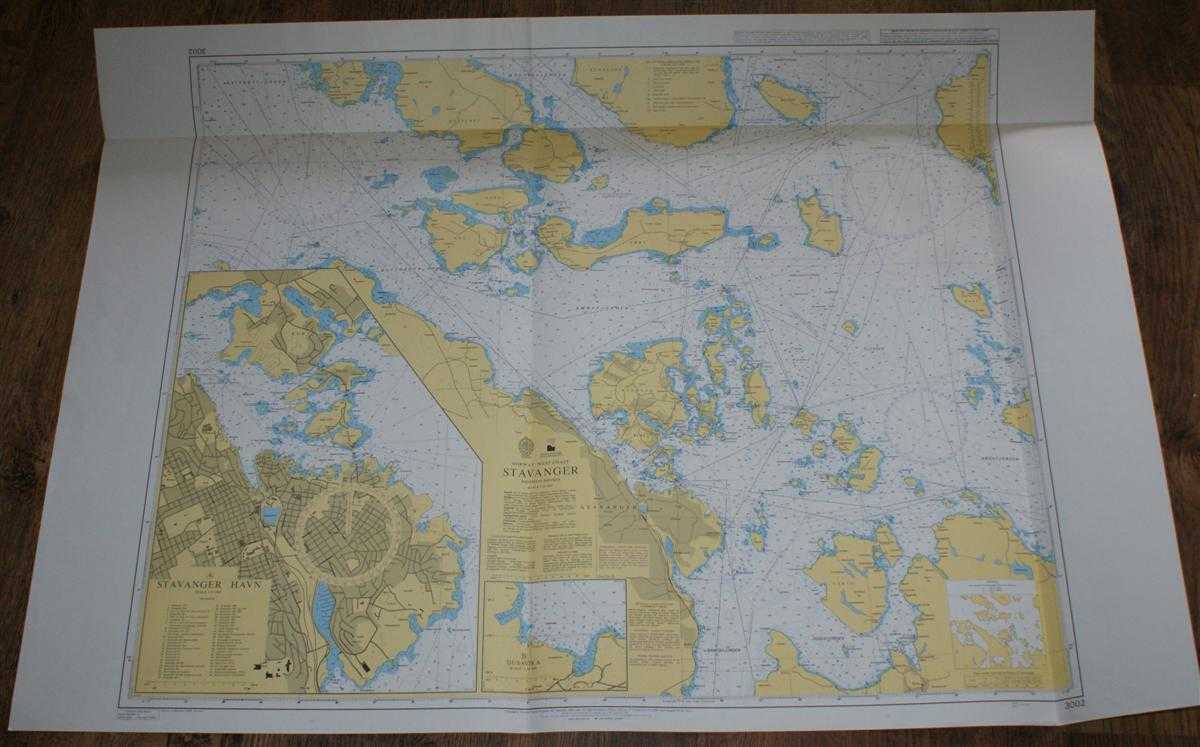
Description: Admiralty, 2005. Revised Edition, Softcover. Very Good Condition/No Dust Jacket. Clean colour chart with two vertical folds and one horizontal. Slight crinkling to the top edge. Nautical Chart No. 3002 Norway - West Coast, Stavanger. 2005 edition of 1999 reproduction of 1987 Norwegian chart with notices to 2005. Scale 1:25,000. Sheet contains inset plans of Stavanger Havn and Dusavika at scale 1:10,000. Area Covered: Norway (part), Mosteroy, Bru, Sokn, Aske, Amoy, Rennesoy, Brimse, Hidle, Heng, Hundvag, Uskjo, Stavanger, Buoy. Byfjorden, Amoyfjorden, Horge-Fjorden, Gandfjorden, Riskafjorden, Hogsfjorden, Kvitsoyfjorden. Size: 84x119cm. Single sheet map/chart which is suitable for framing and will be shipped rolled and in a cardboard tube. Quantity Available: 1. Shipped Weight: under 1 kg. Pictures of this item not already displayed here available upon request. Inventory No: 45517074037. ISBN: 0718118413
Keywords: BZDB4 naval, naval history, maritime, ships, boats; Maps; Scandinavia. Admiralty Nautical Chart No. 3002 Norway - West Coast, Stavanger Maps Scandinavia
See more books from our catalog: naval, naval history, maritime, ships, boats
Title: Nautical Chart No. 3002 Norway - West Coast, Stavanger
Description: Admiralty, 2005. Revised Edition, Softcover. Very Good Condition/No Dust Jacket. Clean colour chart with two vertical folds and one horizontal. Slight crinkling to the top edge. Nautical Chart No. 3002 Norway - West Coast, Stavanger. 2005 edition of 1999 reproduction of 1987 Norwegian chart with notices to 2005. Scale 1:25,000. Sheet contains inset plans of Stavanger Havn and Dusavika at scale 1:10,000. Area Covered: Norway (part), Mosteroy, Bru, Sokn, Aske, Amoy, Rennesoy, Brimse, Hidle, Heng, Hundvag, Uskjo, Stavanger, Buoy. Byfjorden, Amoyfjorden, Horge-Fjorden, Gandfjorden, Riskafjorden, Hogsfjorden, Kvitsoyfjorden. Size: 84x119cm. Single sheet map/chart which is suitable for framing and will be shipped rolled and in a cardboard tube. Quantity Available: 1. Shipped Weight: under 1 kg. Pictures of this item not already displayed here available upon request. Inventory No: 45517074037. ISBN: 0718118413
Keywords: BZDB4 naval, naval history, maritime, ships, boats; Maps; Scandinavia. Admiralty Nautical Chart No. 3002 Norway - West Coast, Stavanger Maps Scandinavia
Price: GBP 26.00 = appr. US$ 37.13 Seller: Bailgate Books Ltd
- Book number: 45517074037
- Book number: 45517074037
See more books from our catalog: naval, naval history, maritime, ships, boats