Author: Admiralty
Title: Nautical Chart No. 510 Norway - West Coast, Sognefjorden
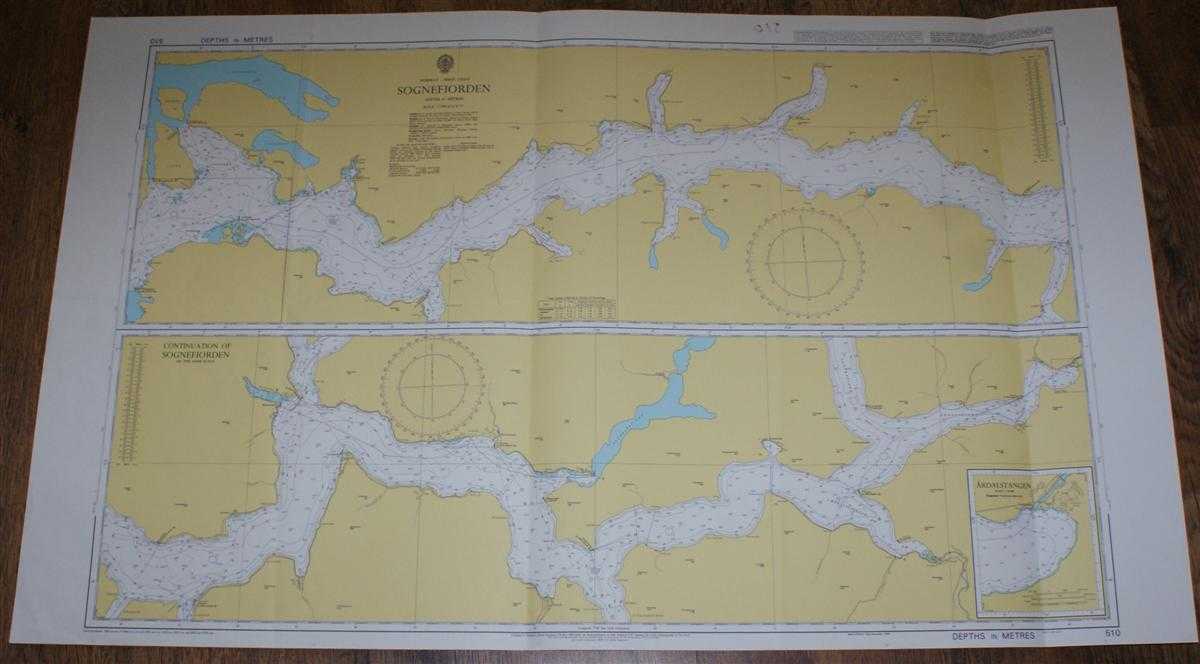
Description: Admiralty, 2003. Revised Edition, Softcover. Very Good Condition/No Dust Jacket. Colour chart with two formal vertical folds and a further two vertical and one horizontal crease. Some light general creasing. Sheet is marked in the top margin on the right hand side by red marker pen which has been used on the reverse but has stained through slightly. Sheet is otherwise clean. Nautical Chart No. 510 Norway - West Coast, Sognefjorden. Copyright 1994 with small corrections to 2003. Scale 1:75,000. Chart is divided into two sections with a further inset with Ardalstangen at scale 1:20,000. Area Covered: Norway (part), Skorpa, Losna, Sognefjorden, Afjorden, Losnosen, Ikjefjorden, Fuglsetfjorden, Vadheimsfjord, Hoyangsfjorden, Lustrafjorden, Balestrand, Vik, Hermansverk, Nokkanes, Fresvik, Ardal, Laerdalsfjorden, Sogndalsfjorden. Size: 72x119. Single sheet map/chart which is suitable for framing and will be shipped rolled and in a cardboard tube. Quantity Available: 1. Shipped Weight: under 1 kg. Pictures of this item not already displayed here available upon request. Inventory No: 45517074032. ISBN: 0718118413
Keywords: BZDB4 naval, naval history, maritime, ships, boats; Maps; Scandinavia. Admiralty Nautical Chart No. 510 Norway - West Coast, Sognefjorden Maps Scandinavia
See more books from our catalog: naval, naval history, maritime, ships, boats
Title: Nautical Chart No. 510 Norway - West Coast, Sognefjorden
Description: Admiralty, 2003. Revised Edition, Softcover. Very Good Condition/No Dust Jacket. Colour chart with two formal vertical folds and a further two vertical and one horizontal crease. Some light general creasing. Sheet is marked in the top margin on the right hand side by red marker pen which has been used on the reverse but has stained through slightly. Sheet is otherwise clean. Nautical Chart No. 510 Norway - West Coast, Sognefjorden. Copyright 1994 with small corrections to 2003. Scale 1:75,000. Chart is divided into two sections with a further inset with Ardalstangen at scale 1:20,000. Area Covered: Norway (part), Skorpa, Losna, Sognefjorden, Afjorden, Losnosen, Ikjefjorden, Fuglsetfjorden, Vadheimsfjord, Hoyangsfjorden, Lustrafjorden, Balestrand, Vik, Hermansverk, Nokkanes, Fresvik, Ardal, Laerdalsfjorden, Sogndalsfjorden. Size: 72x119. Single sheet map/chart which is suitable for framing and will be shipped rolled and in a cardboard tube. Quantity Available: 1. Shipped Weight: under 1 kg. Pictures of this item not already displayed here available upon request. Inventory No: 45517074032. ISBN: 0718118413
Keywords: BZDB4 naval, naval history, maritime, ships, boats; Maps; Scandinavia. Admiralty Nautical Chart No. 510 Norway - West Coast, Sognefjorden Maps Scandinavia
Price: GBP 26.00 = appr. US$ 37.13 Seller: Bailgate Books Ltd
- Book number: 45517074032
- Book number: 45517074032
See more books from our catalog: naval, naval history, maritime, ships, boats