Author: Admiralty
Title: Nautical Chart No. 281 North Sea, Listafjorden to Skudenesfjorden
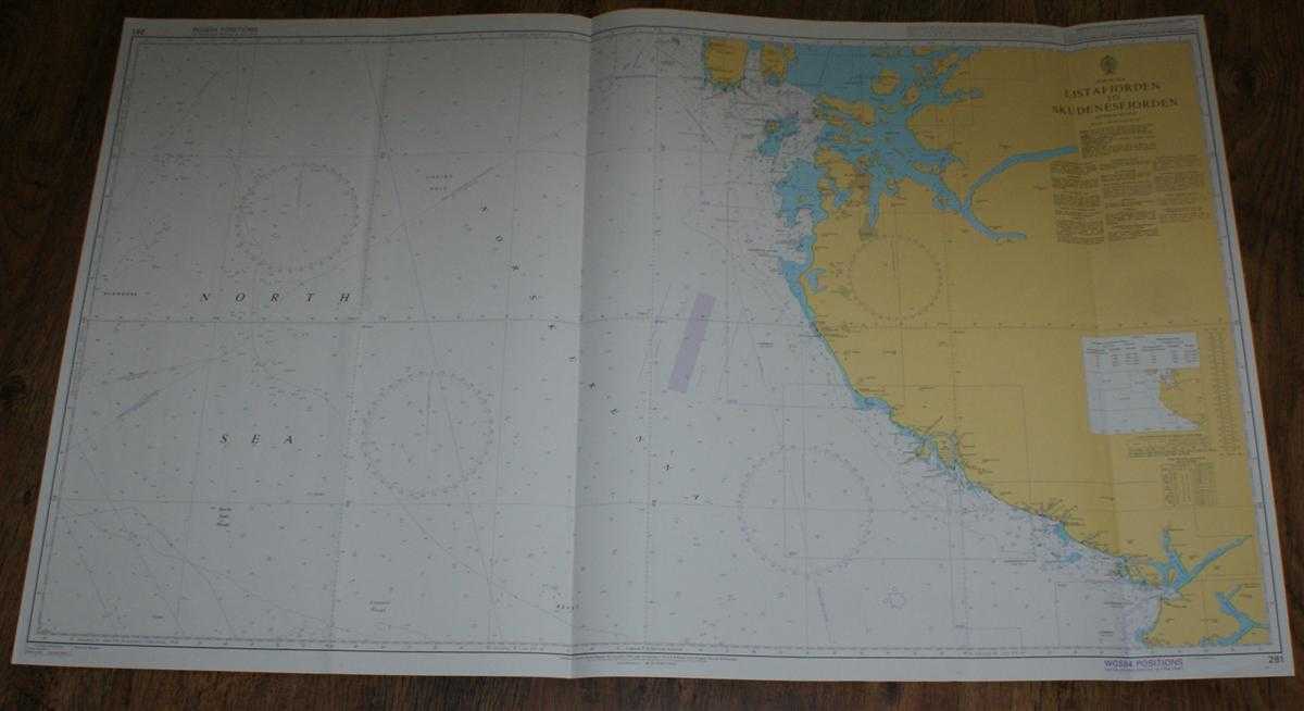
Description: Admiralty, 2004. Revised Edition, Softcover. Very Good Condition/No Dust Jacket. Clean colour chart with two vertical formal folds and a further three vertical and one horizontal creases. Some light creasing and general wear. Nautical Chart No. 281 North Sea, Listafjorden to Skudenesfjorden. Published in 2004. Scale 1:200,000. Area Covered: Norway (part), North Sea (part), Norskerenna, Udsire Hole, Klondyke, Karmoy (part), Vestre Bokn, Finnoy, Fogn, Rennesey, Stavanger, Sandnes, Egersund, Hidra, Flekkefjord, Listafjorden, Boknafjorden, Hogsfjorden, Lysefjorden, Skudenesfjorden. Size: 72x119cm. Single sheet map/chart which is suitable for framing and will be shipped rolled and in a cardboard tube. Quantity Available: 1. Shipped Weight: under 1 kg. Pictures of this item not already displayed here available upon request. Inventory No: 45517074023. ISBN: 0718118413
Keywords: BZDB4 naval, naval history, maritime, ships, boats; Maps; Scandinavia. Admiralty Nautical Chart No. 281 North Sea, Listafjorden to Skudenesfjorden Maps Scandinavia
See more books from our catalog: naval, naval history, maritime, ships, boats
Title: Nautical Chart No. 281 North Sea, Listafjorden to Skudenesfjorden
Description: Admiralty, 2004. Revised Edition, Softcover. Very Good Condition/No Dust Jacket. Clean colour chart with two vertical formal folds and a further three vertical and one horizontal creases. Some light creasing and general wear. Nautical Chart No. 281 North Sea, Listafjorden to Skudenesfjorden. Published in 2004. Scale 1:200,000. Area Covered: Norway (part), North Sea (part), Norskerenna, Udsire Hole, Klondyke, Karmoy (part), Vestre Bokn, Finnoy, Fogn, Rennesey, Stavanger, Sandnes, Egersund, Hidra, Flekkefjord, Listafjorden, Boknafjorden, Hogsfjorden, Lysefjorden, Skudenesfjorden. Size: 72x119cm. Single sheet map/chart which is suitable for framing and will be shipped rolled and in a cardboard tube. Quantity Available: 1. Shipped Weight: under 1 kg. Pictures of this item not already displayed here available upon request. Inventory No: 45517074023. ISBN: 0718118413
Keywords: BZDB4 naval, naval history, maritime, ships, boats; Maps; Scandinavia. Admiralty Nautical Chart No. 281 North Sea, Listafjorden to Skudenesfjorden Maps Scandinavia
Price: GBP 26.00 = appr. US$ 37.13 Seller: Bailgate Books Ltd
- Book number: 45517074023
- Book number: 45517074023
See more books from our catalog: naval, naval history, maritime, ships, boats