Author: Admiralty
Title: Nautical Chart No. 286 North Sea, Tananger to Slatteroy
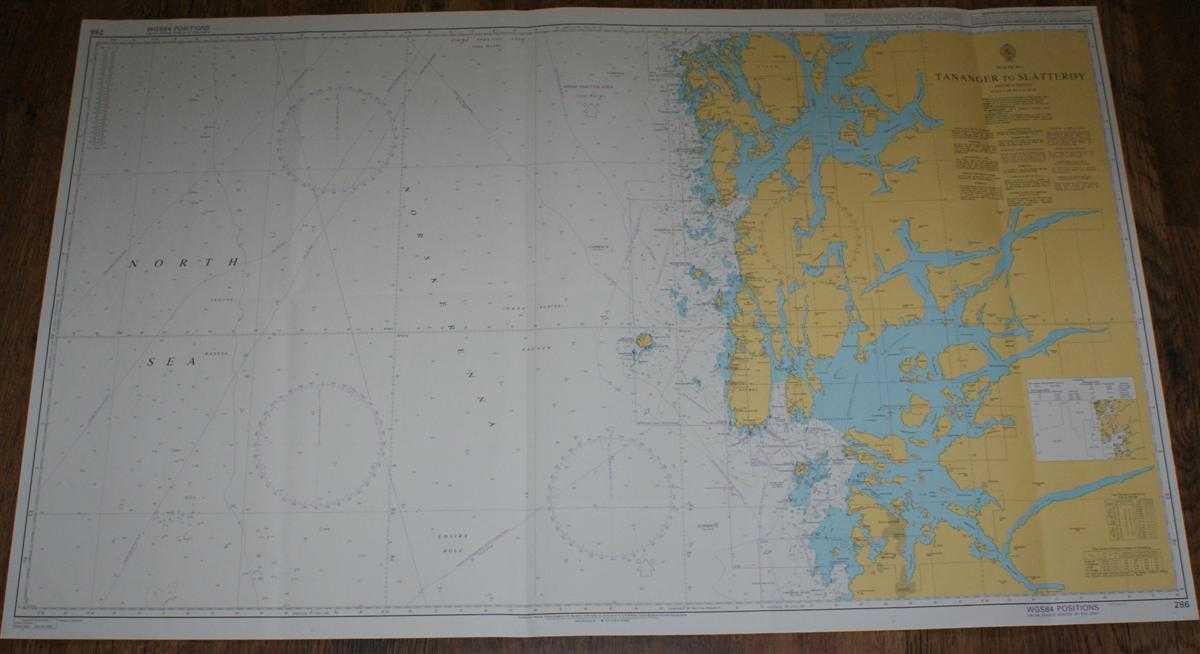
Description: Admiralty, 2004. Revised Edition, Softcover. Very Good Condition/No Dust Jacket. Clean colour chart with two vertical formal folds and a further two vertical and one horizontal creases. Some slight creasing to sheet and edges along with light general wear to folds and edges. Nautical Chart No. 286 North Sea, Tananger to Slatteroy. Published 2004. Scale 1:200,000. Area Covered: Norway (part), Stavanger, Sandnes, Karmoy, Ombo, Finnoy, Vestre Bokn, Kopervik, Haugesund, Haraldstotta, Utsira, Holsnoy, Bomlo, Stord, Goddo. North Sea (part), Norskerenna, Vestre Bakken, Indre Bakken, Udsire Hole, Bomlafjorden, Boknafjorden, Skudenesfjorden, Alfjorden, Nedstransfjorden. Size: 72x119cm. Single sheet map/chart which is suitable for framing and will be shipped rolled and in a cardboard tube. Quantity Available: 1. Shipped Weight: under 1 kg. Pictures of this item not already displayed here available upon request. Inventory No: 45517074022. ISBN: 0718118413
Keywords: BZDB4 naval, naval history, maritime, ships, boats; Maps; Scandinavia. Admiralty Nautical Chart No. 286 North Sea, Tananger to Slatteroy Maps Scandinavia
See more books from our catalog: naval, naval history, maritime, ships, boats
Title: Nautical Chart No. 286 North Sea, Tananger to Slatteroy
Description: Admiralty, 2004. Revised Edition, Softcover. Very Good Condition/No Dust Jacket. Clean colour chart with two vertical formal folds and a further two vertical and one horizontal creases. Some slight creasing to sheet and edges along with light general wear to folds and edges. Nautical Chart No. 286 North Sea, Tananger to Slatteroy. Published 2004. Scale 1:200,000. Area Covered: Norway (part), Stavanger, Sandnes, Karmoy, Ombo, Finnoy, Vestre Bokn, Kopervik, Haugesund, Haraldstotta, Utsira, Holsnoy, Bomlo, Stord, Goddo. North Sea (part), Norskerenna, Vestre Bakken, Indre Bakken, Udsire Hole, Bomlafjorden, Boknafjorden, Skudenesfjorden, Alfjorden, Nedstransfjorden. Size: 72x119cm. Single sheet map/chart which is suitable for framing and will be shipped rolled and in a cardboard tube. Quantity Available: 1. Shipped Weight: under 1 kg. Pictures of this item not already displayed here available upon request. Inventory No: 45517074022. ISBN: 0718118413
Keywords: BZDB4 naval, naval history, maritime, ships, boats; Maps; Scandinavia. Admiralty Nautical Chart No. 286 North Sea, Tananger to Slatteroy Maps Scandinavia
Price: GBP 26.00 = appr. US$ 37.13 Seller: Bailgate Books Ltd
- Book number: 45517074022
- Book number: 45517074022
See more books from our catalog: naval, naval history, maritime, ships, boats