Author: Admiralty
Title: Nautical Chart No. 299 North Sea, Statfjord and Gullfaks Oil Fields to Mongstad
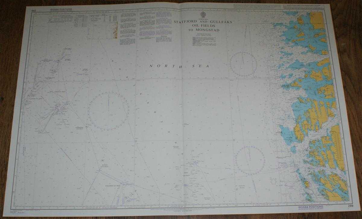
Description: Admiralty, 2005. Revised Edition, Softcover. Very Good Condition/No Dust Jacket. Crisp and clean colour chart with single vertical fold. Nautical Chart No. 299 North Sea, Statfjord and Gullfaks Oil Fields to Mongstad. 2004 edition of 1998 publication with notices to 2005. Scale 1:200,000. Area Covered: Norway (part), Hoven, Floro, Atloyna, Sula, Ytre Sula, Mongstad, Radoyni (part). North Sea (part), Norskerenna, Froysjoen, Stavfjorden, Buefjorden, Sognesjoen, Fensfjorden. Veslefrikk Oil Field, Huldra Gas Field, Statfjord Oil Fields, Tordis Oil Field, Kvitebjorn Gas Field, Snorre Oil Field, etc. Size: 72x104cm. Single sheet map/chart which is suitable for framing and will be shipped rolled and in a cardboard tube. Quantity Available: 1. Shipped Weight: under 1 kg. Pictures of this item not already displayed here available upon request. Inventory No: 45517074021. ISBN: 0718118413
Keywords: BZDB4 naval, naval history, maritime, ships, boats; Maps; Scandinavia. Admiralty Nautical Chart No. 299 North Sea, Statfjord and Gullfaks Oil Fields to Mongstad Maps Scandinavia
See more books from our catalog: naval, naval history, maritime, ships, boats
Title: Nautical Chart No. 299 North Sea, Statfjord and Gullfaks Oil Fields to Mongstad
Description: Admiralty, 2005. Revised Edition, Softcover. Very Good Condition/No Dust Jacket. Crisp and clean colour chart with single vertical fold. Nautical Chart No. 299 North Sea, Statfjord and Gullfaks Oil Fields to Mongstad. 2004 edition of 1998 publication with notices to 2005. Scale 1:200,000. Area Covered: Norway (part), Hoven, Floro, Atloyna, Sula, Ytre Sula, Mongstad, Radoyni (part). North Sea (part), Norskerenna, Froysjoen, Stavfjorden, Buefjorden, Sognesjoen, Fensfjorden. Veslefrikk Oil Field, Huldra Gas Field, Statfjord Oil Fields, Tordis Oil Field, Kvitebjorn Gas Field, Snorre Oil Field, etc. Size: 72x104cm. Single sheet map/chart which is suitable for framing and will be shipped rolled and in a cardboard tube. Quantity Available: 1. Shipped Weight: under 1 kg. Pictures of this item not already displayed here available upon request. Inventory No: 45517074021. ISBN: 0718118413
Keywords: BZDB4 naval, naval history, maritime, ships, boats; Maps; Scandinavia. Admiralty Nautical Chart No. 299 North Sea, Statfjord and Gullfaks Oil Fields to Mongstad Maps Scandinavia
Price: GBP 26.00 = appr. US$ 37.13 Seller: Bailgate Books Ltd
- Book number: 45517074021
- Book number: 45517074021
See more books from our catalog: naval, naval history, maritime, ships, boats