Author: Admiralty
Title: Nautical Chart No. 3541 Norway - West Coast, Boknafjorden and Skjoldafjorden
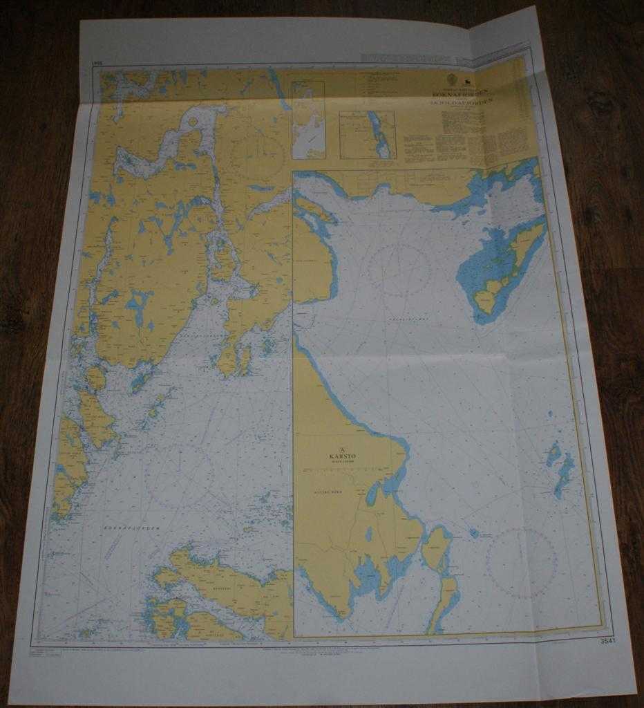
Description: Admiralty, 2005. Revised Edition, Softcover. Very Good Condition/No Dust Jacket. Clean colour chart with two horizontal folds and one vertical fold. Some light general creasing and creasing associated with folds and edges. Nautical Chart No. 3541 Norway - West Coast, Boknafjorden and Skjoldafjorden. Published 2001 with notices to 2005. Scale 1:50,000. Sheet contains inset charts: A - Karsto at scale 1:10,000. B - Skjoldastraumen at scale 1:20,000 Area Covered: Norway (part), Rennesoy, Mosteroy, Austre Bokn, Ogn, Vestre Bokn, Alfjorden, Skjolda Fjorden, Grinda Fjorden, Forlandsfjorden, Kvinnesland, Hervikfjorden, Falkeidflaeet. Size: 84x119cm. Single sheet map/chart which is suitable for framing and will be shipped rolled and in a cardboard tube. Quantity Available: 1. Shipped Weight: under 1 kg. Pictures of this item not already displayed here available upon request. Inventory No: 45517074018. ISBN: 0718118413
Keywords: BZDB4 naval, naval history, maritime, ships, boats; Maps; Scandinavia. Admiralty Nautical Chart No. 3541 Norway - West Coast, Boknafjorden and Skjoldafjorden Maps Scandinavia
See more books from our catalog: naval, naval history, maritime, ships, boats
Title: Nautical Chart No. 3541 Norway - West Coast, Boknafjorden and Skjoldafjorden
Description: Admiralty, 2005. Revised Edition, Softcover. Very Good Condition/No Dust Jacket. Clean colour chart with two horizontal folds and one vertical fold. Some light general creasing and creasing associated with folds and edges. Nautical Chart No. 3541 Norway - West Coast, Boknafjorden and Skjoldafjorden. Published 2001 with notices to 2005. Scale 1:50,000. Sheet contains inset charts: A - Karsto at scale 1:10,000. B - Skjoldastraumen at scale 1:20,000 Area Covered: Norway (part), Rennesoy, Mosteroy, Austre Bokn, Ogn, Vestre Bokn, Alfjorden, Skjolda Fjorden, Grinda Fjorden, Forlandsfjorden, Kvinnesland, Hervikfjorden, Falkeidflaeet. Size: 84x119cm. Single sheet map/chart which is suitable for framing and will be shipped rolled and in a cardboard tube. Quantity Available: 1. Shipped Weight: under 1 kg. Pictures of this item not already displayed here available upon request. Inventory No: 45517074018. ISBN: 0718118413
Keywords: BZDB4 naval, naval history, maritime, ships, boats; Maps; Scandinavia. Admiralty Nautical Chart No. 3541 Norway - West Coast, Boknafjorden and Skjoldafjorden Maps Scandinavia
Price: GBP 26.00 = appr. US$ 37.13 Seller: Bailgate Books Ltd
- Book number: 45517074018
- Book number: 45517074018
See more books from our catalog: naval, naval history, maritime, ships, boats