Author: Admiralty
Title: Nautical Chart No. 3535 Norway - South West Coast, Lindesnes to Lista
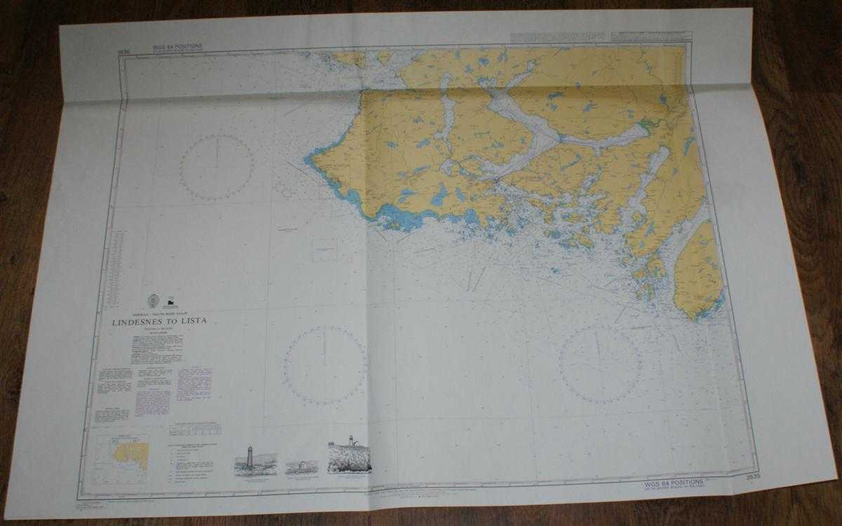
Description: Admiralty, 2002. Revised Edition, Softcover. Very Good Condition/No Dust Jacket. Clean colour chart with two vertical folds and one horizontal fold. Some general light creasing and a diagonal crease from left hand vertical fold. Slight crinkling to top edge and wear to folds. Nautical Chart No. 3535 Norway - South West Coast, Lindesnes to Lista. Published 2002 with notices to 2004. Scale 1:50,000. Sheet contains three small engravings of lighthouses. Area Covered: Norway (part), Lista, Vestbygd, Vanse, Farsund, Oyna, Listafjorden, Lyngdalsfjorden, Aptefjorden, Lindesnes, Gronsfjorden, Lyngdal. Size: 84x119cm. Single sheet map/chart which is suitable for framing and will be shipped rolled and in a cardboard tube. Quantity Available: 1. Shipped Weight: under 1 kg. Pictures of this item not already displayed here available upon request. Inventory No: 45517074012. ISBN: 0718118413
Keywords: BZDB4 naval, naval history, maritime, ships, boats; Maps; Scandinavia. Admiralty Nautical Chart No. 3535 Norway - South West Coast, Lindesnes to Lista Maps Scandinavia
See more books from our catalog: naval, naval history, maritime, ships, boats
Title: Nautical Chart No. 3535 Norway - South West Coast, Lindesnes to Lista
Description: Admiralty, 2002. Revised Edition, Softcover. Very Good Condition/No Dust Jacket. Clean colour chart with two vertical folds and one horizontal fold. Some general light creasing and a diagonal crease from left hand vertical fold. Slight crinkling to top edge and wear to folds. Nautical Chart No. 3535 Norway - South West Coast, Lindesnes to Lista. Published 2002 with notices to 2004. Scale 1:50,000. Sheet contains three small engravings of lighthouses. Area Covered: Norway (part), Lista, Vestbygd, Vanse, Farsund, Oyna, Listafjorden, Lyngdalsfjorden, Aptefjorden, Lindesnes, Gronsfjorden, Lyngdal. Size: 84x119cm. Single sheet map/chart which is suitable for framing and will be shipped rolled and in a cardboard tube. Quantity Available: 1. Shipped Weight: under 1 kg. Pictures of this item not already displayed here available upon request. Inventory No: 45517074012. ISBN: 0718118413
Keywords: BZDB4 naval, naval history, maritime, ships, boats; Maps; Scandinavia. Admiralty Nautical Chart No. 3535 Norway - South West Coast, Lindesnes to Lista Maps Scandinavia
Price: GBP 26.00 = appr. US$ 37.13 Seller: Bailgate Books Ltd
- Book number: 45517074012
- Book number: 45517074012
See more books from our catalog: naval, naval history, maritime, ships, boats