Author: Admiralty
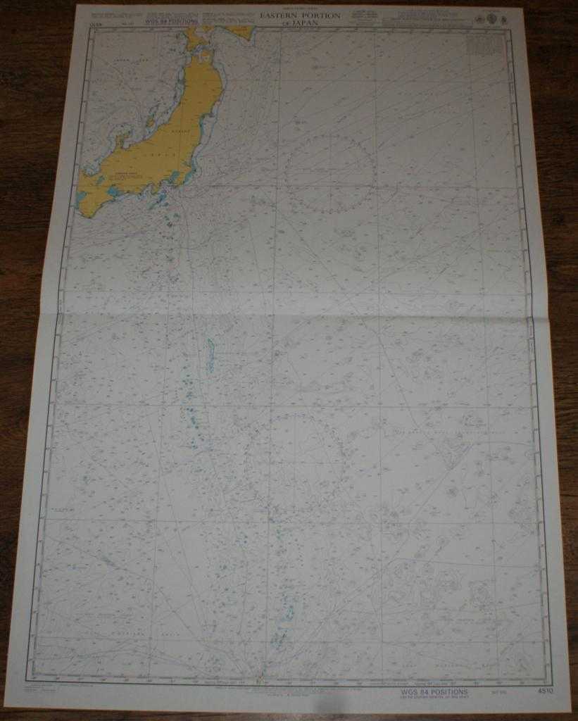
Title: Nautical Chart No. 4510 North Pacific Ocean, Eastern Portion of Japan
Description: Admiralty, 2005. Revised Edition, Softcover. Very Good Condition/No Dust Jacket. Crisp and clean colour chart with single horizontal fold. Nautical Chart No. 4510 North Pacific Ocean, Eastern Portion of Japan. Copyright 2003 with small corrections to 2005. Scale 1:3,500,000 Area Covered: Japan (part), Honshu, Hokkaido (part), Akita, Niigata, Toyama, Nanao, Nagoya, Osaka, Tokyo. North Pacific Ocean (part), Japan Sea (part), Ise Wan, Tokyo Wan, Tsushima Current, Nanpo Shoto, Kuril-Kamchatka Trench, Northwest Pacific Basin, Mariana Islands, Marcus-Wake Seamount Group, Magellan Seamounts Size: 52x71cm. Single sheet map/chart which is suitable for framing and will be shipped rolled and in a cardboard tube.. Quantity Available: 1. Shipped Weight: under 1 kg. Pictures of this item not already displayed here available upon request. Inventory No: 45517064004. ISBN: 0710086822
Keywords: BZDB4 Maps; naval, naval history, maritime, ships, boats; China, Japan, Nepal & Tibet. Admiralty Nautical Chart No. 4510 North Pacific Ocean, Eastern Portion of Japan naval, naval history, maritime, ships, boats China, Japan, Nepal & Tibet
See more books from our catalog: Maps
Title: Nautical Chart No. 4510 North Pacific Ocean, Eastern Portion of Japan
Description: Admiralty, 2005. Revised Edition, Softcover. Very Good Condition/No Dust Jacket. Crisp and clean colour chart with single horizontal fold. Nautical Chart No. 4510 North Pacific Ocean, Eastern Portion of Japan. Copyright 2003 with small corrections to 2005. Scale 1:3,500,000 Area Covered: Japan (part), Honshu, Hokkaido (part), Akita, Niigata, Toyama, Nanao, Nagoya, Osaka, Tokyo. North Pacific Ocean (part), Japan Sea (part), Ise Wan, Tokyo Wan, Tsushima Current, Nanpo Shoto, Kuril-Kamchatka Trench, Northwest Pacific Basin, Mariana Islands, Marcus-Wake Seamount Group, Magellan Seamounts Size: 52x71cm. Single sheet map/chart which is suitable for framing and will be shipped rolled and in a cardboard tube.. Quantity Available: 1. Shipped Weight: under 1 kg. Pictures of this item not already displayed here available upon request. Inventory No: 45517064004. ISBN: 0710086822
Keywords: BZDB4 Maps; naval, naval history, maritime, ships, boats; China, Japan, Nepal & Tibet. Admiralty Nautical Chart No. 4510 North Pacific Ocean, Eastern Portion of Japan naval, naval history, maritime, ships, boats China, Japan, Nepal & Tibet
Price: GBP 28.00 = appr. US$ 39.98 Seller: Bailgate Books Ltd
- Book number: 45517064004
- Book number: 45517064004
See more books from our catalog: Maps