Author: Admiralty
Title: Nautical Chart No. 2607 Mediterranean, France - South Coast, Marseille to Agay Road
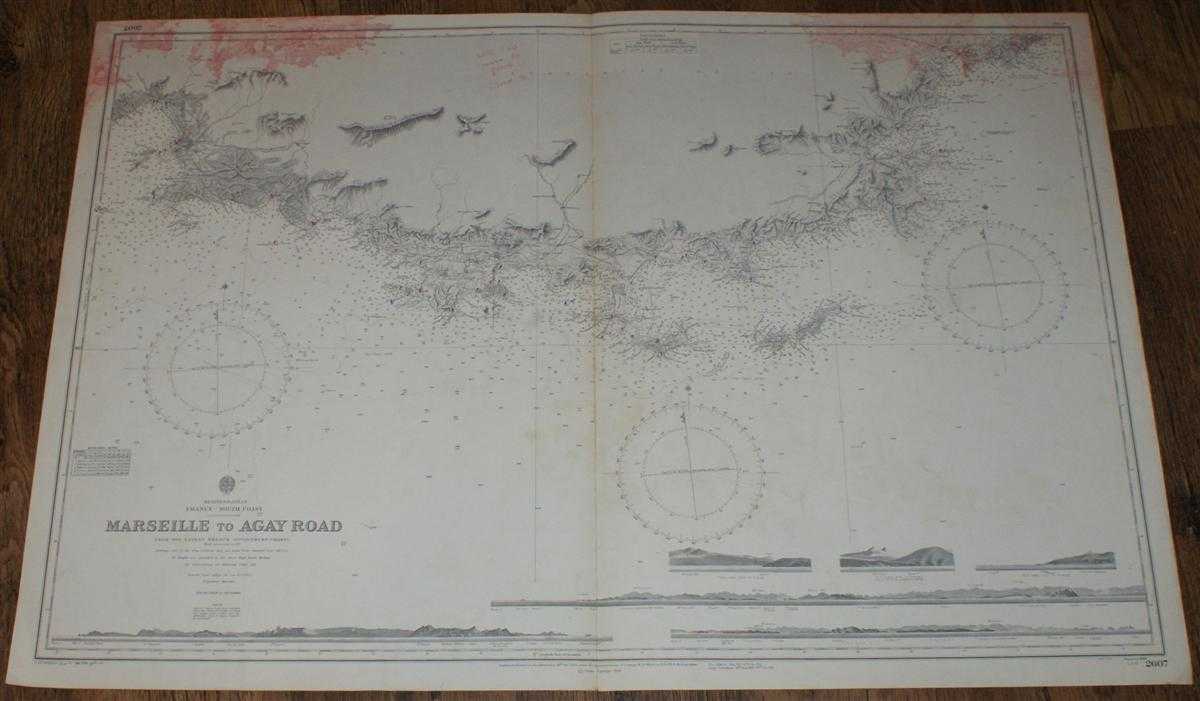
Description: Admiralty, 1959. Revised Edition, Softcover. Good Condition/No Dust Jacket. Black and white chart is a little marked and discoloured. Some annotation. Top of sheet is marked with red stained patches. Staining is more extensive on reverse but does extend into mapped area. Single vertical fold is worn. Edges are slightly darkened and show wear. Nautical Chart No. 2607 Mediterranean, France - South Coast, Marseille to Agay Road. Copyright 1959 with large corrections to 1959 and hand penned small corrections to 1963. Scale 1:145,600 Sheet contains six engraved long-section coastal views Area Covered: France (part), Departments of Bouches du Rhone and Var (parts), Marseille, Pomegues Island, Riou Island, Ciotat, Brusq, Toulon, Hyeres Islands, Porquerolles Island, Port Cros Island, Levant Island, St. Tropez, Frejus Size: 71x103cm. Quantity Available: 1. Shipped Weight: under 1 kg. Pictures of this item not already displayed here available upon request. Inventory No: 45517034057. ISBN: 090019720X
Keywords: BZDB4 Maps; France and French Language; naval, naval history, maritime, ships, boats. Admiralty Nautical Chart No. 2607 Mediterranean, France - South Coast, Marseille to Agay Road France and French Language naval, naval history, maritime, ships, boats
See more books from our catalog: Maps
Title: Nautical Chart No. 2607 Mediterranean, France - South Coast, Marseille to Agay Road
Description: Admiralty, 1959. Revised Edition, Softcover. Good Condition/No Dust Jacket. Black and white chart is a little marked and discoloured. Some annotation. Top of sheet is marked with red stained patches. Staining is more extensive on reverse but does extend into mapped area. Single vertical fold is worn. Edges are slightly darkened and show wear. Nautical Chart No. 2607 Mediterranean, France - South Coast, Marseille to Agay Road. Copyright 1959 with large corrections to 1959 and hand penned small corrections to 1963. Scale 1:145,600 Sheet contains six engraved long-section coastal views Area Covered: France (part), Departments of Bouches du Rhone and Var (parts), Marseille, Pomegues Island, Riou Island, Ciotat, Brusq, Toulon, Hyeres Islands, Porquerolles Island, Port Cros Island, Levant Island, St. Tropez, Frejus Size: 71x103cm. Quantity Available: 1. Shipped Weight: under 1 kg. Pictures of this item not already displayed here available upon request. Inventory No: 45517034057. ISBN: 090019720X
Keywords: BZDB4 Maps; France and French Language; naval, naval history, maritime, ships, boats. Admiralty Nautical Chart No. 2607 Mediterranean, France - South Coast, Marseille to Agay Road France and French Language naval, naval history, maritime, ships, boats
Price: GBP 24.00 = appr. US$ 34.27 Seller: Bailgate Books Ltd
- Book number: 45517034057
- Book number: 45517034057
See more books from our catalog: Maps