Author: Admiralty
Title: Nautical Chart No. 2011 Wales - North Coast, Holyhead Harbour
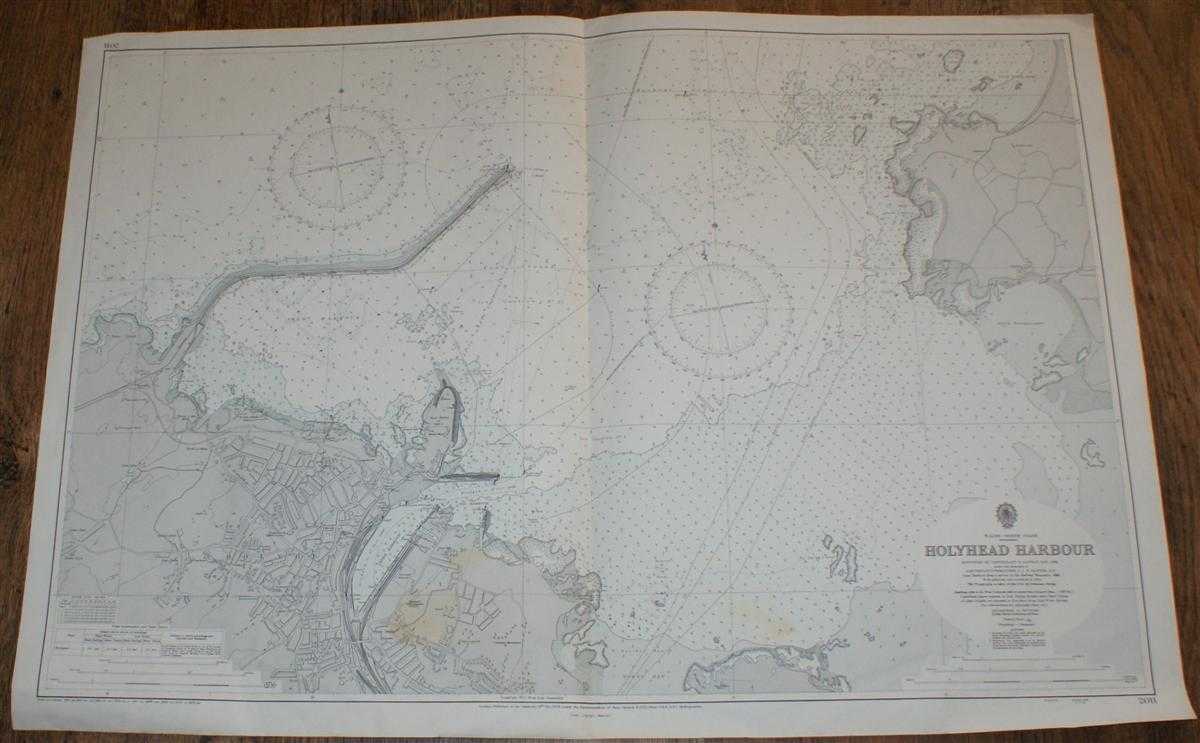
Description: Map Admiralty, London, 1971. Revised Edition, Softcover. Very Good Condition/No Dust Jacket. Coloured chart is lightly stained in the bottom central portion of the sheet. Single vertical fold. Edges are worn and slightly creased. Nautical Chart No. 2011 Wales - North Coast, Holyhead Harbour. Surveyed in 1956-8 with small corrections to 1971. Scale 6,000 Area Covered: Wales (part), Holy Island (part), Holyhead (part), Trwyn Llwyd, Ynys Halen or Salt Island Holyhead Harbour, New Harbour, Old Harbour, Inner Harbour Towyn Bay (part), Porth Penrhyn-Mawr, Porth Tywyn-Mawr, Irish Sea (part) Size: 71x103. Item Type: Map. No dust jacket, as published. Single sheet map/chart which is suitable for framing and will be shipped rolled and in a cardboard tube.. Quantity Available: 1. Shipped Weight: under 1 kg. Pictures of this item not already displayed here available upon request. Inventory No: 45517034014. ISBN: 185170194X
Keywords: BZDB4 Nautical chart, map, shipping Maps; Wales and Welsh History, literature & language; naval, naval history, maritime, ships, boats. Admiralty Nautical Chart No. 2011 Wales - North Coast, Holyhead Harbour Wales and Welsh History, literature & language
See more books from our catalog: Maps
Title: Nautical Chart No. 2011 Wales - North Coast, Holyhead Harbour
Description: Map Admiralty, London, 1971. Revised Edition, Softcover. Very Good Condition/No Dust Jacket. Coloured chart is lightly stained in the bottom central portion of the sheet. Single vertical fold. Edges are worn and slightly creased. Nautical Chart No. 2011 Wales - North Coast, Holyhead Harbour. Surveyed in 1956-8 with small corrections to 1971. Scale 6,000 Area Covered: Wales (part), Holy Island (part), Holyhead (part), Trwyn Llwyd, Ynys Halen or Salt Island Holyhead Harbour, New Harbour, Old Harbour, Inner Harbour Towyn Bay (part), Porth Penrhyn-Mawr, Porth Tywyn-Mawr, Irish Sea (part) Size: 71x103. Item Type: Map. No dust jacket, as published. Single sheet map/chart which is suitable for framing and will be shipped rolled and in a cardboard tube.. Quantity Available: 1. Shipped Weight: under 1 kg. Pictures of this item not already displayed here available upon request. Inventory No: 45517034014. ISBN: 185170194X
Keywords: BZDB4 Nautical chart, map, shipping Maps; Wales and Welsh History, literature & language; naval, naval history, maritime, ships, boats. Admiralty Nautical Chart No. 2011 Wales - North Coast, Holyhead Harbour Wales and Welsh History, literature & language
Price: GBP 24.00 = appr. US$ 34.27 Seller: Bailgate Books Ltd
- Book number: 45517034014
- Book number: 45517034014
See more books from our catalog: Maps