Author: Admiralty
Title: Nautical Chart No. L(D3)1787 Ireland - East Coast, Wexford to Wicklow
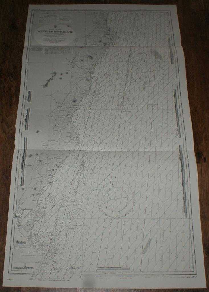
Description: Map Admiralty, 1974. Revised Edition, Softcover. Very Good Condition/No Dust Jacket. Clean black and white chart with coloured AB and AC Decca lines. Two horizontal folds. Slight creasing to both vertical edges. Nautical Chart No. L(D3)1787 Ireland - East Coast, Wexford to Wicklow. Copyright 1972 with small corrections to 1974. Scale 1:81,000 Area Covered: Ireland (part), Ballinalea, Wicklow, Arklow, Gorey, Riverchapel, Wexford, Rosslare Harbour, Dublin Wicklow and Wexford Railway Irish Sea (part), Arklow Bank, Glassgorman Banks, Rusk Channel, North Bay, Rosslare or South Bay, Avoca River, Three Mile Water Sheet also contains nine engraved long-section coast line views Size: 129x71cm. Item Type: Map. No dust jacket, as published. Single sheet map/chart which is suitable for framing and will be shipped rolled and in a cardboard tube.. Quantity Available: 1. Shipped Weight: under 1 kg. Pictures of this item not already displayed here available upon request. Inventory No: 45517021432. ISBN: 0002116448
Keywords: BZDB4 Maps; Ireland; naval, naval history, maritime, ships, boats. Admiralty Nautical Chart No. L(D3)1787 Ireland - East Coast, Wexford to Wicklow Ireland naval, naval history, maritime, ships, boats
See more books from our catalog: Maps
Title: Nautical Chart No. L(D3)1787 Ireland - East Coast, Wexford to Wicklow
Description: Map Admiralty, 1974. Revised Edition, Softcover. Very Good Condition/No Dust Jacket. Clean black and white chart with coloured AB and AC Decca lines. Two horizontal folds. Slight creasing to both vertical edges. Nautical Chart No. L(D3)1787 Ireland - East Coast, Wexford to Wicklow. Copyright 1972 with small corrections to 1974. Scale 1:81,000 Area Covered: Ireland (part), Ballinalea, Wicklow, Arklow, Gorey, Riverchapel, Wexford, Rosslare Harbour, Dublin Wicklow and Wexford Railway Irish Sea (part), Arklow Bank, Glassgorman Banks, Rusk Channel, North Bay, Rosslare or South Bay, Avoca River, Three Mile Water Sheet also contains nine engraved long-section coast line views Size: 129x71cm. Item Type: Map. No dust jacket, as published. Single sheet map/chart which is suitable for framing and will be shipped rolled and in a cardboard tube.. Quantity Available: 1. Shipped Weight: under 1 kg. Pictures of this item not already displayed here available upon request. Inventory No: 45517021432. ISBN: 0002116448
Keywords: BZDB4 Maps; Ireland; naval, naval history, maritime, ships, boats. Admiralty Nautical Chart No. L(D3)1787 Ireland - East Coast, Wexford to Wicklow Ireland naval, naval history, maritime, ships, boats
Price: GBP 25.00 = appr. US$ 35.70 Seller: Bailgate Books Ltd
- Book number: 45517021432
- Book number: 45517021432
See more books from our catalog: Maps