Author: Admiralty
Title: Nautical Chart No. 1228 Europe and Africa - West Coasts, Cabo de Sao Vicente to Cap Ghir
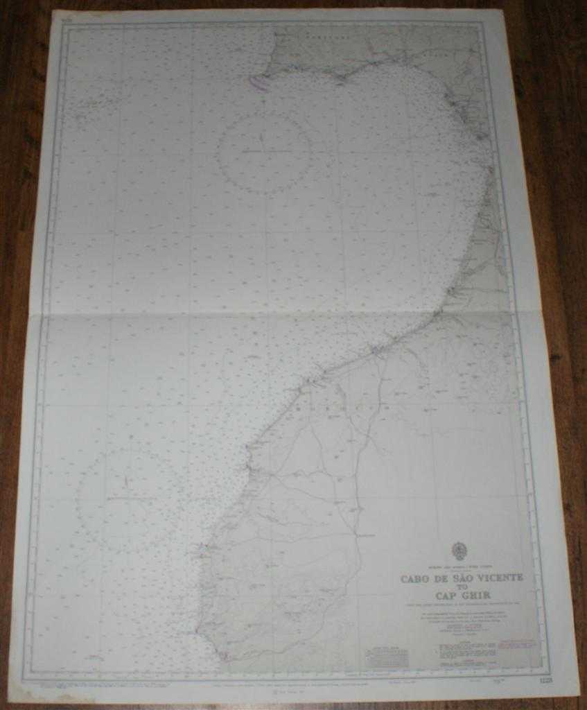
Description: Map Admiralty, 1986. Revised Edition, Softcover. Good Condition/No Dust Jacket. Black and white chart with single horizontal fold. Edges are slightly worn and stained, staining does not extend into mapped area. Nautical Chart No. 1228 Europe and Africa - West Coasts, Cabo de Sao Vicente to Cap Ghir. Copyright 1969 with small corrections to 1986. Scale 1:1,000,000 Area Covered: Portugal (part), Spain (part), Morocco (part), Cabo de Sao Vicente, Sevilla, Cadiz, Casablanca, Marrakech, Cap Ghir North Atlantic Ocean (part), Strait of Gibraltar (entrance only), Rio Guadiana, Rio Guadalquivir Size: 103x71cm. Item Type: Map. No dust jacket, as published. Single sheet map/chart which is suitable for framing and will be shipped rolled and in a cardboard tube.. Quantity Available: 1. Shipped Weight: under 1 kg. Pictures of this item not already displayed here available upon request. Inventory No: 45517021405. ISBN: 0002116448
Keywords: BZDB4 Maps; Spain and Portugal, Spanish & Portuguese Language; Africa; naval, naval history, maritime, ships, boats. Admiralty Nautical Chart No. 1228 Europe and Africa - West Coasts, Cabo de Sao Vicente to Cap Ghir Spain and Portugal, Spanish & Portugues
See more books from our catalog: Maps
Title: Nautical Chart No. 1228 Europe and Africa - West Coasts, Cabo de Sao Vicente to Cap Ghir
Description: Map Admiralty, 1986. Revised Edition, Softcover. Good Condition/No Dust Jacket. Black and white chart with single horizontal fold. Edges are slightly worn and stained, staining does not extend into mapped area. Nautical Chart No. 1228 Europe and Africa - West Coasts, Cabo de Sao Vicente to Cap Ghir. Copyright 1969 with small corrections to 1986. Scale 1:1,000,000 Area Covered: Portugal (part), Spain (part), Morocco (part), Cabo de Sao Vicente, Sevilla, Cadiz, Casablanca, Marrakech, Cap Ghir North Atlantic Ocean (part), Strait of Gibraltar (entrance only), Rio Guadiana, Rio Guadalquivir Size: 103x71cm. Item Type: Map. No dust jacket, as published. Single sheet map/chart which is suitable for framing and will be shipped rolled and in a cardboard tube.. Quantity Available: 1. Shipped Weight: under 1 kg. Pictures of this item not already displayed here available upon request. Inventory No: 45517021405. ISBN: 0002116448
Keywords: BZDB4 Maps; Spain and Portugal, Spanish & Portuguese Language; Africa; naval, naval history, maritime, ships, boats. Admiralty Nautical Chart No. 1228 Europe and Africa - West Coasts, Cabo de Sao Vicente to Cap Ghir Spain and Portugal, Spanish & Portugues
Price: GBP 24.00 = appr. US$ 34.27 Seller: Bailgate Books Ltd
- Book number: 45517021405
- Book number: 45517021405
See more books from our catalog: Maps