Author: Admiralty
Title: Nautical Chart No. 365 North Atlantic - Ilheus Selvagem (Savage or Salvage Islands)
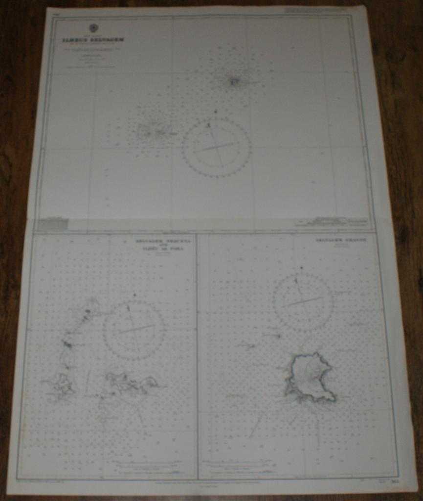
Description: Map Admiralty, 1981. Revised Edition, Softcover. Good Condition/No Dust Jacket. Black and white chart. Sheet is very lightly marked and has some darkening and wear on the edges. Single horizontal fold is a little worn. Other light creasing. Nautical Chart No. 365 North Atlantic - Ilheus Selvagem. From Portuguese Government Charts of 1938 with small corrections to 1981 Sheet consists of three charts: Ilheus Selvagem at scale 1:100,000 Selvagem Pequena and Ilheu de Fora at scale 1:20,000 Selvagem Grande at scale 1:20,000 Size: 103x71cm. Item Type: Map. No dust jacket, as published. Single sheet map/chart which is suitable for framing and will be shipped rolled and in a cardboard tube.. Quantity Available: 1. Shipped Weight: under 1 kg. Pictures of this item not already displayed here available upon request. Inventory No: 45517021403. ISBN: 0002116448
Keywords: BZDB4 Maps; Spain and Portugal, Spanish & Portuguese Language; naval, naval history, maritime, ships, boats. Admiralty Nautical Chart No. 365 North Atlantic - Ilheus Selvagem (Savage or Salvage Islands) Spain and Portugal, Spanish & Portuguese Language
See more books from our catalog: Maps
Title: Nautical Chart No. 365 North Atlantic - Ilheus Selvagem (Savage or Salvage Islands)
Description: Map Admiralty, 1981. Revised Edition, Softcover. Good Condition/No Dust Jacket. Black and white chart. Sheet is very lightly marked and has some darkening and wear on the edges. Single horizontal fold is a little worn. Other light creasing. Nautical Chart No. 365 North Atlantic - Ilheus Selvagem. From Portuguese Government Charts of 1938 with small corrections to 1981 Sheet consists of three charts: Ilheus Selvagem at scale 1:100,000 Selvagem Pequena and Ilheu de Fora at scale 1:20,000 Selvagem Grande at scale 1:20,000 Size: 103x71cm. Item Type: Map. No dust jacket, as published. Single sheet map/chart which is suitable for framing and will be shipped rolled and in a cardboard tube.. Quantity Available: 1. Shipped Weight: under 1 kg. Pictures of this item not already displayed here available upon request. Inventory No: 45517021403. ISBN: 0002116448
Keywords: BZDB4 Maps; Spain and Portugal, Spanish & Portuguese Language; naval, naval history, maritime, ships, boats. Admiralty Nautical Chart No. 365 North Atlantic - Ilheus Selvagem (Savage or Salvage Islands) Spain and Portugal, Spanish & Portuguese Language
Price: GBP 24.00 = appr. US$ 34.27 Seller: Bailgate Books Ltd
- Book number: 45517021403
- Book number: 45517021403
See more books from our catalog: Maps