Author: Admiralty
Title: Nautical Chart No. L(D7)2314 Norway - Helgoy to Soroy
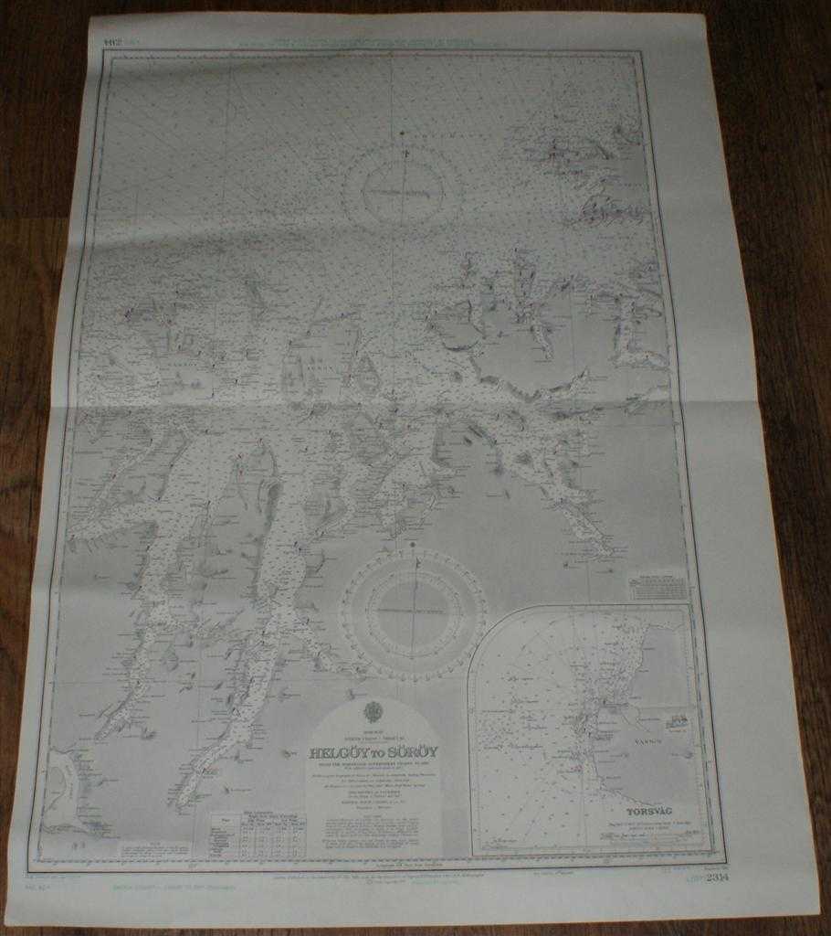
Description: Map Admiralty, 1973. Revised Edition, Softcover. Very Good Condition/No Dust Jacket. Clean black and white chart with coloured AC and AD Decca lines. Single horizontal fold with a further slightly less defined vertical fold. Other slight creasing with some light wear to edges. Nautical Chart No. L(D7)2314 Norway North Coast - Sheet 12 - Helgoy to Soroy. Copyright 1972 with small corrections to 1973. Scale 1:211,070 Area Covered: Norway (part),Ringvassoy (part), Helgoy, Reinoy, Vannoy, Arnoy, Uloy, Lokoy, Kaagen, Silda, Soroy (part) Lopphavet, Fugloy Sveet, Soroy Sund, Hamar Fjord, Kvaenangen Fjord, Nord Reisa, Lyngen Fjord, Ulls Fjord Inset chart of Torsvag at scale 1:50,000 Size: 71x103cm. Item Type: Map. No dust jacket, as published. Single sheet map/chart which is suitable for framing and will be shipped rolled and in a cardboard tube.. Quantity Available: 1. Shipped Weight: under 1 kg. Pictures of this item not already displayed here available upon request. Inventory No: 45517011323. ISBN: 0952054531
Keywords: BZDB4 Nautical chart, map, shipping Maps; Scandinavia; naval, naval history, maritime, ships, boats. Admiralty Nautical Chart No. L(D7)2314 Norway - Helgoy to Soroy Scandinavia naval, naval history, maritime, ships, boats
See more books from our catalog: Maps
Title: Nautical Chart No. L(D7)2314 Norway - Helgoy to Soroy
Description: Map Admiralty, 1973. Revised Edition, Softcover. Very Good Condition/No Dust Jacket. Clean black and white chart with coloured AC and AD Decca lines. Single horizontal fold with a further slightly less defined vertical fold. Other slight creasing with some light wear to edges. Nautical Chart No. L(D7)2314 Norway North Coast - Sheet 12 - Helgoy to Soroy. Copyright 1972 with small corrections to 1973. Scale 1:211,070 Area Covered: Norway (part),Ringvassoy (part), Helgoy, Reinoy, Vannoy, Arnoy, Uloy, Lokoy, Kaagen, Silda, Soroy (part) Lopphavet, Fugloy Sveet, Soroy Sund, Hamar Fjord, Kvaenangen Fjord, Nord Reisa, Lyngen Fjord, Ulls Fjord Inset chart of Torsvag at scale 1:50,000 Size: 71x103cm. Item Type: Map. No dust jacket, as published. Single sheet map/chart which is suitable for framing and will be shipped rolled and in a cardboard tube.. Quantity Available: 1. Shipped Weight: under 1 kg. Pictures of this item not already displayed here available upon request. Inventory No: 45517011323. ISBN: 0952054531
Keywords: BZDB4 Nautical chart, map, shipping Maps; Scandinavia; naval, naval history, maritime, ships, boats. Admiralty Nautical Chart No. L(D7)2314 Norway - Helgoy to Soroy Scandinavia naval, naval history, maritime, ships, boats
Price: GBP 25.00 = appr. US$ 35.70 Seller: Bailgate Books Ltd
- Book number: 45517011323
- Book number: 45517011323
See more books from our catalog: Maps