Author: Admiralty
Title: Nautical Chart No. 2360, Baltic, The Coast of Sweden, Sheet I, From Falsterbo to Kalmar Sund, Scale 1:205,000 main plan plus various others
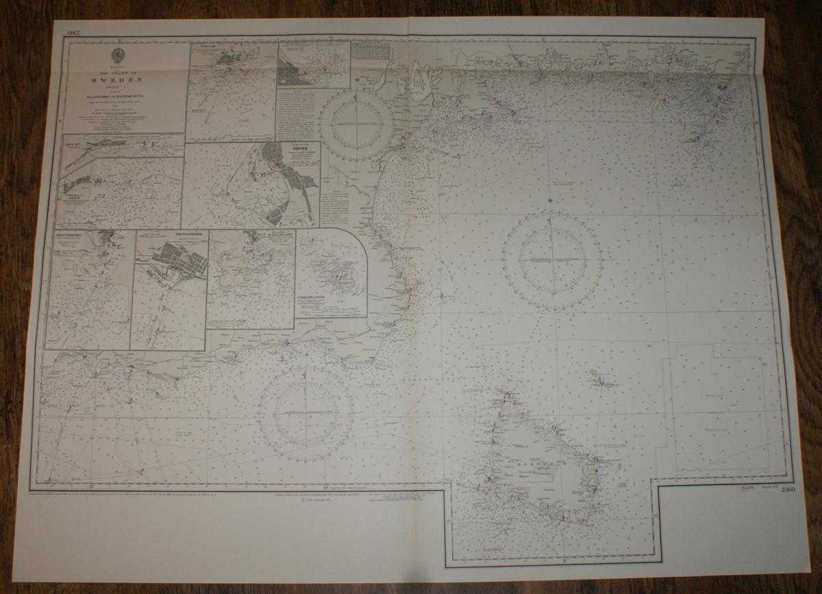
Description: Map Admiralty, London, 1973. Revised Edition, Softcover. Very Good Condition/No Dust Jacket. Crisp clean black and white chart with single vertical fold. Small inked stamp on reverse. Nautical Chart No. 2360, Baltic, The Coast of Sweden, Sheet I, From Falsterbo to Kalmar Sund, Scale 1:205,000 main plan plus various others. From the Swedish survey of Admrl. Gustaf Klint 1849, with corrections from the Swedish Charts to 1963, Large corrections to 1965, small corrections to 1973. Includes nine inset plans of: Ahus Harbour, Scale 1:20,000; Approaches to Ahus, Scale 1:50,000; Solvesborg, Scale 1:50,000; Trellesborg, Scale 1:19,750 ; Approaches to Karlshamn, Scale 1:50,000; Christianso, Scale 1:20,200 Bornsholm, Ronne, Scale 1:10,200; Ystad, Scale 1:40,000; Simrishahm, Scale 1:10,100 Area Covered: Hano Bight, Bornholmsgat, Baltic. Size: 1040mm x 790mm. Item Type: Map. No dust jacket, as published. Single sheet map/chart which is suitable for framing and will be shipped rolled and in a cardboard tube.. Quantity Available: 1. Shipped Weight: under 1 kg. Pictures of this item not already displayed here available upon request. Inventory No: 45516111039. ISBN: 0948265795
Keywords: BZDB4 nautical chart, shipping, Sweden Maps; Scandinavia; naval, naval history, maritime, ships, boats. Admiralty Nautical Chart No. 2360, Baltic, The Coast of Sweden, Sheet I, From Falsterbo to Kalmar Sund, Scale 1:205,000 main plan plus various others S
See more books from our catalog: Maps
Title: Nautical Chart No. 2360, Baltic, The Coast of Sweden, Sheet I, From Falsterbo to Kalmar Sund, Scale 1:205,000 main plan plus various others
Description: Map Admiralty, London, 1973. Revised Edition, Softcover. Very Good Condition/No Dust Jacket. Crisp clean black and white chart with single vertical fold. Small inked stamp on reverse. Nautical Chart No. 2360, Baltic, The Coast of Sweden, Sheet I, From Falsterbo to Kalmar Sund, Scale 1:205,000 main plan plus various others. From the Swedish survey of Admrl. Gustaf Klint 1849, with corrections from the Swedish Charts to 1963, Large corrections to 1965, small corrections to 1973. Includes nine inset plans of: Ahus Harbour, Scale 1:20,000; Approaches to Ahus, Scale 1:50,000; Solvesborg, Scale 1:50,000; Trellesborg, Scale 1:19,750 ; Approaches to Karlshamn, Scale 1:50,000; Christianso, Scale 1:20,200 Bornsholm, Ronne, Scale 1:10,200; Ystad, Scale 1:40,000; Simrishahm, Scale 1:10,100 Area Covered: Hano Bight, Bornholmsgat, Baltic. Size: 1040mm x 790mm. Item Type: Map. No dust jacket, as published. Single sheet map/chart which is suitable for framing and will be shipped rolled and in a cardboard tube.. Quantity Available: 1. Shipped Weight: under 1 kg. Pictures of this item not already displayed here available upon request. Inventory No: 45516111039. ISBN: 0948265795
Keywords: BZDB4 nautical chart, shipping, Sweden Maps; Scandinavia; naval, naval history, maritime, ships, boats. Admiralty Nautical Chart No. 2360, Baltic, The Coast of Sweden, Sheet I, From Falsterbo to Kalmar Sund, Scale 1:205,000 main plan plus various others S
Price: GBP 24.00 = appr. US$ 34.27 Seller: Bailgate Books Ltd
- Book number: 45516111039
- Book number: 45516111039
See more books from our catalog: Maps