Author: Admiralty
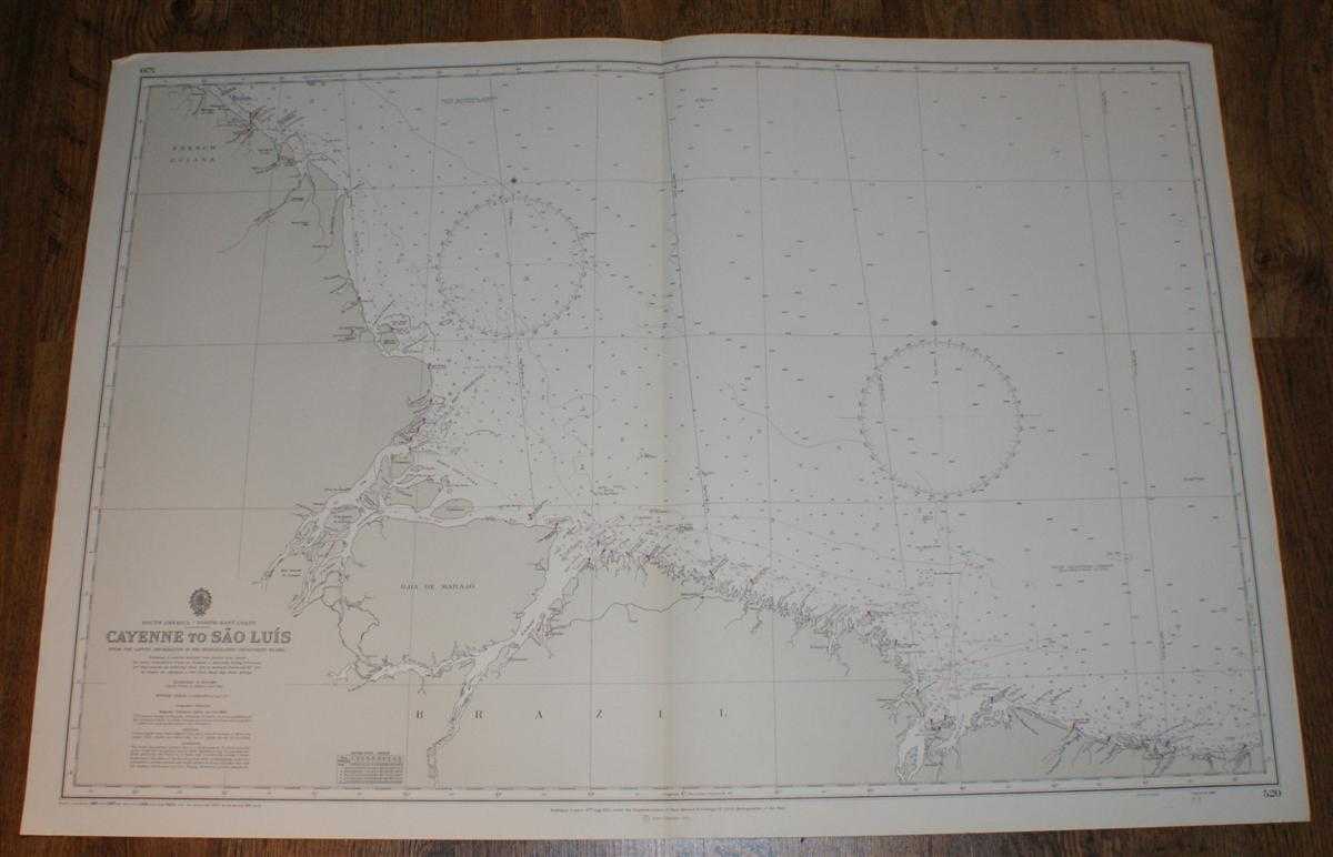
Title: Nautical Chart No. 520. South America, North East Coast, Cayenne to Sao Luis. From the Latest Information in the Hydrographic Department to 1965 with small corrections to 1971. Scale 1:1,500,000
Description: Map Admiralty, London, 1971. Revised Edition, Softcover. Very Good Condition/No Dust Jacket. Crisp clean black and white chart. Single vertical fold, lightly marked on reverse. Nautical Chart No. 520. South America, North East Coast, Cayenne to Sao Luis. From the Latest Information in the Hydrographic Department to 1965 with small corrections to 1971. Scale 1:1,500,000 Area covered: Brazil, French Guiana, Ilha de Marajo; South Equatorial Current, Banco Santa Rosa, Rio Para, Rio Amazonas, Braco Sul, Cabo Raso do Norte, Cabo Orange, Canal deTurluri, Barras das Canarias; Parnaiba, Sao Luis, Turiacu,Braganca, Belem, Cassiopore, Cayenne. Size: 1040mm x 710mm. Item Type: Map. No dust jacket, as published. Single sheet map/chart which is suitable for framing and will be shipped rolled and in a cardboard tube.. Quantity Available: 1. Shipped Weight: under 1 kg. Pictures of this item not already displayed here available upon request. Inventory No: 45516041177. ISBN: 019820227X
Keywords: BZDB4 , nautical chart, shipping, Maps; South & Central America & the West Indies; naval, naval history, maritime, ships, boats. Admiralty Nautical Chart No. 520. South America, North East Coast, Cayenne to Sao Luis. From the Latest Information in the Hyd
See more books from our catalog: Maps
Title: Nautical Chart No. 520. South America, North East Coast, Cayenne to Sao Luis. From the Latest Information in the Hydrographic Department to 1965 with small corrections to 1971. Scale 1:1,500,000
Description: Map Admiralty, London, 1971. Revised Edition, Softcover. Very Good Condition/No Dust Jacket. Crisp clean black and white chart. Single vertical fold, lightly marked on reverse. Nautical Chart No. 520. South America, North East Coast, Cayenne to Sao Luis. From the Latest Information in the Hydrographic Department to 1965 with small corrections to 1971. Scale 1:1,500,000 Area covered: Brazil, French Guiana, Ilha de Marajo; South Equatorial Current, Banco Santa Rosa, Rio Para, Rio Amazonas, Braco Sul, Cabo Raso do Norte, Cabo Orange, Canal deTurluri, Barras das Canarias; Parnaiba, Sao Luis, Turiacu,Braganca, Belem, Cassiopore, Cayenne. Size: 1040mm x 710mm. Item Type: Map. No dust jacket, as published. Single sheet map/chart which is suitable for framing and will be shipped rolled and in a cardboard tube.. Quantity Available: 1. Shipped Weight: under 1 kg. Pictures of this item not already displayed here available upon request. Inventory No: 45516041177. ISBN: 019820227X
Keywords: BZDB4 , nautical chart, shipping, Maps; South & Central America & the West Indies; naval, naval history, maritime, ships, boats. Admiralty Nautical Chart No. 520. South America, North East Coast, Cayenne to Sao Luis. From the Latest Information in the Hyd
Price: GBP 24.00 = appr. US$ 34.27 Seller: Bailgate Books Ltd
- Book number: 45516041177
- Book number: 45516041177
See more books from our catalog: Maps