Author: John Bartholomew
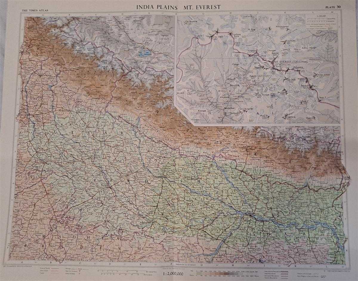
Title: Map of 'India Plains' and 'Mt. Everest', Plate 30 disbound from 1959 Mid-Century Times Atlas of the World, Volume II, (South-West Asia and Russia) includes North-east India, Scale 1:2,000,000 and Mount Everest, Scale 1:250,000
Description: The Times Publishing Company Ltd. London, 1959. Mid-Century Edition, Softcover. Fine Condition/No Dust Jacket. Single disbound map sheet from 'The Times Atlas of the World, Mid-Century Edition; Volume II Eurasia, suitable for framing. Map is in colour and has vertical centre fold. Approx. sheet size is 49 x 61cm. Sheet is clean, bright and crisp. Scale 1:2,000,000. Map shows relief, national and other boundaries, cities, town, rivers main roads, some tracks, railways, main civil airports and other airfields, sand dune areas, dry salt lakes, salt lakes, glacier and ice caps, marsh and flood areas. Inset map of Everest at 1:250,000 shows route of 1953 Hunt - Hilary Expedition. First printing of this edition. Quantity Available: 1. Shipped Weight: under 1 kg. Pictures of this item not already displayed here available upon request. Inventory No: 45022081063. ISBN: 0333371852
Keywords: BZDB4 Maps; Geology, geography, mineralogy, environment; Indian sub-continent & South East Asia. Unbranded John Bartholomew Map of 'India Plains' and 'Mt. Everest', Plate 30 disbound from 1959 Mid-Century Times Atlas of the World, Volume II, (South-West A
See more books from our catalog: Maps
Title: Map of 'India Plains' and 'Mt. Everest', Plate 30 disbound from 1959 Mid-Century Times Atlas of the World, Volume II, (South-West Asia and Russia) includes North-east India, Scale 1:2,000,000 and Mount Everest, Scale 1:250,000
Description: The Times Publishing Company Ltd. London, 1959. Mid-Century Edition, Softcover. Fine Condition/No Dust Jacket. Single disbound map sheet from 'The Times Atlas of the World, Mid-Century Edition; Volume II Eurasia, suitable for framing. Map is in colour and has vertical centre fold. Approx. sheet size is 49 x 61cm. Sheet is clean, bright and crisp. Scale 1:2,000,000. Map shows relief, national and other boundaries, cities, town, rivers main roads, some tracks, railways, main civil airports and other airfields, sand dune areas, dry salt lakes, salt lakes, glacier and ice caps, marsh and flood areas. Inset map of Everest at 1:250,000 shows route of 1953 Hunt - Hilary Expedition. First printing of this edition. Quantity Available: 1. Shipped Weight: under 1 kg. Pictures of this item not already displayed here available upon request. Inventory No: 45022081063. ISBN: 0333371852
Keywords: BZDB4 Maps; Geology, geography, mineralogy, environment; Indian sub-continent & South East Asia. Unbranded John Bartholomew Map of 'India Plains' and 'Mt. Everest', Plate 30 disbound from 1959 Mid-Century Times Atlas of the World, Volume II, (South-West A
Price: GBP 32.00 = appr. US$ 45.70 Seller: Bailgate Books Ltd
- Book number: 45022081063
- Book number: 45022081063
See more books from our catalog: Maps